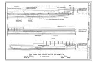
File:Erie Canal (Original) Locks 37 and 38, Title Sheet - Erie Canal (Original), Locks 37 and 38, 84 North Mohawk Street, Cohoes, Albany County, NY HAER NY-337 (sheet 1 of 6).tif

Original file (14,400 × 9,600 pixels, file size: 1.95 MB, MIME type: image/tiff)
Captions
Captions
Summary[edit]
| Warning | The original file is very high-resolution. It might not load properly or could cause your browser to freeze when opened at full size. |
|---|
| Erie Canal (Original) Locks 37 and 38, Title Sheet - Erie Canal (Original), Locks 37 and 38, 84 North Mohawk Street, Cohoes, Albany County, NY | |||||
|---|---|---|---|---|---|
| Photographer |
Mauro, Jeremy T. Related names:
|
||||
| Title |
Erie Canal (Original) Locks 37 and 38, Title Sheet - Erie Canal (Original), Locks 37 and 38, 84 North Mohawk Street, Cohoes, Albany County, NY |
||||
| Depicted place | New York; Albany County; Cohoes | ||||
| Date | 2010 | ||||
| Dimensions | 24 x 36 in. (D size) | ||||
| Current location |
Library of Congress Prints and Photographs Division Washington, D.C. 20540 USA http://hdl.loc.gov/loc.pnp/pp.print |
||||
| Accession number |
HAER NY-337 (sheet 1 of 6) |
||||
| Credit line |
|
||||
| Notes |
The Erie Canal catalyzed commerce, industry, and population growth in Cohoes, as it did in places all along its path. Although little survives of Locks 37 and 38, portions now serve as foundations for a row of industrial buildings that demonstrate Cohoes' expansion as a mill town through the middle decades of the nineteenth century. Largely functional and quotidian, these buildings and the canal beneath them were modified as needed over time to maintain their usefulness, and the resulting site is an accretion at the center of a larger manufacturing complex where the paths of a few leading nineteenth-century engineers and capitalists crossed those of thousands of predominately young immigrant mill workers. The power-canal system was abandoned after 1915 and the adjacent mills closed in the 1930s. Today, the remains of Locks 37 and 38 and the building above them lie within the Harmony Mill Historic District, created in 1987, and the Harmony Mills National Historic Landmark District, designated in 1999.
|
||||
| References |
|
||||
| Source | https://www.loc.gov/pictures/item/ny2030.sheet.00001a | ||||
| Permission (Reusing this file) |
|
||||
| Other versions |
          |
||||
| Object location | 42° 46′ 27.01″ N, 73° 42′ 02.02″ W | View this and other nearby images on: OpenStreetMap |
|---|
File history
Click on a date/time to view the file as it appeared at that time.
| Date/Time | Thumbnail | Dimensions | User | Comment | |
|---|---|---|---|---|---|
| current | 09:18, 30 July 2014 |  | 14,400 × 9,600 (1.95 MB) | Fæ (talk | contribs) | GWToolset: Creating mediafile for Fæ. HABS 30 July 2014 (2601:2900) |
You cannot overwrite this file.
File usage on Commons
The following 3 pages use this file:
- File:2010 Site Plan, 1835 Site Plan (Conjectural) - Erie Canal (Original), Locks 37 and 38, 84 North Mohawk Street, Cohoes, Albany County, NY HAER NY-337 (sheet 4 of 6).tif
- File:Cohoes Site History 1835-1920 - Erie Canal (Original), Locks 37 and 38, 84 North Mohawk Street, Cohoes, Albany County, NY HAER NY-337 (sheet 3 of 6).tif
- File:Erie Canal (Original) Locks 37 and 38, Title Sheet - Erie Canal (Original), Locks 37 and 38, 84 North Mohawk Street, Cohoes, Albany County, NY HAER NY-337 (sheet 1 of 6).tif
Metadata
This file contains additional information such as Exif metadata which may have been added by the digital camera, scanner, or software program used to create or digitize it. If the file has been modified from its original state, some details such as the timestamp may not fully reflect those of the original file. The timestamp is only as accurate as the clock in the camera, and it may be completely wrong.
| Width | 14,400 px |
|---|---|
| Height | 9,600 px |
| Compression scheme | CCITT Group 4 fax encoding |
| Pixel composition | Black and white (White is 0) |
| Orientation | Normal |
| Number of components | 1 |
| Number of rows per strip | 4 |
| Horizontal resolution | 400 dpi |
| Vertical resolution | 400 dpi |
| Data arrangement | chunky format |

