File:Flag map of Germany (separation).svg
Jump to navigation
Jump to search

Size of this PNG preview of this SVG file: 239 × 599 pixels. Other resolutions: 95 × 240 pixels | 191 × 480 pixels | 306 × 768 pixels | 408 × 1,024 pixels | 816 × 2,048 pixels | 512 × 1,284 pixels.
Original file (SVG file, nominally 512 × 1,284 pixels, file size: 645 KB)
Captions
Captions
Add a one-line explanation of what this file represents
Summary[edit]
.svg&action=edit§ion=1)
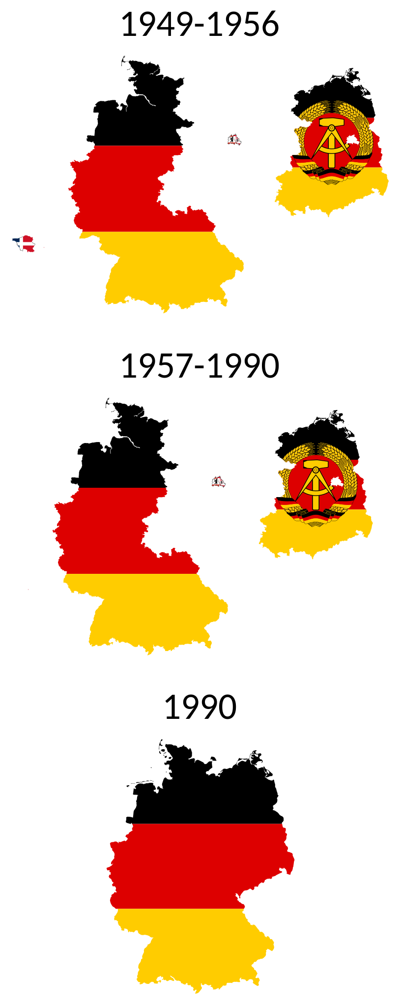
| Description | SVG flag map of the German Separation |
| Date | (UTC) |
| Source | Own work based on: BRDDDR.png |
| Author |
|
| Other versions |
 .svg) .svg) |
| SVG development | This W3C-invalid flag map was created with an unknown SVG tool. |
Licensing[edit]
.svg&action=edit§ion=2)
I, the copyright holder of this work, hereby publish it under the following licenses:
| This file is licensed under the Creative Commons Attribution-Share Alike 3.0 Unported license. | ||
| ||
| This licensing tag was added to this file as part of the GFDL licensing update. |

|
Permission is granted to copy, distribute and/or modify this document under the terms of the GNU Free Documentation License, Version 1.2 or any later version published by the Free Software Foundation; with no Invariant Sections, no Front-Cover Texts, and no Back-Cover Texts. A copy of the license is included in the section entitled GNU Free Documentation License. |
You may select the license of your choice.
Uploaded with derivativeFX
File history
Click on a date/time to view the file as it appeared at that time.
| Date/Time | Thumbnail | Dimensions | User | Comment | |
|---|---|---|---|---|---|
| current | 15:53, 18 January 2023 | 512 × 1,284 (645 KB) | MoRisop (talk | contribs) | Flag of East Berlin | |
| 19:35, 5 July 2020 | 512 × 1,284 (568 KB) | Leonel Sohns (talk | contribs) | Minified | ||
| 08:28, 12 November 2019 | 1,952 × 4,895 (877 KB) | Pediwikian (talk | contribs) | Small fixes | ||
| 08:09, 12 November 2019 | 1,832 × 4,775 (877 KB) | Pediwikian (talk | contribs) | Saarland (1949-1956) | ||
| 08:06, 24 November 2011 |  | 1,382 × 2,797 (342 KB) | Fry1989 (talk | contribs) | final change, maping united Germany and 1990 same size as the others | |
| 07:47, 24 November 2011 |  | 1,382 × 2,290 (336 KB) | Fry1989 (talk | contribs) | numbers got chopped off a tad | |
| 07:41, 24 November 2011 |  | 1,382 × 2,290 (330 KB) | Fry1989 (talk | contribs) | putting a ring around West Berlin for better highlight | |
| 03:07, 7 March 2011 |  | 1,382 × 2,290 (329 KB) | Fry1989 (talk | contribs) | West Berlin now UN blue. It was never officially part of West Germany. | |
| 02:57, 7 March 2011 |  | 1,382 × 2,290 (317 KB) | Fry1989 (talk | contribs) | arrange tighter | |
| 00:06, 7 March 2011 |  | 1,446 × 2,406 (317 KB) | Fry1989 (talk | contribs) | {{Information |Description=SVG flag map of the German Seperation |Source=*File:BRDDDR.png |Date=2011-03-07 00:04 (UTC) |Author=*File:BRDDDR.png: *derivative work: ~~~~ |Permission= |other_versions= }} {{self|Cc-by-sa-3.0-migrated|GFDL}} ''U |
You cannot overwrite this file.
File usage on Commons
The following 12 pages use this file:
- User:Fry1989/Gallery
- User:OgreBot/Watercraft/2019 November 12
- File:BRD-DDR.PNG
- File:BRDDDR.PNG
- File:BRDDDR.png
- File:BRDDDR ar.png
- File:Flag map of East Germany (1959–1990).svg
- File:Flag map of Germany.svg
- File:Flag map of West Germany (1949–1990).svg
- File:German seperation map.svg (file redirect)
- File:Réunification.png
- Category:German reunification
File usage on other wikis
The following other wikis use this file:
- Usage on am.wikipedia.org
- Usage on ast.wikipedia.org
- Usage on az.wikipedia.org
- Usage on ba.wikipedia.org
- Usage on be.wikipedia.org
- Usage on bg.wikipedia.org
- Usage on bn.wikipedia.org
- Usage on br.wikipedia.org
- Usage on ca.wikipedia.org
- Usage on da.wikipedia.org
- Usage on de.wikipedia.org
- Usage on diq.wikipedia.org
- Usage on eo.wikipedia.org
- Usage on es.wikipedia.org
- Usage on fa.wikipedia.org
- Usage on fi.wikipedia.org
- Usage on fr.wikipedia.org
- Usage on gl.wikipedia.org
- Usage on hi.wikipedia.org
- Usage on hr.wikipedia.org
- Usage on hu.wikipedia.org
- Usage on hy.wikipedia.org
- Usage on id.wikipedia.org
- Usage on it.wikipedia.org
- Usage on ja.wikipedia.org
- Usage on lfn.wikipedia.org
- Usage on ms.wikipedia.org
- Usage on nl.wikipedia.org
- Usage on no.wikipedia.org
- Usage on pl.wikipedia.org
- Usage on ro.wikipedia.org
- Usage on ru.wikipedia.org
- Usage on ru.wikinews.org
- Usage on sc.wikipedia.org
View more global usage of this file.
.svg)
Metadata
.svg&oldid=823414092)
Categories:
- 1990 events in Germany
- 1990 in West Germany
- 1990 in the German Democratic Republic
- Flags of the German Democratic Republic
- German division
- German reunification
- Historical flag maps of Germany
- Maps of the Cold War in Europe
- SVG variations on the national flag of Germany
- SVG flag maps of Germany
- SVG maps of the German Democratic Republic