File:Flooding near the Betsiboka River, Madagascar 2010-03-23 lrg.jpg
Jump to navigation
Jump to search
Size of this preview: 600 × 600 pixels. Other resolutions: 240 × 240 pixels | 480 × 480 pixels | 768 × 768 pixels | 1,024 × 1,024 pixels | 2,048 × 2,048 pixels | 3,000 × 3,000 pixels.
Original file (3,000 × 3,000 pixels, file size: 5.34 MB, MIME type: image/jpeg)
Captions
Captions
Add a one-line explanation of what this file represents
Summary[edit]
| Description |
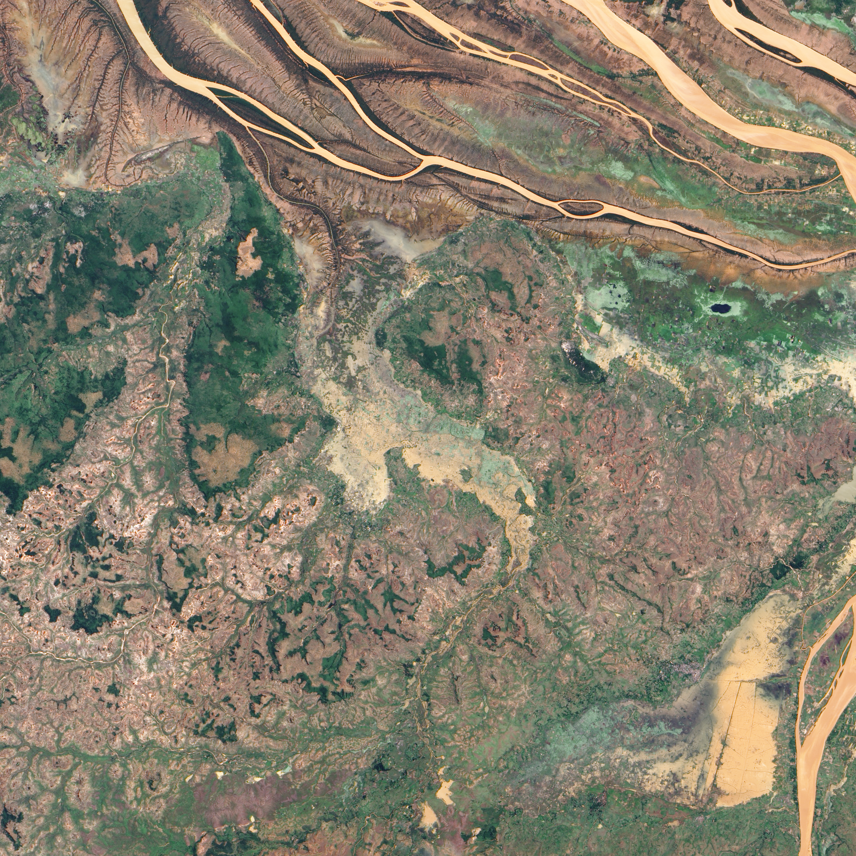
English: In northwestern Madagascar, the Betsiboka River flows toward the coast, its braided streams emptying into the Bombetoka Bay. In late March 2010, however, not long after Tropical Cyclone Hubert passed through the region, part of the river pushed over its banks, flooding nearby agricultural fields.
The Advanced Land Imager (ALI) on NASA’s Earth Observing-1 (EO-1) satellite captured this natural-color image on March 23, 2010. Immediately south of the Betsiboka River, which is visible in the large image, this area is roughly 40 kilometers (25 miles) from the coast. The wide beige-and-green swath filling most of the image is flooded, and uneven rectangles demarcate individual fields. Only areas of relatively high ground appear to have escaped standing water. |
| Date | |
| Source | http://earthobservatory.nasa.gov/NaturalHazards/view.php?id=43240&src=nha |
| Author | NASA |
| Other versions |
|

Licensing[edit]
| This file is in the public domain in the United States because it was solely created by NASA. NASA copyright policy states that "NASA material is not protected by copyright unless noted". (See Template:PD-USGov, NASA copyright policy page or JPL Image Use Policy.) | ||
 |
Warnings:
|
File history
Click on a date/time to view the file as it appeared at that time.
| Date/Time | Thumbnail | Dimensions | User | Comment | |
|---|---|---|---|---|---|
| current | 00:53, 26 January 2013 | | 3,000 × 3,000 (5.34 MB) | Slick-o-bot (talk | contribs) | Bot: convert to a non-interlaced jpeg (see bug #17645) |
| 00:50, 26 March 2010 |  | 3,000 × 3,000 (5.04 MB) | Captain-tucker (talk | contribs) | {{Information |Description={{en|In northwestern Madagascar, the Betsiboka River flows toward the coast, its braided streams emptying into the Bombetoka Bay. In late March 2010, however, not long after Tropical Cyclone Hubert passed through the region, par |
You cannot overwrite this file.
File usage on Commons
The following page uses this file:
File usage on other wikis
The following other wikis use this file:
- Usage on en.wikipedia.org
- Usage on ha.wikipedia.org