File:Fortifs gouvion.jpg
Jump to navigation
Jump to search
Size of this preview: 712 × 599 pixels. Other resolutions: 285 × 240 pixels | 570 × 480 pixels | 897 × 755 pixels.
Original file (897 × 755 pixels, file size: 705 KB, MIME type: image/jpeg)
Captions
Captions
Add a one-line explanation of what this file represents
Summary[edit]
| Description |
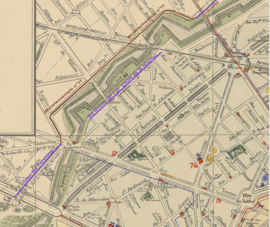
Français : Plan cadastral de la ville de Paris... / établi d'après les documents officiels les plus récentes et comprenant l'Exposition universelle de 1900, par Mme Max Mabyre http://gallica.bnf.fr/ark:/12148/btv1b530294583 ajouté en superposition tracé route de la révolte |
| Date | |
| Source | BN-Gallica http://gallica.bnf.fr/ark:/12148/btv1b530294583 |
| Author | Max Mabyre Plan cadastral de la ville de Paris |
Licensing[edit]
| Previous public domain rationale, no longer applicable | ||
|---|---|---|
|
File history
Click on a date/time to view the file as it appeared at that time.
| Date/Time | Thumbnail | Dimensions | User | Comment | |
|---|---|---|---|---|---|
| current | 16:21, 20 November 2014 | | 897 × 755 (705 KB) | Paris17bg (talk | contribs) | User created page with UploadWizard |
You cannot overwrite this file.
File usage on Commons
There are no pages that use this file.
File usage on other wikis
The following other wikis use this file:
- Usage on fr.wikipedia.org