File:Furnas Mill Bridge, underneath westward, vertical.jpg
Jump to navigation
Jump to search
Size of this preview: 450 × 600 pixels. Other resolutions: 180 × 240 pixels | 360 × 480 pixels | 576 × 768 pixels | 768 × 1,024 pixels | 2,112 × 2,816 pixels.
Original file (2,112 × 2,816 pixels, file size: 2.58 MB, MIME type: image/jpeg)
Captions
Captions
Add a one-line explanation of what this file represents
| Camera location | | View this and other nearby images on: OpenStreetMap |
|---|
| Description |
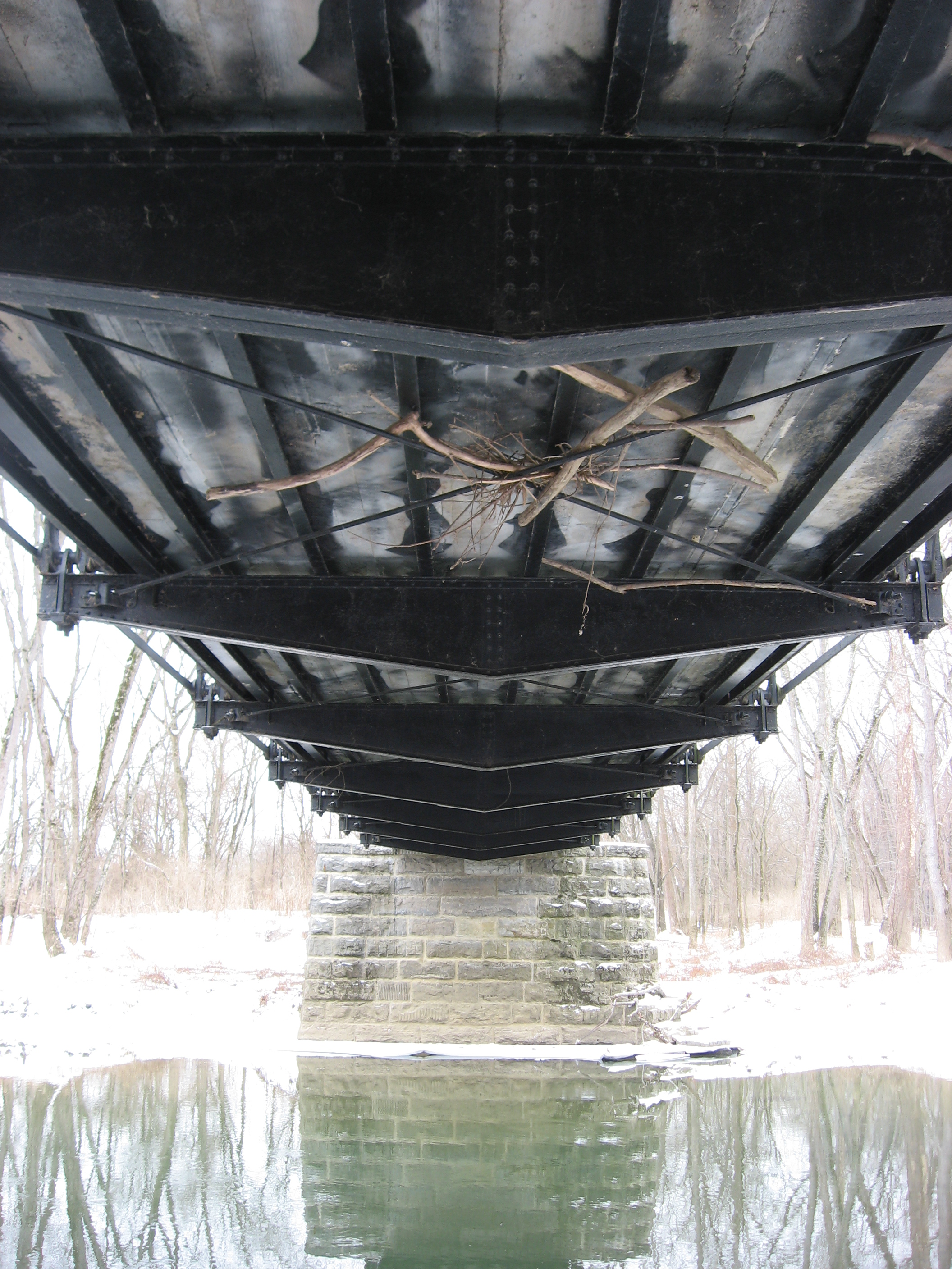
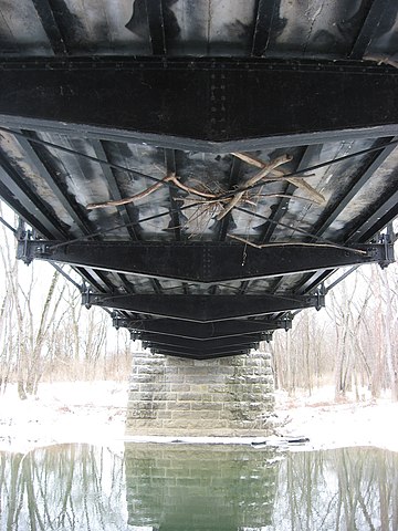
English: Underside, looking westward, of the Furnas Mill Bridge, which carries Road 650S over Sugar Creek in the Atterbury Fish and Wildlife Area northwest of Edinburgh in Blue River Township, Johnson County, Indiana, United States. Built in 1891, it is listed on the National Register of Historic Places. |
||
| Date | Taken on 28 January 2011 | ||
| Source | Own work | ||
| Author | Nyttend | ||
| Permission (Reusing this file) |
|
File history
Click on a date/time to view the file as it appeared at that time.
| Date/Time | Thumbnail | Dimensions | User | Comment | |
|---|---|---|---|---|---|
| current | 03:48, 30 January 2011 | | 2,112 × 2,816 (2.58 MB) | Nyttend (talk | contribs) | {{Location|39|22|56|N|85|59|53|W}} {{Information |Description={{en|Underside, looking westward, of the {{w|Furnas Mill Bridge}}, which carries Road 650S over Sugar Creek in the Atterbury Fish and Wildlife Area northwest of {{w|Edinburgh, Indiana|Edinburgh |
You cannot overwrite this file.
File usage on Commons
There are no pages that use this file.