File:Gebiet Arras - St. Quentin - Mons.jpg
Jump to navigation
Jump to search
Size of this preview: 704 × 600 pixels. Other resolutions: 282 × 240 pixels | 564 × 480 pixels | 902 × 768 pixels | 1,202 × 1,024 pixels | 2,404 × 2,048 pixels | 5,687 × 4,845 pixels.
Original file (5,687 × 4,845 pixels, file size: 9.49 MB, MIME type: image/jpeg)
Captions
Captions
Add a one-line explanation of what this file represents
Summary[edit]
| Description |
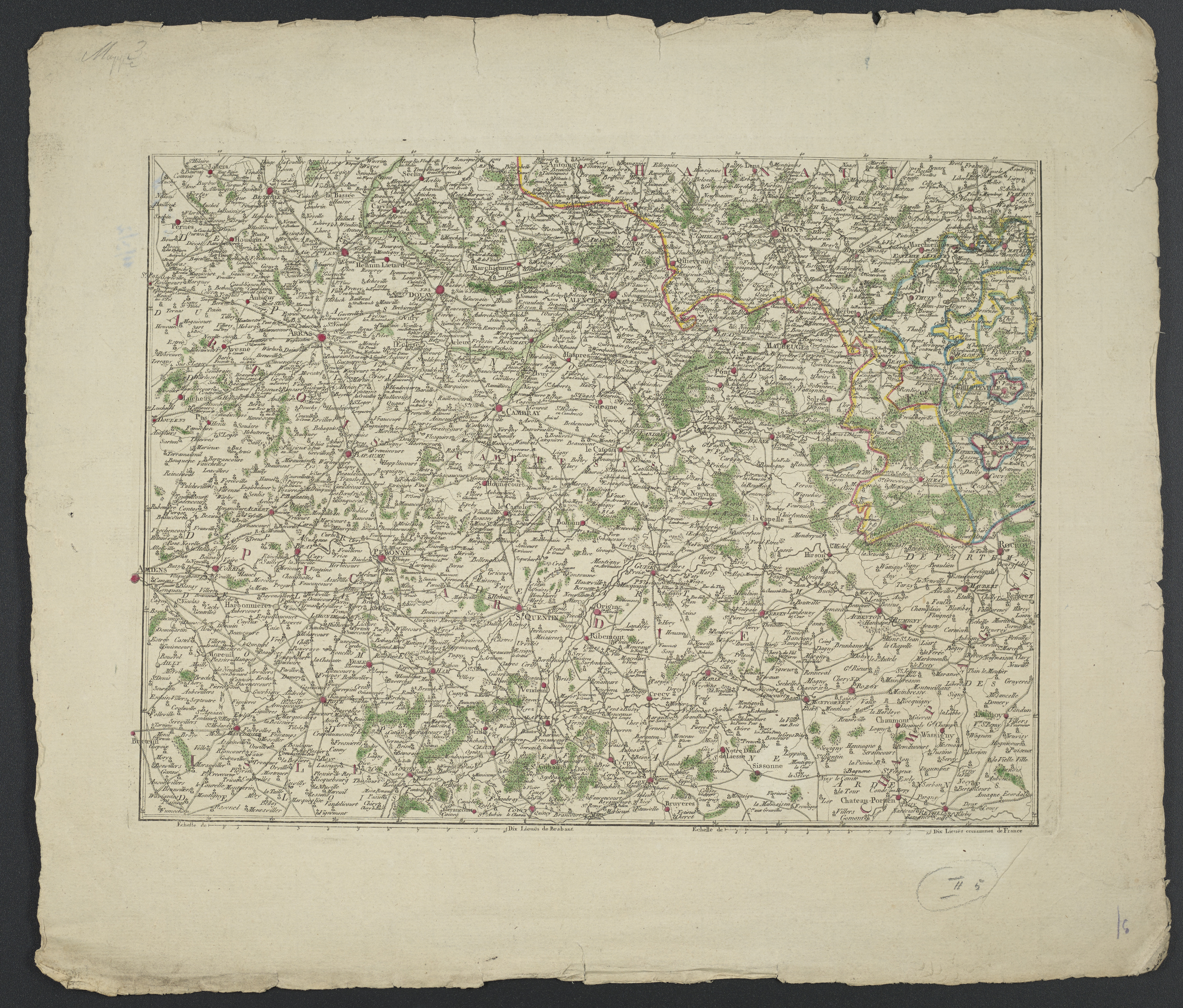
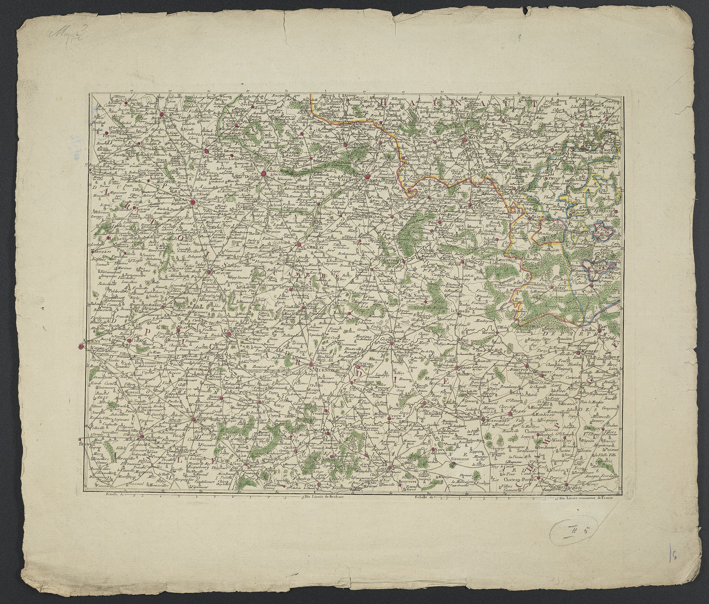
Deutsch: 1 Kt. : teilw. kolor. (37 x 27 cm); Koordinaten E 2°16'00"-E 4°33'00"/N 50°34'00"-N 49°29'00"; Maßstab in graph. Form (Lieuës de Brabant, Lieuës communes de France). - Ohne Titel. - Maßstab unter Kt.-Feld. - Ohne Relief |
| Date | circa 1780 |
| Source | Leibniz-Institut für Länderkunde, Leipzig |
| Author | o. A. |
Verwaltungskarte des Gebietes um Arras, St. Quentin und Mons mit Straßen und Wäldern
Licensing[edit]
| This file is made available under the Creative Commons CC0 1.0 Universal Public Domain Dedication. | |
| The person who associated a work with this deed has dedicated the work to the public domain by waiving all of their rights to the work worldwide under copyright law, including all related and neighboring rights, to the extent allowed by law. You can copy, modify, distribute and perform the work, even for commercial purposes, all without asking permission.
|
File history
Click on a date/time to view the file as it appeared at that time.
| Date/Time | Thumbnail | Dimensions | User | Comment | |
|---|---|---|---|---|---|
| current | 09:49, 7 September 2018 | | 5,687 × 4,845 (9.49 MB) | Higgenhorscht (talk | contribs) | User created page with UploadWizard |
You cannot overwrite this file.
File usage on Commons
There are no pages that use this file.