File:Geo Map of Income by Location in Texas (2014).png
Jump to navigation
Jump to search
Size of this preview: 545 × 599 pixels. Other resolutions: 218 × 240 pixels | 436 × 480 pixels | 802 × 882 pixels.
Original file (802 × 882 pixels, file size: 246 KB, MIME type: image/png)
Captions
Captions
Add a one-line explanation of what this file represents
Summary[edit]
.png&action=edit§ion=1)
| Description |
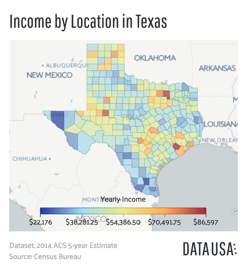
English: A map of the median income of each county in Texas as of 2014. |
| Date | |
| Source | http://datausa.io/profile/geo/texas/#income_geo |
| Author | Datawheel, LLC |
Licensing[edit]
.png&action=edit§ion=2)

|
This work is free software; you can redistribute it and/or modify it under the terms of the GNU Affero General Public License as published by the Free Software Foundation; either version 3 of the License, or any later version. This work is distributed in the hope that it will be useful, but without any warranty; without even the implied warranty of merchantability or fitness for a particular purpose. See version 3 of the GNU Affero General Public License for more details.
|
File history
Click on a date/time to view the file as it appeared at that time.
| Date/Time | Thumbnail | Dimensions | User | Comment | |
|---|---|---|---|---|---|
| current | 15:25, 8 June 2016 | | 802 × 882 (246 KB) | Mattrdini (talk | contribs) | User created page with UploadWizard |
You cannot overwrite this file.
File usage on Commons
There are no pages that use this file.
File usage on other wikis
The following other wikis use this file:
- Usage on de.wikipedia.org
- Usage on en.wikipedia.org
.png&oldid=458329760)