File:HUC Regions Map - NHDPlusHRStatus.png
Jump to navigation
Jump to search

Size of this preview: 741 × 600 pixels. Other resolutions: 297 × 240 pixels | 593 × 480 pixels | 949 × 768 pixels | 1,265 × 1,024 pixels | 2,530 × 2,048 pixels | 4,200 × 3,400 pixels.
Original file (4,200 × 3,400 pixels, file size: 1.32 MB, MIME type: image/png)
Captions
Captions
Add a one-line explanation of what this file represents
Summary[edit]
| Description |
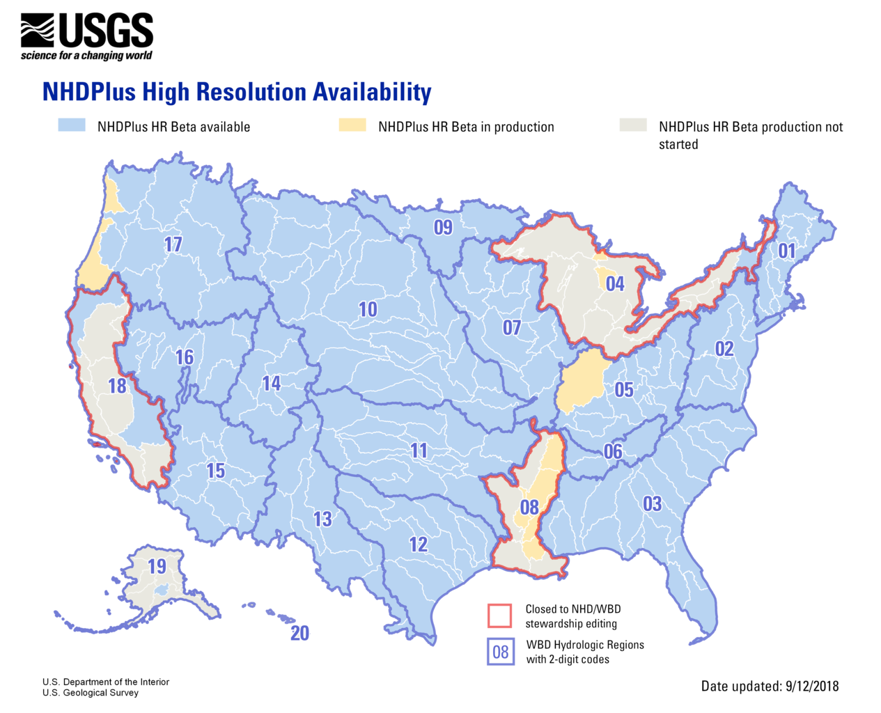
English: NHDPlus High Resolution maps availability by region, dated 9/12/2018. Includes updates to WBD map that cross international boundaries. |
| Date | |
| Source | Image: https://prd-wret.s3-us-west-2.amazonaws.com/assets/palladium/production/s3fs-public/styles/full_width/public/thumbnails/image/NHDPlusHR%20Status_Web_20180912.png?itok=eWLS4oS9 Website: https://www.usgs.gov/core-science-systems/ngp/national-hydrography/nhdplus-high-resolution |
| Author | USGS, DOI |
Licensing[edit]
This image is in the public domain in the United States because it only contains materials that originally came from the United States Geological Survey, an agency of the United States Department of the Interior. For more information, see the official USGS copyright policy.
|
File history
Click on a date/time to view the file as it appeared at that time.
| Date/Time | Thumbnail | Dimensions | User | Comment | |
|---|---|---|---|---|---|
| current | 10:56, 5 October 2020 | | 4,200 × 3,400 (1.32 MB) | Remitamine (talk | contribs) | Higher resolution version |
| 10:39, 29 September 2018 |  | 1,140 × 923 (471 KB) | Furicorn (talk | contribs) | Transferred from https://prd-wret.s3-us-west-2.amazonaws.com/assets/palladium/production/s3fs-public/styles/full_width/public/thumbnails/image/NHDPlusHR%20Status_Web_20180912.png?itok=eWLS4oS9 |
You cannot overwrite this file.
File usage on Commons
There are no pages that use this file.