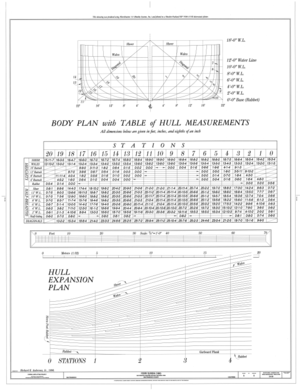
File:Half Breadth Plan, Sheer Plan - Ferry EUREKA, Hyde Street Pier, San Francisco, San Francisco County, CA HAER CAL,38-SANFRA,194- (sheet 1 of 5).png

Original file (17,712 × 13,632 pixels, file size: 10.17 MB, MIME type: image/png)
Captions
Captions
| This image is a JPEG version of the original TIF image at File: Half Breadth Plan, Sheer Plan - Ferry EUREKA, Hyde Street Pier, San Francisco, San Francisco County, CA HAER CAL,38-SANFRA,194- (sheet 1 of 5).tif.
However, any edits to the image should be based on the original TIF version in order to prevent generation loss, and both versions should be updated. Do not make edits based on this version. |
Summary[edit]
| Warning | The original file is very high-resolution. It might not load properly or could cause your browser to freeze when opened at full size. |
|---|
| Half Breadth Plan, Sheer Plan - Ferry EUREKA, Hyde Street Pier, San Francisco, San Francisco County, CA | |||||
|---|---|---|---|---|---|
| Photographer |
Anderson, Richard K. Jr., creator |
||||
| Title |
Half Breadth Plan, Sheer Plan - Ferry EUREKA, Hyde Street Pier, San Francisco, San Francisco County, CA |
||||
| Depicted place | California; San Francisco County; San Francisco | ||||
| Date |
1996 date QS:P571,+1996-00-00T00:00:00Z/9 |
||||
| Dimensions | 34 x 44 in. (E size) | ||||
| Current location |
Library of Congress Prints and Photographs Division Washington, D.C. 20540 USA http://hdl.loc.gov/loc.pnp/pp.print |
||||
| Accession number |
HAER CAL,38-SANFRA,194- (sheet 1 of 5) |
||||
| Credit line |
|
||||
| Notes |
EUREKA is one of two survivors from a once large fleet of steam ferries that served on San Francisco Bay and played a vital role in the regional economy. These ferries provided the connection between San Francisco and its transbay hinterland that made possible the growth of suburbs in Marin County, Contra Costa County, and the East Bay. Before highways and suspension bridges, the ferries were the main conduits for travelers within the region.
|
||||
| References |
Related names:
|
||||
| Source | https://www.loc.gov/pictures/item/ca1504.sheet.00001a | ||||
| Permission (Reusing this file) |
|
||||
| Other versions |
     |
||||
| Object location | 37° 46′ 30″ N, 122° 25′ 05.99″ W | View this and other nearby images on: OpenStreetMap |
|---|
File history
Click on a date/time to view the file as it appeared at that time.
| Date/Time | Thumbnail | Dimensions | User | Comment | |
|---|---|---|---|---|---|
| current | 07:18, 9 July 2014 |  | 17,712 × 13,632 (10.17 MB) | Fæ (talk | contribs) | {{Compressed version|file=File:Half_Breadth_Plan,_Sheer_Plan_-_Ferry_EUREKA,_Hyde_Street_Pier,_San_Francisco,_San_Francisco_County,_CA_HAER_CAL,38-SANFRA,194-_(sheet_1_of_5).tif|thumb=nothumb}} =={{int:filedesc}}== {{Photograph | accession number = H... |
You cannot overwrite this file.
File usage on Commons
The following 12 pages use this file:
- File:Body Plan, Table of Hull Measurements, Hull Expansion Plan - Ferry EUREKA, Hyde Street Pier, San Francisco, San Francisco County, CA HAER CAL,38-SANFRA,194- (sheet 3 of 5).png
- File:Body Plan, Table of Hull Measurements, Hull Expansion Plan - Ferry EUREKA, Hyde Street Pier, San Francisco, San Francisco County, CA HAER CAL,38-SANFRA,194- (sheet 3 of 5).tif
- File:Half-Breadth Plan, Sheer Plan - Ferry EUREKA, Hyde Street Pier, San Francisco, San Francisco County, CA HAER CAL,38-SANFRA,194- (sheet 2 of 5).png
- File:Half-Breadth Plan, Sheer Plan - Ferry EUREKA, Hyde Street Pier, San Francisco, San Francisco County, CA HAER CAL,38-SANFRA,194- (sheet 2 of 5).tif
- File:Half Breadth Plan, Sheer Plan - Ferry EUREKA, Hyde Street Pier, San Francisco, San Francisco County, CA HAER CAL,38-SANFRA,194- (sheet 1 of 5).png
- File:Half Breadth Plan, Sheer Plan - Ferry EUREKA, Hyde Street Pier, San Francisco, San Francisco County, CA HAER CAL,38-SANFRA,194- (sheet 1 of 5).tif
- File:Hurricane Deck, Passenger Deck, Main Deck Repairs - Ferry EUREKA, Hyde Street Pier, San Francisco, San Francisco County, CA HAER CAL,38-SANFRA,194- (sheet 4 of 5).png
- File:Hurricane Deck, Passenger Deck, Main Deck Repairs - Ferry EUREKA, Hyde Street Pier, San Francisco, San Francisco County, CA HAER CAL,38-SANFRA,194- (sheet 4 of 5).tif
- File:Steam Piping System, Midship Section - Ferry EUREKA, Hyde Street Pier, San Francisco, San Francisco County, CA HAER CAL,38-SANFRA,194- (sheet 5 of 5).png
- File:Steam Piping System, Midship Section - Ferry EUREKA, Hyde Street Pier, San Francisco, San Francisco County, CA HAER CAL,38-SANFRA,194- (sheet 5 of 5).tif
- File:Title Sheet - Ferry EUREKA, Hyde Street Pier, San Francisco, San Francisco County, CA HAER CAL,38-SANFRA,194- (sheet 1 of 2).png
- File:Title Sheet - Ferry EUREKA, Hyde Street Pier, San Francisco, San Francisco County, CA HAER CAL,38-SANFRA,194- (sheet 1 of 2).tif
Metadata
This file contains additional information such as Exif metadata which may have been added by the digital camera, scanner, or software program used to create or digitize it. If the file has been modified from its original state, some details such as the timestamp may not fully reflect those of the original file. The timestamp is only as accurate as the clock in the camera, and it may be completely wrong.
| Horizontal resolution | 28.35 dpc |
|---|---|
| Vertical resolution | 28.35 dpc |

