File:Harmony Church Milsboro Sussex Co DE.JPG
Jump to navigation
Jump to search

Size of this preview: 800 × 533 pixels. Other resolutions: 320 × 213 pixels | 640 × 427 pixels | 1,024 × 683 pixels | 1,280 × 853 pixels | 2,560 × 1,707 pixels | 5,819 × 3,879 pixels.
Original file (5,819 × 3,879 pixels, file size: 5.89 MB, MIME type: image/jpeg)
Captions
Captions
Add a one-line explanation of what this file represents
Summary[edit]
| Description |
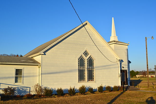
English: Harmony Church,listed on the NRHP on April 26, 1979. Located on Delaware Route 24, east of Road 313, Millsboro, Sussex County, Delaware. Related to the Nanticoke Tribe |
| Date | |
| Source | Own work |
| Author | Smallbones |
| Camera location | | View this and other nearby images on: OpenStreetMap |
|---|
|
This is an image of a place or building that is listed on the National Register of Historic Places in the United States of America. Its reference number is 79003308. |
Licensing[edit]
I, the copyright holder of this work, hereby publish it under the following license:
| This file is made available under the Creative Commons CC0 1.0 Universal Public Domain Dedication. | |
| The person who associated a work with this deed has dedicated the work to the public domain by waiving all of their rights to the work worldwide under copyright law, including all related and neighboring rights, to the extent allowed by law. You can copy, modify, distribute and perform the work, even for commercial purposes, all without asking permission.
|
File history
Click on a date/time to view the file as it appeared at that time.
| Date/Time | Thumbnail | Dimensions | User | Comment | |
|---|---|---|---|---|---|
| current | 17:09, 2 December 2013 | | 5,819 × 3,879 (5.89 MB) | Smallbones (talk | contribs) | User created page with UploadWizard |
You cannot overwrite this file.
File usage on Commons
There are no pages that use this file.
File usage on other wikis
The following other wikis use this file:
- Usage on en.wikipedia.org
- Usage on fr.wikipedia.org
- Usage on www.wikidata.org
Metadata
Categories:
- National Register of Historic Places in Sussex County, Delaware
- Buildings of religious function on the National Register of Historic Places in Delaware
- Churches in Sussex County, Delaware
- United Methodist churches in Delaware
- Gothic Revival churches in Delaware
- Wooden churches in Delaware
- Churches in Delaware built in 1891
- Churches in the United States photographed in 2013
- November 2013 in Delaware