File:Hubbard Glacier Alaska Map.jpg
Jump to navigation
Jump to search

Size of this preview: 376 × 599 pixels. Other resolutions: 151 × 240 pixels | 589 × 938 pixels.
Original file (589 × 938 pixels, file size: 100 KB, MIME type: image/jpeg)
Captions
Captions
Add a one-line explanation of what this file represents
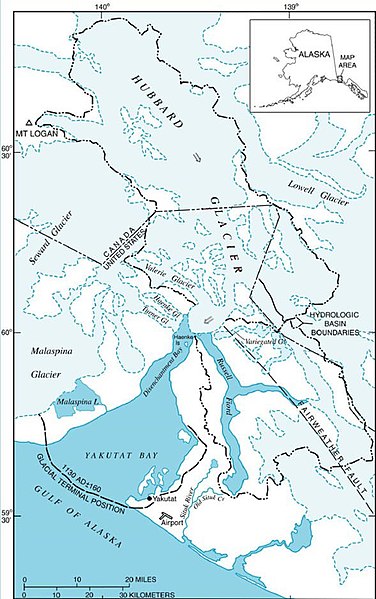
Map of Hubbard Glacier, Alaska
Credit: U.S. Geological Survey
Obtained from URL: https://www2.usgs.gov/climate_landuse/clu_rd/glacierstudies/hubbard.asp Permission: https://www2.usgs.gov/laws/info_policies.html
This image is in the public domain in the United States because it only contains materials that originally came from the United States Geological Survey, an agency of the United States Department of the Interior. For more information, see the official USGS copyright policy.
|
File history
Click on a date/time to view the file as it appeared at that time.
| Date/Time | Thumbnail | Dimensions | User | Comment | |
|---|---|---|---|---|---|
| current | 01:20, 23 November 2004 | | 589 × 938 (100 KB) | Rick Sidwell~commonswiki (talk | contribs) | Map of Hubbard Glacier, Alaska |
You cannot overwrite this file.
File usage on Commons
The following page uses this file:
File usage on other wikis
The following other wikis use this file:
- Usage on ca.wikipedia.org
- Usage on cs.wikipedia.org
- Usage on de.wikipedia.org
- Usage on en.wikipedia.org
- Usage on es.wikipedia.org
- Usage on fr.wikipedia.org
- Usage on it.wikipedia.org
- Usage on ja.wikipedia.org
- Usage on nl.wikipedia.org
- Usage on pl.wikipedia.org
- Usage on ru.wikipedia.org
- Usage on sv.wikipedia.org
- Usage on tr.wikipedia.org
- Usage on uk.wikipedia.org
- Usage on www.wikidata.org