File:Isola di Sant'Erasmo (Venezia) - Torre Massimiliana Interno.jpg
Jump to navigation
Jump to search

Size of this preview: 448 × 600 pixels. Other resolutions: 179 × 240 pixels | 358 × 480 pixels | 574 × 768 pixels | 765 × 1,024 pixels | 1,530 × 2,048 pixels | 4,912 × 6,576 pixels.
Original file (4,912 × 6,576 pixels, file size: 16.28 MB, MIME type: image/jpeg)
Captions
Captions
Add a one-line explanation of what this file represents
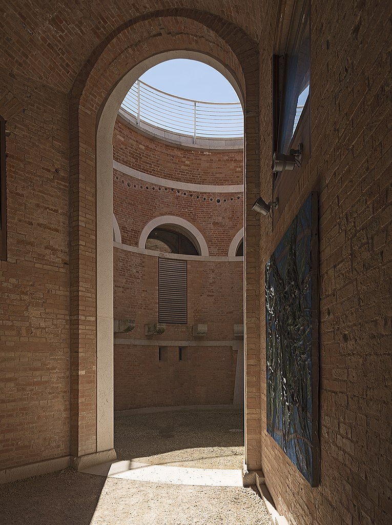
Torre Massimiliana in Sant’Erasmo island. View of the courtyard..
Summary[edit]
| Description |
English: La Torre Massimiliana: is a nineteenth century fortress located on the island of Sant'Erasmo in the northern part of the lagoon of Venice in front of the tip of Lido. View of the courtyard. Français : La Torre Massimiliana est une forteresse du XIXe siècle placée sur l'île de Sant'Erasmo dans la partie nord de la lagune de Venise, en face de la pointe du Lido. Vue de la cour intérieure. Italiano: La Torre Massimiliana è una fortezza ottocentesca posta sull'isola lagunare di Sant'Erasmo, presso l'estremità che si rivolge al Lido. Vista sul cortile. |
| Date | Taken on 10 May 2015 |
| Source | Own work |
| Author | Didier Descouens |
| Permission (Reusing this file) |
I, the copyright holder of this work, hereby publish it under the following license: This file is licensed under the Creative Commons Attribution-Share Alike 4.0 International license.
|
| Other versions |
|
_-_Torre_Massimiliana.jpg)
_-_Torre_Massimiliana_Interno.jpg)
_-_Torre_Massimiliana_Interno.jpg&action=edit§ion=1)
| Object location | | View this and other nearby images on: OpenStreetMap |
|---|
_-_Torre_Massimiliana_Interno.jpg¶ms=045.445092_N_0012.393152_E_globe:Earth_class:object_type:object_region:IT_&language=en)
File history
Click on a date/time to view the file as it appeared at that time.
| Date/Time | Thumbnail | Dimensions | User | Comment | |
|---|---|---|---|---|---|
| current | 08:38, 9 August 2015 | | 4,912 × 6,576 (16.28 MB) | Archaeodontosaurus (talk | contribs) | {{Information |Description ={{en|1=c}} |Source ={{own}} |Author =Archaeodontosaurus |Date = |Permission = |other_versions = }} |
You cannot overwrite this file.
File usage on Commons
The following 2 pages use this file:
File usage on other wikis
The following other wikis use this file:
- Usage on fr.wikipedia.org
- Usage on it.wikipedia.org
_-_Torre_Massimiliana_Interno.jpg&oldid=797525338)