File:Karte Bahnstrecke Karlsruhe Muehlacker.png
Jump to navigation
Jump to search
Size of this preview: 800 × 463 pixels. Other resolutions: 320 × 185 pixels | 640 × 371 pixels | 1,000 × 579 pixels.
Original file (1,000 × 579 pixels, file size: 295 KB, MIME type: image/png)
Captions
Captions
Add a one-line explanation of what this file represents
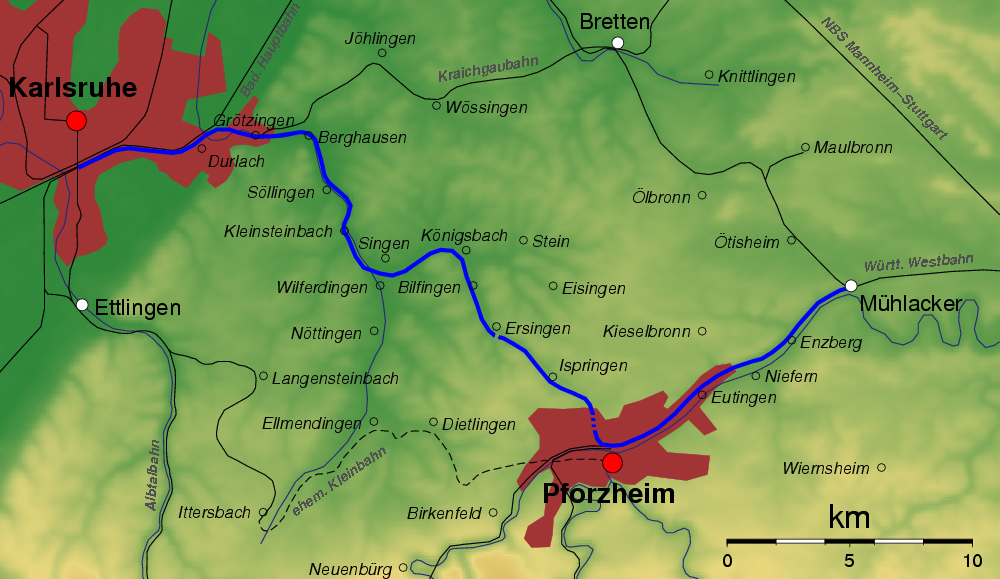
| Description | Karte der Eisenbahnstrecke Karlsruhe-Pforzheim-Mühlacker (blau) sowie angrenzender Eisenbahnstrecken (schwarz). Auswahl von Städten und Ortschaften entlang der Strecke. |
| Date | |
| Source | Own work |
| Author | MCMC |
| Permission (Reusing this file) |
author puts it under GFDL |
The map has been created with the Generic Mapping Tools: https://www.generic-mapping-tools.org/ using one or more of these public-domain datasets for the relief:
|

|
Permission is granted to copy, distribute and/or modify this document under the terms of the GNU Free Documentation License, Version 1.2 or any later version published by the Free Software Foundation; with no Invariant Sections, no Front-Cover Texts, and no Back-Cover Texts. A copy of the license is included in the section entitled GNU Free Documentation License. |
| This file is licensed under the Creative Commons Attribution-Share Alike 3.0 Unported license. | ||
| ||
| This licensing tag was added to this file as part of the GFDL licensing update. |
File history
Click on a date/time to view the file as it appeared at that time.
| Date/Time | Thumbnail | Dimensions | User | Comment | |
|---|---|---|---|---|---|
| current | 17:47, 26 November 2006 | | 1,000 × 579 (295 KB) | MCMC (talk | contribs) | |
| 18:13, 25 November 2006 |  | 1,000 × 565 (282 KB) | MCMC (talk | contribs) | {{Information |Description=Karte der Eisenbahnstrecke Karlsruhe-Pforzheim-Mühlacker (blau) sowie angrenzender Eisenbahnstrecken (schwarz). Auswahl von Städten und Ortschaften entlang der Strecke. |Source=own work |Date=25. Nov. 2006 |Author=[[User:MCMC| |
You cannot overwrite this file.
File usage on Commons
The following 2 pages use this file:
File usage on other wikis
The following other wikis use this file:
- Usage on de.wikipedia.org
- Usage on en.wikipedia.org
- Usage on ja.wikipedia.org
- Usage on www.wikidata.org