File:Końskie (gmina) location map.png

Original file (2,128 × 1,875 pixels, file size: 835 KB, MIME type: image/png)
Captions
Captions
Summary[edit]
_location_map.png&action=edit§ion=1)
| Description |
English: Location map |
| Date | |
| Source | Own work |
| Author | Smat |
| Description |
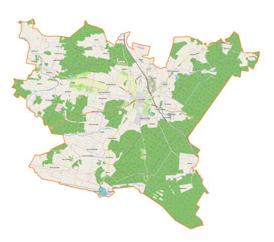
Polski: Mapa gminy Końskie, Polska
English: Map of Końskie (gmina), Poland |
|||||||||
| Date | ||||||||||
| Source | You may find a page on the OpenStreetMap wiki page for Końskie (gmina) | |||||||||
| Creator |
OpenStreetMap contributors OpenStreetMap contributors |
|||||||||
| Permission (Reusing this file) |
OpenStreetMap data is available under the Open Database License (details). Map tiles are licensed under the Creative Commons Attribution-ShareAlike 2.0 license (CC-BY-SA 2.0).
This file is licensed under the Creative Commons Attribution-Share Alike 2.0 Generic license.
|
|||||||||
| Geotemporal data | ||||||||||
| Bounding box |
|
|||||||||
| Georeferencing | If inappropriate please set warp_status = skip to hide. | |||||||||
Licensing[edit]
_location_map.png&action=edit§ion=2)
| This work contains information from OpenStreetMap, which is made available under the Open Database License (ODbL).
The ODbL does not require any particular license for maps produced from ODbL data. Prior to 1 August 2020, map tiles produced by the OpenStreetMap Foundation were licensed under the CC-BY-SA-2.0 license. Maps produced by other people may be subject to other licences. |
File history
Click on a date/time to view the file as it appeared at that time.
| Date/Time | Thumbnail | Dimensions | User | Comment | |
|---|---|---|---|---|---|
| current | 12:09, 17 January 2019 | | 2,128 × 1,875 (835 KB) | Smat (talk | contribs) | User created page with UploadWizard |
You cannot overwrite this file.
File usage on Commons
There are no pages that use this file.
File usage on other wikis
The following other wikis use this file:
- Usage on pl.wikipedia.org
- Końskie
- Szabelnia
- Bedlenko
- Czerwony Most
- Drutarnia (województwo świętokrzyskie)
- Dyszów
- Głupiów
- Gatniki
- Gracuch (wieś)
- Górny Młyn (województwo świętokrzyskie)
- Izabelów (województwo świętokrzyskie)
- Koczwara
- Kornica (Polska)
- Małachów (SIMC 0243760)
- Młynek Nieświński
- Modliszewice
- Nieświń
- Nowy Dziebałtów
- Nowy Kazanów
- Nowy Sokołów
- Niebo (województwo świętokrzyskie)
- Paruchy
- Proćwin
- Przybyszowy
- Sielpia Wielka
- Stary Dziebałtów
- Stary Kazanów
- Stary Sokołów
- Stadnicka Wola
- Trzemoszna
- Baczyna (województwo świętokrzyskie)
- Barycz (powiat konecki)
- Bedlno (województwo świętokrzyskie)
- Kopaniny (powiat konecki)
- Nałęczów (województwo świętokrzyskie)
- Piekło (województwo świętokrzyskie)
- Pomorzany (województwo świętokrzyskie)
- Pomyków (województwo świętokrzyskie)
- Poraj (województwo świętokrzyskie)
- Sierosławice (województwo świętokrzyskie)
- Stara Kuźnica (województwo świętokrzyskie)
- Sworzyce (województwo świętokrzyskie)
- Brody (powiat konecki)
- Grabków (powiat konecki)
- Jeżów (powiat konecki)
- Piła (powiat konecki)
- Rogów (powiat konecki)
- Wincentów (powiat konecki)
- Wąsosz (gmina Końskie)
- Końskie (stacja kolejowa)
View more global usage of this file.
_location_map.png)
_location_map.png&oldid=704423815)