File:Lambton7.jpg
Jump to navigation
Jump to search

Size of this preview: 800 × 522 pixels. Other resolutions: 320 × 209 pixels | 640 × 417 pixels | 1,024 × 668 pixels | 1,280 × 835 pixels | 2,560 × 1,669 pixels | 9,291 × 6,058 pixels.
Original file (9,291 × 6,058 pixels, file size: 3.16 MB, MIME type: image/jpeg)
Captions
Captions
Add a one-line explanation of what this file represents
| Description |
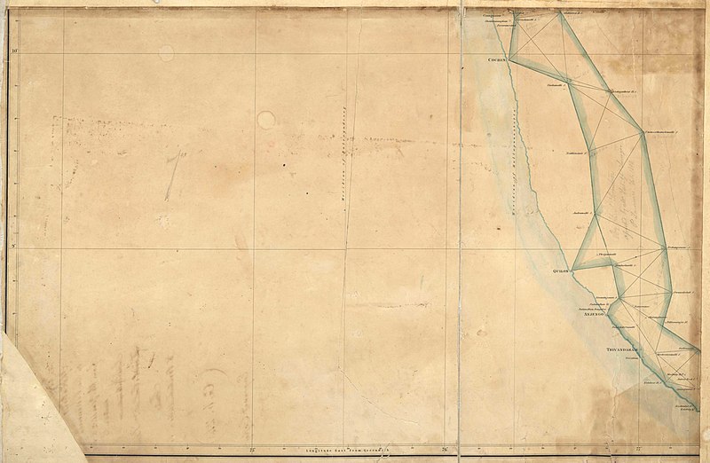
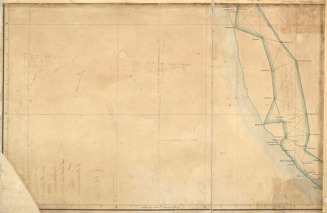
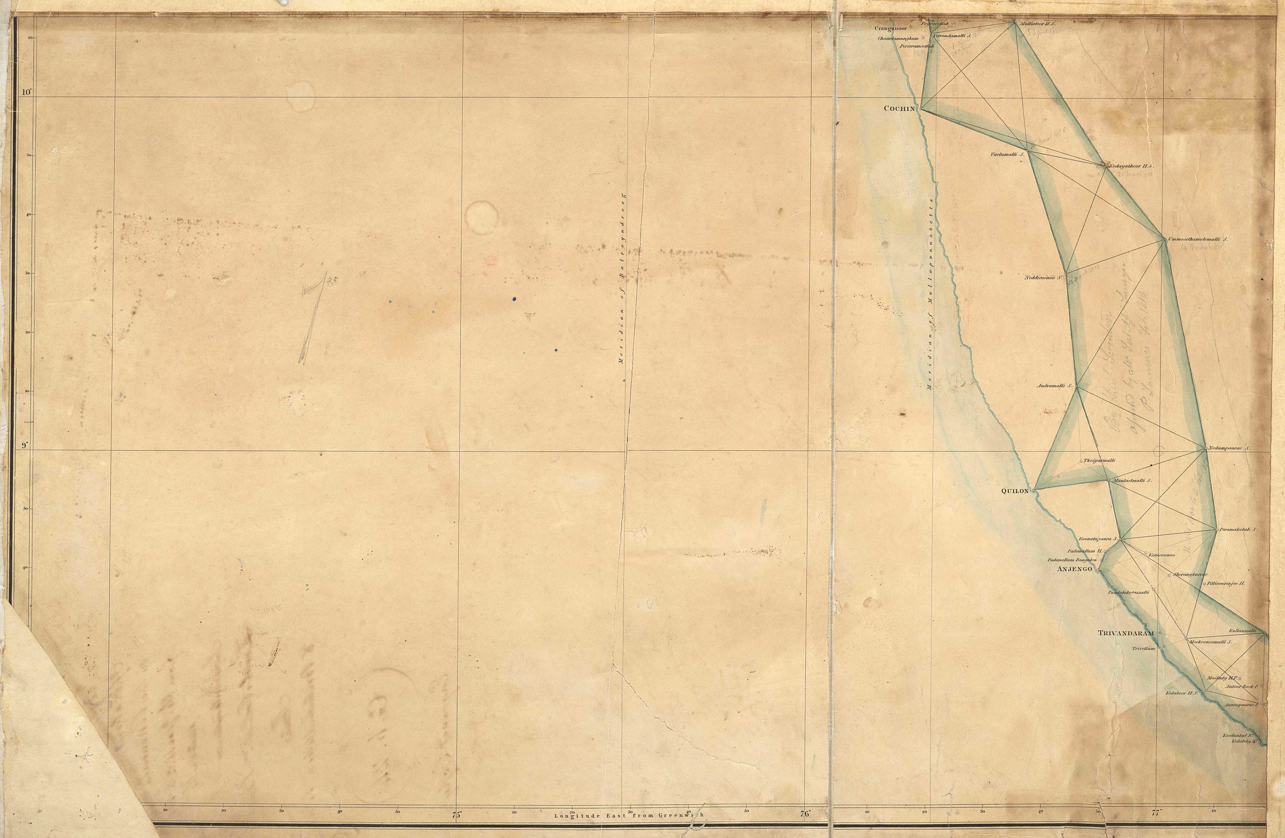
Part 7 of 4 rows and 2 cols grid forming Plan of Lambton's Trigonometrical Survey in the peninsula of India |
|||||||||
| Date | ||||||||||
| Source | Survey of India (https://zenodo.org/record/3596441#.YQFMUkDhXIU) | |||||||||
| Creator |
Survey of India |
|||||||||
| Permission (Reusing this file) |
|
|||||||||
| Geotemporal data | ||||||||||
| Bounding box |
|
|||||||||
| Georeferencing | ||||||||||
File history
Click on a date/time to view the file as it appeared at that time.
| Date/Time | Thumbnail | Dimensions | User | Comment | |
|---|---|---|---|---|---|
| current | 12:43, 28 July 2021 | | 9,291 × 6,058 (3.16 MB) | Shyamal (talk | contribs) | c:User:Rillke/bigChunkedUpload.js: {{Information |description= Part 7 of 4 rows and 2 cols grid forming Plan of Lambton's Trigonometrical Survey in the peninsula of India |source= Survey of India (https://zenodo.org/record/3596441#.YQFMUkDhXIU) |date=1801 | author = Survey of India |permission = {{pd-old-70}} }} |
You cannot overwrite this file.
File usage on Commons
There are no pages that use this file.