File:Landsat of Fountain Fire.tif
Jump to navigation
Jump to search
Size of this JPG preview of this TIF file: 657 × 599 pixels. Other resolutions: 263 × 240 pixels | 526 × 480 pixels | 842 × 768 pixels | 1,122 × 1,024 pixels | 2,245 × 2,048 pixels | 7,871 × 7,181 pixels.
Original file (7,871 × 7,181 pixels, file size: 7.33 MB, MIME type: image/tiff, 6 pages)
Captions
Captions
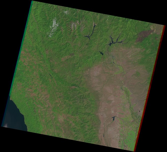
False-color Landsat/USGS image from EarthExplorer depicting Northern California; Redding and Fountain Fire burn scar in upper right
Summary[edit]
| Description |
English: An image from EarthExplorer by USGS, depicting Northern California in false color. Source: https://earthexplorer.usgs.gov/ |
| Date | |
| Source | EarthExplorer.USGS.gov |
| Author | USGS |
Licensing[edit]
This image is in the public domain in the United States because it only contains materials that originally came from the United States Geological Survey, an agency of the United States Department of the Interior. For more information, see the official USGS copyright policy.
|
File history
Click on a date/time to view the file as it appeared at that time.
| Date/Time | Thumbnail | Dimensions | User | Comment | |
|---|---|---|---|---|---|
| current | 00:41, 11 November 2022 |  | 7,871 × 7,181, 6 pages (7.33 MB) | Penitentes (talk | contribs) | Uploaded a work by USGS from EarthExplorer.USGS.gov with UploadWizard |
You cannot overwrite this file.
File usage on Commons
There are no pages that use this file.
File usage on other wikis
The following other wikis use this file:
- Usage on en.wikipedia.org