File:Lapal Tunnel West 50pc.jpg
Jump to navigation
Jump to search
Size of this preview: 796 × 600 pixels. Other resolutions: 319 × 240 pixels | 637 × 480 pixels | 1,020 × 768 pixels | 1,280 × 964 pixels | 2,560 × 1,928 pixels | 3,388 × 2,552 pixels.
Original file (3,388 × 2,552 pixels, file size: 2.56 MB, MIME type: image/jpeg)
Captions
Captions
Add a one-line explanation of what this file represents
This work is an Ordnance Survey map over 50 years old, which is covered by Crown Copyright which in this case expires 50 years after publication. Ordnance Survey does however ask that they be credited and that the date of publication be given.
Any ancillary rights gained through the creation of the electronic version are granted as freely usable under any circumstances.
|
This work created by the United Kingdom Government is in the public domain.
This is because it is one of the following:
HMSO has declared that the expiry of Crown Copyrights applies worldwide (ref: HMSO Email Reply)
|
 |
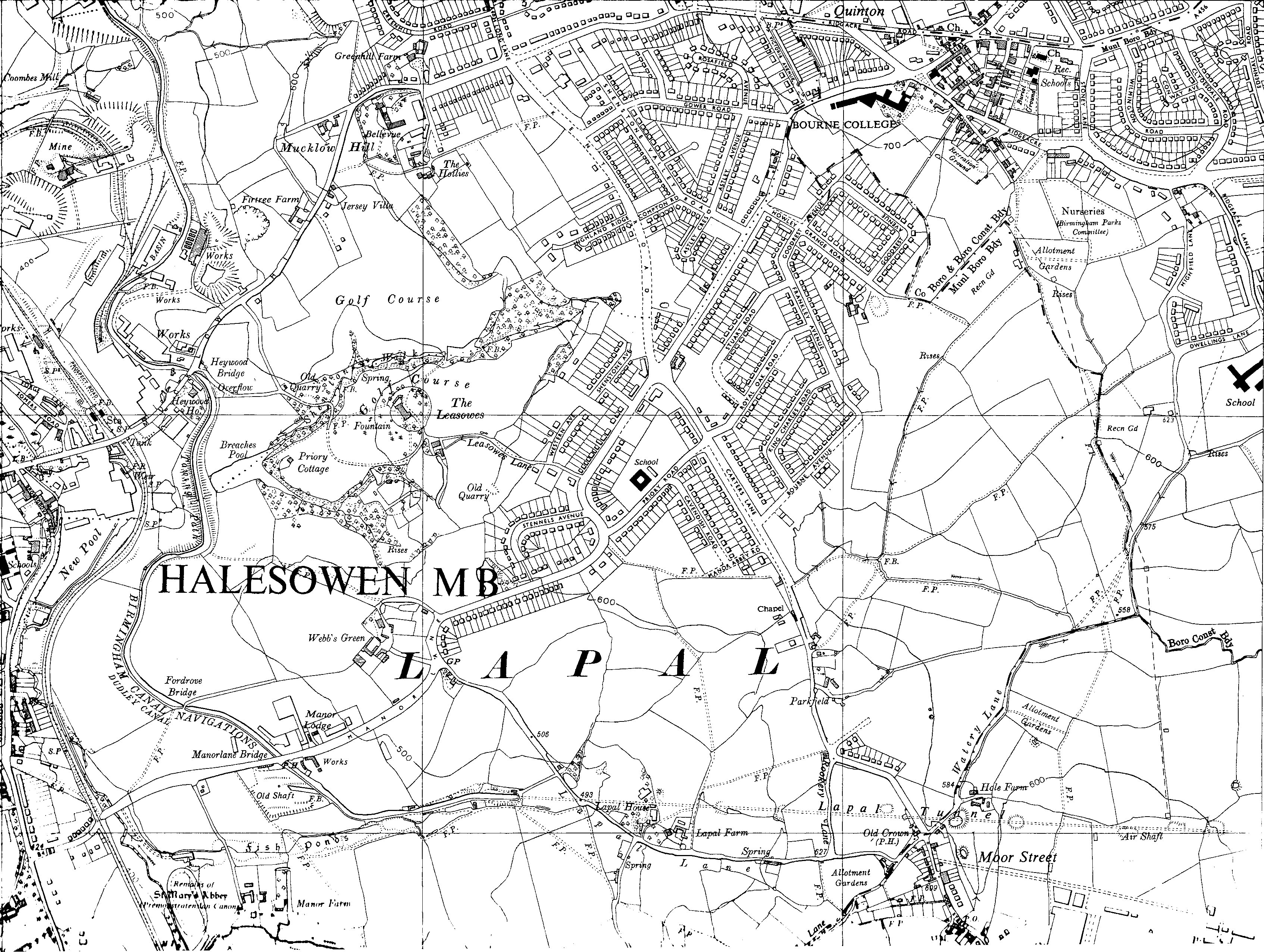
| Description | Old OS map of Halesowen and the western portal of the Lapal Tunnel on the Dudley Canal in England. Portal is below the capital "A" of "LAPAL". |
| Date | |
| Source | Ordnance Survey map SO98SE, 6 inch series 1955, scanned by en:User:Oosoom |
| Author | Ordnance Survey (UK) |
Location of Lapal Tunnel west portal:
| Camera location | | View this and other nearby images on: OpenStreetMap |
|---|
| Open this image as an overlay in Google Earth (Google Maps, Bing) | (Help|Source) |
File history
Click on a date/time to view the file as it appeared at that time.
| Date/Time | Thumbnail | Dimensions | User | Comment | |
|---|---|---|---|---|---|
| current | 12:33, 6 November 2007 | | 3,388 × 2,552 (2.56 MB) | Oosoom (talk | contribs) | {{oldOS}} {{Information |Description=Old OS map of Helesowen and the western portal of the Lepal Tunnel on the Dudley Canal in England. |Source=Ordnance Survey map SO98SE, 6 inch |
You cannot overwrite this file.
File usage on Commons
There are no pages that use this file.
File usage on other wikis
The following other wikis use this file:
- Usage on en.wikipedia.org