File:Late Devonian palaeogeographic map.jpg
跳转到导航
跳转到搜索
本预览的尺寸:800 × 402像素。 其他分辨率:320 × 161像素 | 640 × 321像素 | 1,024 × 514像素 | 1,651 × 829像素。
原始文件 (1,651 × 829像素,文件大小:178 KB,MIME类型:image/jpeg)
说明
说明
添加一行文字以描述该文件所表现的内容
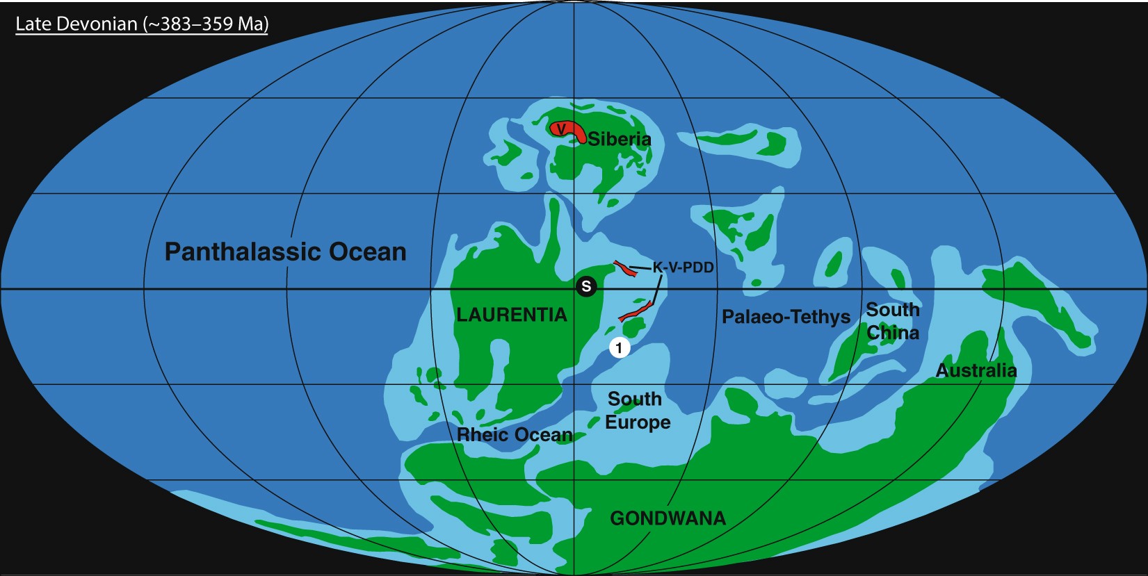
Map of the Late Devonian world
摘要
[编辑]
| 描述 |
English: Palaeogeographic map of the Late Devonian world, based on ref.77. The location of Steinbruch Schmidt(1), the Siljan impact crater (S), the Viluy Traps (V), and the Kola, Vyatka, and Pripyat–Dniepr–Donets rift systems (K-V-PDD) are indicated. |
| 日期 | |
| 来源 | Precisely dating the Frasnian–Famennian boundary: implications for the cause of the Late Devonian mass extinction. Sci Rep 8, 9578 (2018). https://doi.org/10.1038/s41598-018-27847-7 |
| 作者 | Percival, L.M.E., Davies, J.H.F.L., Schaltegger, U. et al. |
许可协议
[编辑]
文件历史
点击某个日期/时间查看对应时刻的文件。
| 日期/时间 | 缩略图 | 大小 | 用户 | 备注 | |
|---|---|---|---|---|---|
| 当前 | 2022年7月25日 (一) 03:20 | | 1,651 × 829(178 KB) | NGPezz(留言 | 贡献) | Uploaded a work by Percival, L.M.E., Davies, J.H.F.L., Schaltegger, U. et al. from Precisely dating the Frasnian–Famennian boundary: implications for the cause of the Late Devonian mass extinction. Sci Rep 8, 9578 (2018). https://doi.org/10.1038/s41598-018-27847-7 with UploadWizard |
您不可以覆盖此文件。
文件用途
没有页面使用本文件。
全域文件用途
以下其他wiki使用此文件:
- id.wikipedia.org上的用途
- ne.wikipedia.org上的用途
- si.wikipedia.org上的用途
- tl.wikipedia.org上的用途
- zh.wikipedia.org上的用途