File:Leptodirus hohenwarti distribution german.svg
Jump to navigation
Jump to search

Size of this PNG preview of this SVG file: 600 × 600 pixels. Other resolutions: 240 × 240 pixels | 480 × 480 pixels | 768 × 768 pixels | 1,024 × 1,024 pixels | 2,048 × 2,048 pixels | 1,000 × 1,000 pixels.
Original file (SVG file, nominally 1,000 × 1,000 pixels, file size: 213 KB)
Captions
Captions
Add a one-line explanation of what this file represents
| Description |
English: Blank map of Europe |
| Date | (UTC) |
| Source | |
| Author |
|
| This is a retouched picture, which means that it has been digitally altered from its original version. Modifications: translation from french to german. The original can be viewed here: Blank map europe.svg:
|
| I, the copyright holder of this work, release this work into the public domain. This applies worldwide. In some countries this may not be legally possible; if so: I grant anyone the right to use this work for any purpose, without any conditions, unless such conditions are required by law. |
Original upload log[edit]
This image is a derivative work of the following images:
- File:Leptodirus_hohenwarti_distribution.svg licensed with PD-self
- 2010-02-19T19:44:00Z Totodu74 1000x1000 (190355 Bytes) thinner stroke for the Europe map, Arial 72 for both texts
- 2010-02-19T18:11:21Z Totodu74 1000x1000 (190221 Bytes) Grmblbl... Does it look better now ?
- 2010-02-19T18:09:58Z Totodu74 1000x1000 (190113 Bytes) Location in Europe
- 2010-02-17T23:01:31Z Totodu74 1000x1000 (53330 Bytes) Will be better
- 2010-02-14T22:29:38Z Totodu74 621x375 (30019 Bytes) Change transparency
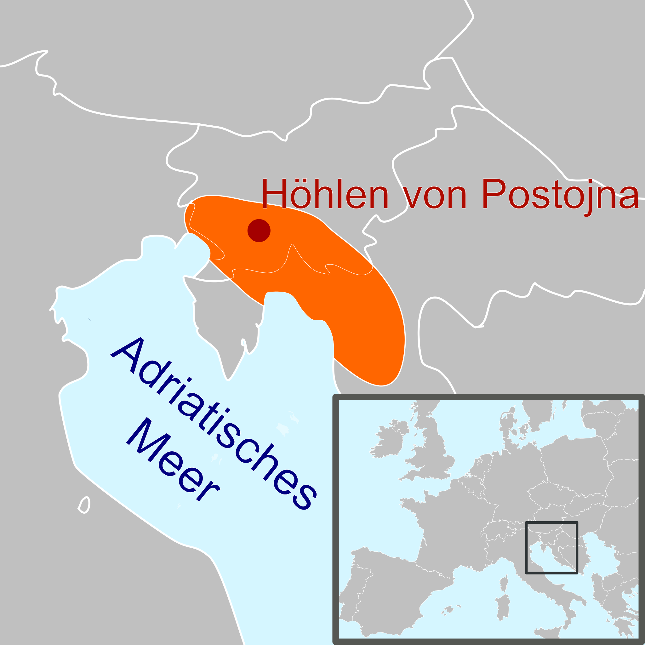
- 2010-02-14T22:25:17Z Totodu74 621x375 (29715 Bytes) {{Information |Description=* {{en|''Leptodirus hohenwarti'' distribution from [http://www.natura2000.gov.si/uploads/tx_library/koncno_porocilo_MonitoringHrosci3_2.pdf this doc]}} |Source=*[[:File:Flag-map_of_Slovenia.svg|]] |
- File:Blank_map_europe.svg licensed with PD-USGov-CIA-WF
- 2010-04-18T12:24:45Z Avala 680x520 (528468 Bytes)
- 2010-04-13T20:46:30Z Patrickneil 680x520 (543089 Bytes) Fut.Perf. added some islands in October, and whether or not the map has Kosovo, it should have the islands
- 2010-04-12T09:04:50Z Zirland 680x520 (528468 Bytes) Reverted to version as of 13:23, 5 December 2009
- 2010-04-09T16:29:37Z Anka Friedrich 680x520 (523284 Bytes) * removed hard coded styles in paths, which prevent colors beeing set by styles for ids or classes * removed style style2412, which colored timezones in southern europe
- 2009-12-05T13:23:39Z Avala 680x520 (528468 Bytes)
- 2009-10-17T17:24:14Z NuclearVacuum 680x520 (543089 Bytes) some minor editings
- 2009-10-17T14:34:47Z Future Perfect at Sunrise 680x520 (542517 Bytes) added some Greek islands
- 2009-03-25T20:06:19Z Samulili 680x520 (533055 Bytes) Reverted to version as of 15:29, 24 March 2009
- 2009-03-24T23:22:45Z Avala 680x520 (528468 Bytes) this is the original file. upload an alternative for alternative views. simle as that.
- 2009-03-24T15:29:37Z Patrickneil 680x520 (533055 Bytes) The are blank alternatives, that without Kosovo, make this a duplicate file
- 2009-03-20T22:30:51Z Avala 680x520 (528468 Bytes) Reverted to version as of 21:10, 27 May 2007 (original version)
- 2008-10-26T21:20:07Z Cradel 680x520 (533055 Bytes) there is another version of this image
- 2008-10-26T17:25:49Z Avala 680x520 (528468 Bytes) didn't we agree to have alternative files that include disputed territories? this way it is POV, who decides which one deserves to be shown as a country more, Kosovo, Palestine, TRNC, Abkhazia etc.
- 2008-10-25T13:36:13Z Cradel 680x520 (533055 Bytes) what ?
- 2008-10-24T22:42:12Z Avala 680x520 (528468 Bytes)
- 2008-09-22T13:35:30Z Cradel 680x520 (533055 Bytes) user has been warned
- 2008-09-22T02:11:46Z Tocino 680x520 (528468 Bytes) Reverted to version as of 17:38, 19 September 2008
- 2008-09-20T11:36:04Z Cradel 680x520 (533055 Bytes) Reverted to version as of 18:23, 17 September 2008
- 2008-09-19T17:38:55Z Tocino 680x520 (528468 Bytes) Reverted to version as of 18:12, 17 September 2008
- 2008-09-17T18:23:13Z Cradel 680x520 (533055 Bytes) look at the "other versions" section
- 2008-09-17T18:12:42Z Tocino 680x520 (528468 Bytes) Kosovo is not internationally recognized and this map is used for more than just CIA purposes
- 2008-09-16T16:01:06Z Cradel 680x520 (533055 Bytes) CIA recognises Kosovo, this is their map, do not vandalise it
- 2008-09-16T15:39:16Z Tocino 680x520 (528468 Bytes) Reverted to version as of 00:01, 16 September 2008
- 2008-09-16T10:07:44Z Cradel 680x520 (533055 Bytes) it is a god dammed CIA map
- 2008-09-16T00:01:36Z Tocino 680x520 (528468 Bytes) Reverted to version as of 17:23, 15 September 2008
- 2008-09-15T20:44:48Z Cradel 680x520 (533055 Bytes) Reverted to version as of 19:15, 14 September 2008
- 2008-09-15T17:23:28Z Tocino 680x520 (528468 Bytes) Reverted to version as of 17:03, 14 September 2008
- 2008-09-14T19:15:53Z Cradel 680x520 (533055 Bytes) sigh, please look her : https://www.cia.gov/library/publications/the-world-factbook/geos/kv.html
- 2008-09-14T17:03:29Z Milosevo 680x520 (528468 Bytes) Reverted to version as of 14:45, 13 September 2008 CIA recognizes cosovo? What? And tomorrow ROSKOSMOS recognizes covoso ..
- 2008-09-13T18:08:41Z Cradel 680x520 (533055 Bytes) fix
- 2008-09-13T18:01:06Z Cradel 680x520 (530422 Bytes) this is CIA map, which recognises kosovo
- 2008-09-13T14:45:29Z Avala 680x520 (528468 Bytes)
- 2008-08-06T20:03:48Z Cradel 680x520 (530422 Bytes) Reverted to version as of 16:17, 4 August 2008
- 2008-08-05T04:35:29Z Rokerismoravee 680x520 (528468 Bytes) Reverted to version as of 14:46, 4 August 2008
- 2008-08-04T16:17:13Z Cradel 680x520 (530422 Bytes) Reverted to version as of 12:09, 3 August 2008
- 2008-08-04T14:46:55Z Rokerismoravee 680x520 (528468 Bytes) Reverted to version as of 13:14, 2 August 2008
- 2008-08-03T12:09:59Z Cradel 680x520 (530422 Bytes) again : what are you talking about
- 2008-08-02T13:14:48Z Milosevo 680x520 (528468 Bytes) Territory of Kosovo isn't correct
- 2008-08-02T12:48:39Z Cradel 680x520 (530422 Bytes) this map was taken from the CIA world Factbook, which recognises Kosovo so please
- 2008-08-01T21:28:39Z Rokerismoravee 680x520 (528468 Bytes) Reverted to version as of 12:54, 1 August 2008
- 2008-08-01T19:07:24Z Cradel 680x520 (530422 Bytes) Reverted to version as of 20:44, 9 June 2008
- 2008-08-01T12:54:32Z Rokerismoravee 680x520 (528468 Bytes) Reverted to version as of 17:34, 9 June 2008
- 2008-06-09T20:44:17Z Cradel 680x520 (530422 Bytes) Reverted to version as of 17:01, 9 June 2008
- 2008-06-09T17:34:51Z Milosevo 680x520 (528468 Bytes) Reverted to version as of 14:14, 9 June 2008
- 2008-06-09T17:01:41Z Cradel 680x520 (530422 Bytes) Reverted to version as of 20:14, 8 June 2008
- 2008-06-09T14:14:04Z Milosevo 680x520 (528468 Bytes) revert, vandalism. No UN-Member
- 2008-06-08T20:14:58Z Cradel 680x520 (530422 Bytes) Reverted vandalism
- 2008-06-08T15:21:43Z Milosevo 680x520 (528468 Bytes) Reverted to version as of 21:10, 27 May 2007
- 2008-05-30T12:01:01Z Cradel 680x520 (530422 Bytes) + Kosovo
- 2007-05-27T21:10:55Z Ssolbergj 680x520 (528468 Bytes)
Uploaded with derivativeFX
File history
Click on a date/time to view the file as it appeared at that time.
| Date/Time | Thumbnail | Dimensions | User | Comment | |
|---|---|---|---|---|---|
| current | 10:42, 13 July 2010 | | 1,000 × 1,000 (213 KB) | Fecchi (talk | contribs) | {{Information |Description=* {{en|''Leptodirus hohenwarti'' distribution from [http://www.natura2000.gov.si/uploads/tx_library/koncno_porocilo_MonitoringHrosci3_2.pdf this doc]}} {{en|Blank map of Europe}} |Source=*[[:File:Leptodirus_hohenwarti_distributi |
You cannot overwrite this file.
File usage on Commons
The following page uses this file:
File usage on other wikis
The following other wikis use this file:
- Usage on de.wikipedia.org