File:Lieberoser Wueste 87.jpg
Jump to navigation
Jump to search

Size of this preview: 800 × 533 pixels. Other resolutions: 320 × 213 pixels | 640 × 427 pixels | 1,024 × 683 pixels | 1,280 × 853 pixels | 2,560 × 1,707 pixels | 5,472 × 3,648 pixels.
Original file (5,472 × 3,648 pixels, file size: 11.77 MB, MIME type: image/jpeg)
Captions
Captions
Add a one-line explanation of what this file represents
Summary
[edit]| Description |
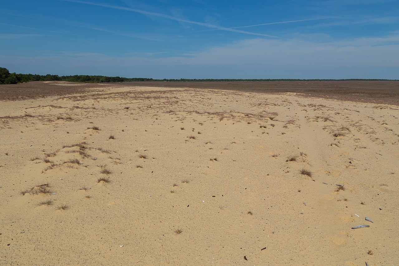
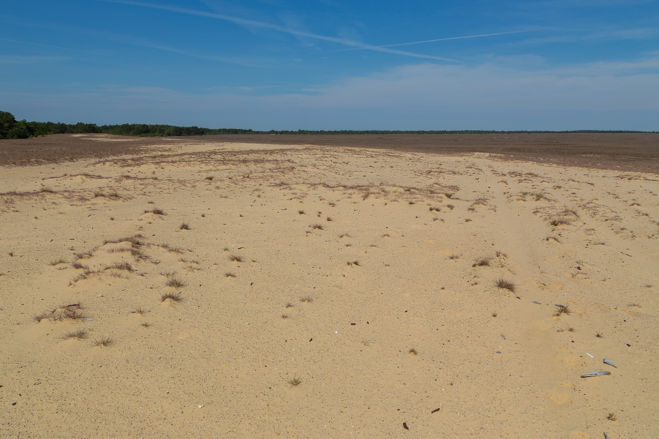
English: At the western edge of Lieberose Desert (Lieberoser Wüste) in the Lieberoser Heide near Lieberose, Landkreis Dahme-Spreewald, Brandenburg, Germany. It is Germany's largest desert and part of the nature reserve Lieberoser Endmoräne. The desert area is surrounded by Scots Pine (Pinus sylvestris) forests. (Photo taken on a guided tour.)
Deutsch: Waldkiefern (Pinus sylvestris) am Westrand der Lieberoser Wüste innerhalb der Lieberoser Heide in der Nähe von Lieberose, Landkreis Dahme-Spreewald, Brandenburg, Deutschland. Die rund 5 Quadratkilometer große Panzerwüste ist die größte Wüste Deutschlands und seit 1999 Teil des Naturschutzgebietes „Lieberoser Endmoräne“. Von den Rändern aus dringen im Zuge der natürlichen Sukzession allmählich Waldkiefern auf das Offengelände vor, das zunehmend durch Silbergrasfluren besiedelt wird. Dennoch gibt es an vielen Stellen der Wüste auch noch fast blanke Sandflächen mit Dünenbildungen. (Hinweis: Das Foto entstand während einer fachlich geleiteten Führung. Die Lieberoser Wüste ist ein Totalreservat und darf somit normalerweise nicht betreten werden.)
|
||||||||||||||||||||||||||
| Date | |||||||||||||||||||||||||||
| Source | Own work | ||||||||||||||||||||||||||
| Author |
|
||||||||||||||||||||||||||

| Camera location | | View this and other nearby images on: OpenStreetMap |
|---|
Notes
[edit]
This image is not public domain. Please respect the copyright protection. It may only be used according to the rules mentioned here. This specifically excludes use in social media, if applicable terms of the licenses listed here not appropriate. (See for example CC BY-SA on Facebook.) Of course, a free license is no carte blanche for use. Especially there restrictions not based on the License, for example to the personality rights of the author. This is especially true for the required attribution and the use of the image. It is expressly not allowed to give the impression through the use of the image, that the author supports the work, in which the image is used, or whose rights holders in any way. |

| Please do not upload a modified image here without consultation with the author. The author would like to make possible minor modifications only at his own source. (The source is usually a RAW file. Processing of the JPEG file means a loss of quality.) This ensures that the changes and the quality are preserved. Please if you think that any changes should be required, please contact the author. Otherwise you can upload a new image with a new name. Please use one of the templates derivative or extract. Please enter your name too, if you upload a derivative or a detail, because you're in charge of the changes. Please do not rename this file. The name is part of the attribution. In the case of misstatements, the author is pleased to provide information. |
Licensing
[edit]
This file is licensed under the Creative Commons Attribution-Share Alike 4.0 International license.
- You are free:
- to share – to copy, distribute and transmit the work
- to remix – to adapt the work
- Under the following conditions:
- attribution – You must give appropriate credit, provide a link to the license, and indicate if changes were made. You may do so in any reasonable manner, but not in any way that suggests the licensor endorses you or your use.
- share alike – If you remix, transform, or build upon the material, you must distribute your contributions under the same or compatible license as the original.
This image was uploaded as part of Wiki Loves Earth 2021.
|
 |
File history
Click on a date/time to view the file as it appeared at that time.
| Date/Time | Thumbnail | Dimensions | User | Comment | |
|---|---|---|---|---|---|
| current | 16:18, 8 May 2021 | | 5,472 × 3,648 (11.77 MB) | J.-H. Janßen (talk | contribs) | {{Information |Description ={{en|1=At the western edge of Lieberose Desert (''Lieberoser Wüste'') in the Lieberoser Heide near Lieberose, Landkreis Dahme-Spreewald, Brandenburg, Germany. It is Germany's largest desert and part of the nature reserve ''Lieberoser Endmoräne''. The desert area is surrounded by Scots Pine (''Pinus sylvestris'') forests. (Photo taken on a guided tou... |
You cannot overwrite this file.
File usage on Commons
There are no pages that use this file.