File:Location Chapultepec BC.png
Jump to navigation
Jump to search
No higher resolution available.
Location_Chapultepec_BC.png (277 × 182 pixels, file size: 24 KB, MIME type: image/png)
Captions
Captions
Add a one-line explanation of what this file represents
Summary[edit]
| Description |
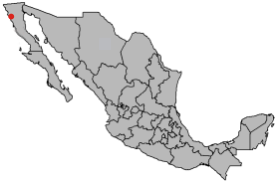
Español: Mapa de localizacion del Ex Ejido Chapultepec, México.
English: Location map of Ex Ejido Chapultepec, México. |
| Date | |
| Source | Own work |
| Author | Bubus |
| Permission (Reusing this file) |
I, the copyright holder of this work, hereby publish it under the following license: This file is licensed under the Creative Commons Attribution-Share Alike 2.5 Generic license.
|
File history
Click on a date/time to view the file as it appeared at that time.
| Date/Time | Thumbnail | Dimensions | User | Comment | |
|---|---|---|---|---|---|
| current | 08:31, 13 January 2008 | | 277 × 182 (24 KB) | Bubus~commonswiki (talk | contribs) | == Summary == {{Information| |Description=*{{es icon}} Mapa de localizacion del Ex Ejido Chapultepec, México. *{{en icon}} Location map of Ex Ejido Chapultepec, México. |Source=Own work. |Date=Jan 2007 |Author=Bubusx |Permission={{self|c |
You cannot overwrite this file.
File usage on Commons
There are no pages that use this file.
File usage on other wikis
The following other wikis use this file:
- Usage on ru.wikipedia.org