File:Locator Franconian Circle.svg
Jump to navigation
Jump to search

Size of this PNG preview of this SVG file: 613 × 600 pixels. Other resolutions: 245 × 240 pixels | 491 × 480 pixels | 785 × 768 pixels | 1,046 × 1,024 pixels | 2,093 × 2,048 pixels | 1,165 × 1,140 pixels.
Original file (SVG file, nominally 1,165 × 1,140 pixels, file size: 193 KB)
Captions
Captions
Add a one-line explanation of what this file represents
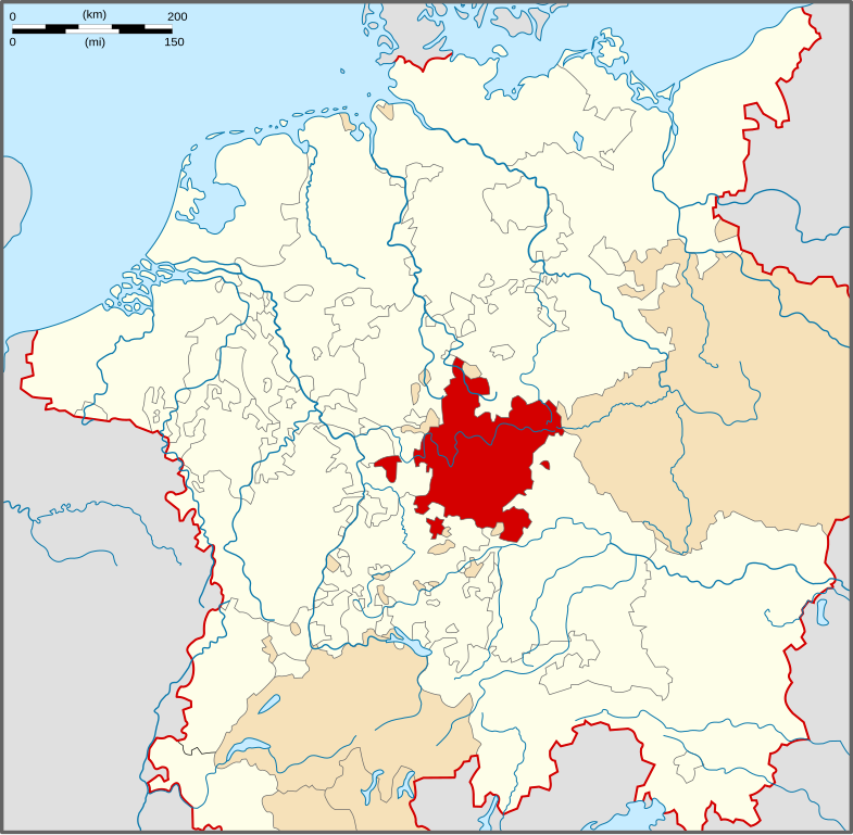
| Description | Locator Map of the Franconian Circle of Holy Roman Empire. |
| Date | |
| Source | PERTHES ATLAS Geschichte |
| Author | Sir Iain |
| Permission (Reusing this file) |
Attribution ShareAlike 3.0 |
This file is licensed under the Creative Commons Attribution-Share Alike 3.0 Unported license.
- You are free:
- to share – to copy, distribute and transmit the work
- to remix – to adapt the work
- Under the following conditions:
- attribution – You must give appropriate credit, provide a link to the license, and indicate if changes were made. You may do so in any reasonable manner, but not in any way that suggests the licensor endorses you or your use.
- share alike – If you remix, transform, or build upon the material, you must distribute your contributions under the same or compatible license as the original.
File history
Click on a date/time to view the file as it appeared at that time.
| Date/Time | Thumbnail | Dimensions | User | Comment | |
|---|---|---|---|---|---|
| current | 16:19, 28 March 2010 | | 1,165 × 1,140 (193 KB) | Sir Iain (talk | contribs) | {{Information |Description=Locator Map of the Franconian Circle of Holy Roman Empire. |Source=PERTHES ATLAS Geschichte |Date=28/03/2010 |Author=Sir Iain |Permission=Attribution ShareAlike 3.0 |other_versions= }} {{cc-by-sa-3.0}} [[Category:Reichskreise] |
You cannot overwrite this file.
File usage on Commons
The following 2 pages use this file:
File usage on other wikis
The following other wikis use this file:
- Usage on azb.wikipedia.org
- Usage on bg.wikipedia.org
- Usage on cs.wikipedia.org
- Usage on de.wikipedia.org
- Usage on en.wikipedia.org
- Schweinfurt
- Bad Mergentheim
- Rothenburg ob der Tauber
- Prince-Bishopric of Würzburg
- Principality of Ansbach
- Principality of Bayreuth
- Wertheim am Main
- County of Castell
- Weißenburg in Bayern
- Prince-Bishopric of Eichstätt
- Hohenlohe
- Bad Windsheim
- Franconian Circle
- Erbach im Odenwald
- Schlitz, Hesse
- Gaildorf
- Welzheim
- Aub
- House of Schwarzenberg
- Wikipedia:WikiProject Former countries/Holy Roman Empire task force
- Template:Franconian Circle
- House of Henneberg
- Hausen, Upper Franconia
- Seinsheim
- Wiesentheid
- Prince-Bishopric of Bamberg
- Löwenstein-Wertheim
- County of Rieneck
- Free Imperial City of Nuremberg
- User:Tisquesusa/sandbox9
- Usage on es.wikipedia.org
- Usage on et.wikipedia.org
- Usage on fr.wikipedia.org
- Usage on ka.wikipedia.org
- Usage on ko.wikipedia.org
- Usage on lt.wikipedia.org
- Usage on nl.wikipedia.org
- Usage on pt.wikipedia.org
- Usage on ru.wikipedia.org
- Usage on sv.wikipedia.org
- Usage on uk.wikipedia.org
View more global usage of this file.