File:London heathrow 01.JPG
Original file (3,648 × 2,736 pixels, file size: 8.57 MB, MIME type: image/jpeg)
Captions
Captions
Summary[edit]
| Description |
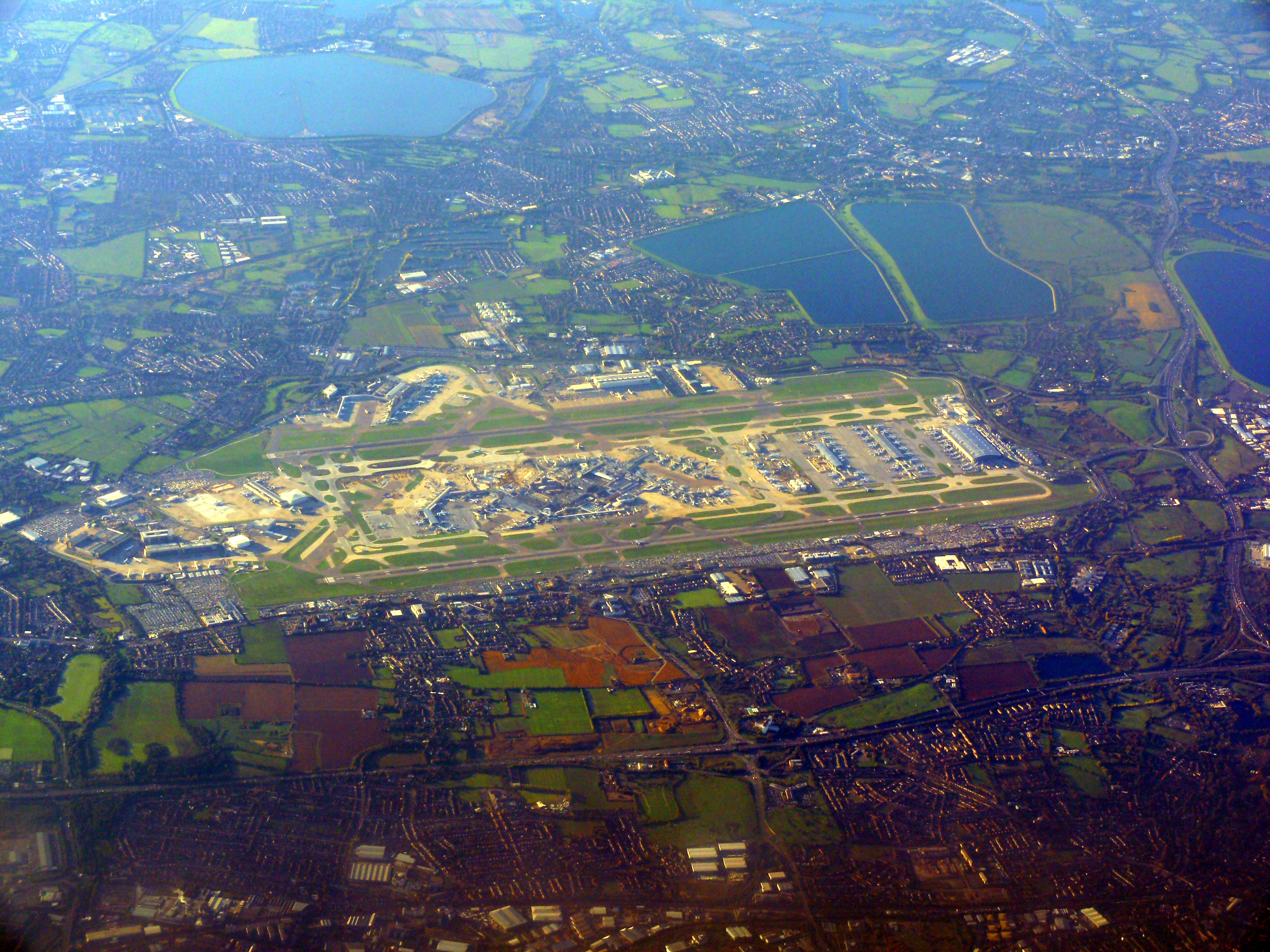
English: London Heathrow Airport or Heathrow, at the far south of the London Borough of Hillingdon, is the largest airport in the United Kingdom. It is close to two relatively busy sections of motorway (M4 and M25) shown and the surrounding land, as can be traced in many parks, sports fields, green buffer heaths, lakes and a few residual farms (and great reservoirs built on woodland and grazing land, east and west, respectively), was mainly rural in use until the 1960s; it widely has a gravel extraction use leading to most of the smaller lakes. The nascent towns of Staines and Ashford fully shown are linked by railway to London.
Nederlands: Londen Heathrow de grootste luchthaven van het Verenigd Koninkrijk. |
|||
| Date | ||||
| Source | Own work | |||
| Author | Ad Meskens | |||
| Permission (Reusing this file) |
You are free to use this picture for any purpose as long as you credit its author, Ad Meskens. Example: © Ad Meskens / Wikimedia Commons
This file has been released under a license which is incompatible with Facebook's licensing terms. It is not permitted to upload this file to Facebook.
|
|||
| Other versions |


.JPG)
| Camera location | | View this and other nearby images on: OpenStreetMap |
|---|
Licensing[edit]

|
Permission is granted to copy, distribute and/or modify this document under the terms of the GNU Free Documentation License, Version 1.2 or any later version published by the Free Software Foundation; with no Invariant Sections, no Front-Cover Texts, and no Back-Cover Texts. A copy of the license is included in the section entitled GNU Free Documentation License. |
- You are free:
- to share – to copy, distribute and transmit the work
- to remix – to adapt the work
- Under the following conditions:
- attribution – You must give appropriate credit, provide a link to the license, and indicate if changes were made. You may do so in any reasonable manner, but not in any way that suggests the licensor endorses you or your use.
- share alike – If you remix, transform, or build upon the material, you must distribute your contributions under the same or compatible license as the original.
| Annotations | This image is annotated: View the annotations at Commons |
File history
Click on a date/time to view the file as it appeared at that time.
| Date/Time | Thumbnail | Dimensions | User | Comment | |
|---|---|---|---|---|---|
| current | 18:26, 2 November 2010 | | 3,648 × 2,736 (8.57 MB) | Ad Meskens (talk | contribs) | {{Information |Description={{en|1=London Heathrow Airport or Heathrow, in the London Borough of Hillingdon, is the largest airport in the United Kingdom.}} {{nl|1=Londen Heathrow de groots |
You cannot overwrite this file.
File usage on Commons
The following 3 pages use this file:
File usage on other wikis
The following other wikis use this file:
- Usage on af.wikipedia.org
- Usage on he.wikipedia.org
- Usage on he.wikivoyage.org