File:ME 3 map.png
Jump to navigation
Jump to search

Size of this preview: 800 × 474 pixels. Other resolutions: 320 × 190 pixels | 640 × 379 pixels | 1,024 × 607 pixels | 1,280 × 759 pixels | 3,100 × 1,838 pixels.
Original file (3,100 × 1,838 pixels, file size: 458 KB, MIME type: image/png)
Captions
Captions
Add a one-line explanation of what this file represents
Summary[edit]
| Description | |
| Date | |
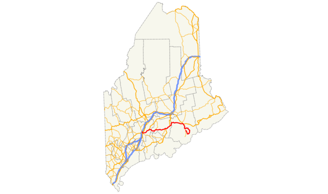
| Source | Map created by uploader; incorporates data from FHWA (National Highway Planning Network), U.S. Census Bureau (TIGER county line data), and KML data from English Wikipedia. |
| Author | Scott Nazelrod |
| Permission (Reusing this file) |
CC-BY-SA 3.0 |
Licensing[edit]
This file is licensed under the Creative Commons Attribution-Share Alike 3.0 Unported license.
- You are free:
- to share – to copy, distribute and transmit the work
- to remix – to adapt the work
- Under the following conditions:
- attribution – You must give appropriate credit, provide a link to the license, and indicate if changes were made. You may do so in any reasonable manner, but not in any way that suggests the licensor endorses you or your use.
- share alike – If you remix, transform, or build upon the material, you must distribute your contributions under the same or compatible license as the original.
File history
Click on a date/time to view the file as it appeared at that time.
| Date/Time | Thumbnail | Dimensions | User | Comment | |
|---|---|---|---|---|---|
| current | 23:40, 2 February 2013 | | 3,100 × 1,838 (458 KB) | Scott5114 (talk | contribs) | {{Information |Description={{en|1=Map of Route 3 in w:Maine, United States}} |Source=Map created by uploader; incorporates data from FHWA (National Highway Planning Network), U.S. Census Bureau (TIGER county line data), and KML... |
You cannot overwrite this file.
File usage on Commons
The following page uses this file:
File usage on other wikis
The following other wikis use this file:
- Usage on www.wikidata.org