File:Maison - Vue d'ensemble - Bayeux - Médiathèque de l'architecture et du patrimoine - APMH00003419.jpg
Jump to navigation
Jump to search
No higher resolution available.
Maison_-_Vue_d'ensemble_-_Bayeux_-_Médiathèque_de_l'architecture_et_du_patrimoine_-_APMH00003419.jpg (398 × 512 pixels, file size: 48 KB, MIME type: image/jpeg)
Captions
Captions
Add a one-line explanation of what this file represents
Summary[edit]
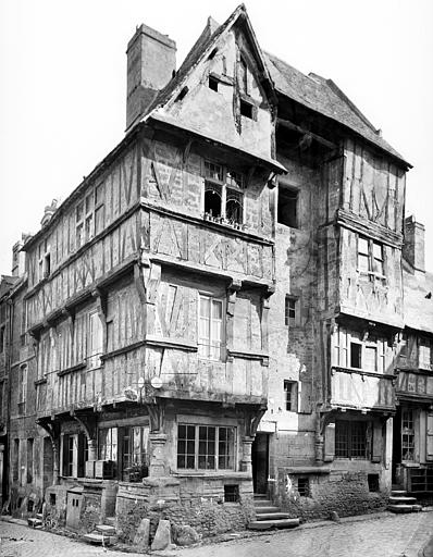
| Français : Maison.
( |
|||||||||||||||||||||||
|---|---|---|---|---|---|---|---|---|---|---|---|---|---|---|---|---|---|---|---|---|---|---|---|
| Photographer |
|
||||||||||||||||||||||
| Title |
Français : Maison. |
||||||||||||||||||||||
| Description |
Français : Vue d'ensemble. |
||||||||||||||||||||||
| Depicted place |
Français : Saint-Martin (rue), Bayeux, Calvados, France. |
||||||||||||||||||||||
| Date | Taken in May 1880 | ||||||||||||||||||||||
| Medium | Negative film | ||||||||||||||||||||||
| Accession number |
MH0003419 |
||||||||||||||||||||||
| References | Base Mémoire: APMH00003419 | ||||||||||||||||||||||
| Source | Médiathèque de l'architecture et du patrimoine (image) | ||||||||||||||||||||||
| Permission (Reusing this file) |
This file is licensed under the Creative Commons Attribution-Share Alike 4.0 International license.
|
||||||||||||||||||||||
| Object location | | View this and other nearby images on: OpenStreetMap |
|---|
File history
Click on a date/time to view the file as it appeared at that time.
| Date/Time | Thumbnail | Dimensions | User | Comment | |
|---|---|---|---|---|---|
| current | 05:01, 28 April 2020 | | 398 × 512 (48 KB) | Gzen92Bot (talk | contribs) | image from data.culture.gouv.fr |
You cannot overwrite this file.
File usage on Commons
The following page uses this file: