File:Map Weiswampach.PNG
Jump to navigation
Jump to search
No higher resolution available.
Map_Weiswampach.PNG (203 × 270 pixels, file size: 7 KB, MIME type: image/png)
Captions
Captions
Add a one-line explanation of what this file represents
Summary[edit]
| Description |
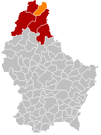
English: Own edit of Kanton ClervauxLocatie.png |
| Date | 17 October 2005 (original upload date) |
| Source | No machine-readable source provided. Own work assumed (based on copyright claims). |
| Author | No machine-readable author provided. Markussep assumed (based on copyright claims). |
Licensing[edit]
| I, the copyright holder of this work, release this work into the public domain. This applies worldwide. In some countries this may not be legally possible; if so: I grant anyone the right to use this work for any purpose, without any conditions, unless such conditions are required by law. |
File history
Click on a date/time to view the file as it appeared at that time.
| Date/Time | Thumbnail | Dimensions | User | Comment | |
|---|---|---|---|---|---|
| current | 17:56, 8 January 2018 | | 203 × 270 (7 KB) | NordNordWest (talk | contribs) | upd |
| 21:27, 10 November 2015 |  | 203 × 270 (5 KB) | NordNordWest (talk | contribs) | no more districts in Luxembourg | |
| 10:21, 28 October 2011 |  | 203 × 270 (3 KB) | Les Meloures (talk | contribs) | Replace map after creation of new municipalities in Luxembourg | |
| 15:23, 9 May 2006 |  | 203 × 270 (4 KB) | Bastin8 (talk | contribs) | ||
| 20:23, 17 October 2005 |  | 203 × 270 (4 KB) | Markussep (talk | contribs) | own edit of Image:Kanton ClervauxLocatie.png |
You cannot overwrite this file.
File usage on Commons
The following 4 pages use this file:
File usage on other wikis
The following other wikis use this file:
- Usage on als.wikipedia.org
- Usage on be-tarask.wikipedia.org
- Usage on ca.wikipedia.org
- Usage on cv.wikipedia.org
- Usage on da.wikipedia.org
- Usage on de.wikipedia.org
- Usage on fa.wikipedia.org
- Usage on frr.wikipedia.org
- Usage on it.wikipedia.org
- Usage on lb.wikipedia.org
- Usage on li.wikipedia.org
- Usage on nds.wikipedia.org
- Usage on nl.wikipedia.org
- Usage on no.wikipedia.org
- Usage on pl.wikipedia.org
- Usage on pt.wikipedia.org
- Usage on ru.wikipedia.org
- Usage on simple.wikipedia.org
- Usage on sk.wikipedia.org
- Usage on sv.wikipedia.org
- Usage on tr.wikipedia.org
- Usage on uk.wikipedia.org
- Usage on www.wikidata.org
- Usage on zh-min-nan.wikipedia.org
- Usage on zh.wikipedia.org