File:Map of Quinault Canyon.png
Jump to navigation
Jump to search
Size of this preview: 484 × 600 pixels. Other resolutions: 194 × 240 pixels | 387 × 480 pixels | 620 × 768 pixels | 826 × 1,024 pixels | 1,617 × 2,004 pixels.
Original file (1,617 × 2,004 pixels, file size: 3.9 MB, MIME type: image/png)
Captions
Captions
Add a one-line explanation of what this file represents
Summary[edit]
| Description |
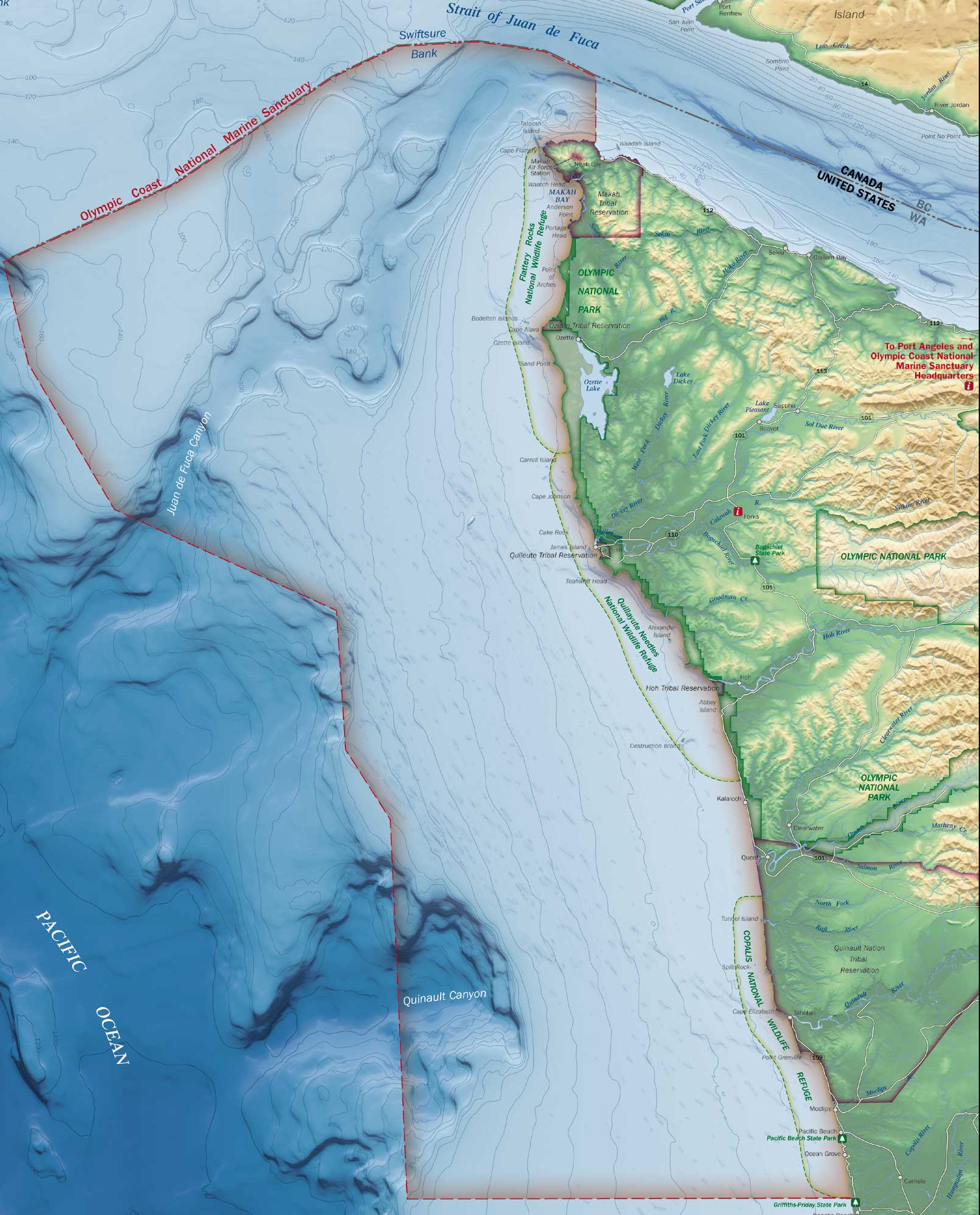
English: Slightly sliced version of File:Olympic Coast NMS map.jpg, a map of Quinault Canyon, off Washington State, USA. |
| Source | https://sanctuaries.noaa.gov/pgallery/atlasmaps/oc.html |
| Author | NOAA, National Marine Sanctuaries |
| Permission (Reusing this file) |
PD |
| Other versions | File:Olympic_Coast_NMS_map.jpg |
Slightly sliced another Wikimedia image, the original. Quinault Canyon itself is lower left.
Licensing[edit]
This image is in the public domain because it contains materials that originally came from the U.S. National Oceanic and Atmospheric Administration, taken or made as part of an employee's official duties.
|
File history
Click on a date/time to view the file as it appeared at that time.
| Date/Time | Thumbnail | Dimensions | User | Comment | |
|---|---|---|---|---|---|
| current | 03:37, 23 August 2017 | | 1,617 × 2,004 (3.9 MB) | Dino (talk | contribs) | {{Information |Description ={{en|1=Slightly sliced version of [https://commons.wikimedia.org/wiki/File:Olympic_Coast_NMS_map.jpg], a map of Quinault Canyon, off Washington State, USA.}} |Source =https://sanctuaries.noaa.gov/pgallery/atlasmap... |
You cannot overwrite this file.
File usage on Commons
The following page uses this file:
File usage on other wikis
The following other wikis use this file:
- Usage on en.wikipedia.org