File:Map of Silesia in 1791 by Reilly 111.jpg
Jump to navigation
Jump to search

Size of this preview: 800 × 549 pixels. Other resolutions: 320 × 220 pixels | 640 × 439 pixels | 1,024 × 703 pixels | 1,161 × 797 pixels.
Original file (1,161 × 797 pixels, file size: 420 KB, MIME type: image/jpeg)
Captions
Captions
Add a one-line explanation of what this file represents
Summary[edit]
| Description |
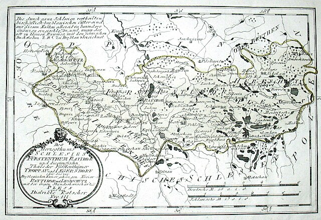
Deutsch: Des Herzogthums Schlesien Fürstenthum Ratibor und die preussischen Theile der Fürstenthümer Troppau und Iaegerndorf oder die zur Breßlauischen Kammer gehörigen Kreise Rattibor und Leobschütz mit der freyen Standesherrschaft Pless und dem Distikte Katscher. Nro. 111. Kolorierter Kupferstich |
|||||||||||||||||||||||||
| Date | ||||||||||||||||||||||||||
| Source | http://cgi.ebay.de/ws/eBayISAPI.dll?ViewItem&item=350280420766 | |||||||||||||||||||||||||
| Author |
|
|||||||||||||||||||||||||
| Permission (Reusing this file) |
PD-art | |||||||||||||||||||||||||
| Other versions | File:Reillly-um1790-Herzogthum-Schlesien.jpg | |||||||||||||||||||||||||
Licensing[edit]
|
This is a faithful photographic reproduction of a two-dimensional, public domain work of art. The work of art itself is in the public domain for the following reason:
The official position taken by the Wikimedia Foundation is that "faithful reproductions of two-dimensional public domain works of art are public domain".
This photographic reproduction is therefore also considered to be in the public domain in the United States. In other jurisdictions, re-use of this content may be restricted; see Reuse of PD-Art photographs for details. | ||||
File history
Click on a date/time to view the file as it appeared at that time.
| Date/Time | Thumbnail | Dimensions | User | Comment | |
|---|---|---|---|---|---|
| current | 19:50, 19 December 2009 | | 1,161 × 797 (420 KB) | Ephraim33 (talk | contribs) | {{Information |Description={{de|Des Herzogthums Schlesien Fürstenthum Ratibor und die preussischen Theile der Fürstenthümer Troppau und Iaegerndorf oder die zur Breßlauischen Kammer gehörigen Kreise Rattibor und Leobschütz mit der freyen Standesherr |
You cannot overwrite this file.
File usage on Commons
The following page uses this file:
- File:Reilly 111.jpg (file redirect)
File usage on other wikis
The following other wikis use this file:
- Usage on de.wikipedia.org