File:Map of Vietnam 1829.jpg
跳转到导航
跳转到搜索
本预览的尺寸:399 × 599像素。 其他分辨率:160 × 240像素 | 320 × 480像素 | 511 × 768像素 | 682 × 1,024像素 | 1,364 × 2,048像素 | 3,464 × 5,200像素。
原始文件 (3,464 × 5,200像素,文件大小:8.83 MB,MIME类型:image/jpeg)
说明
说明
添加一行文字以描述该文件所表现的内容
文件历史
点击某个日期/时间查看对应时刻的文件。
| 日期/时间 | 缩略图 | 大小 | 用户 | 备注 | |
|---|---|---|---|---|---|
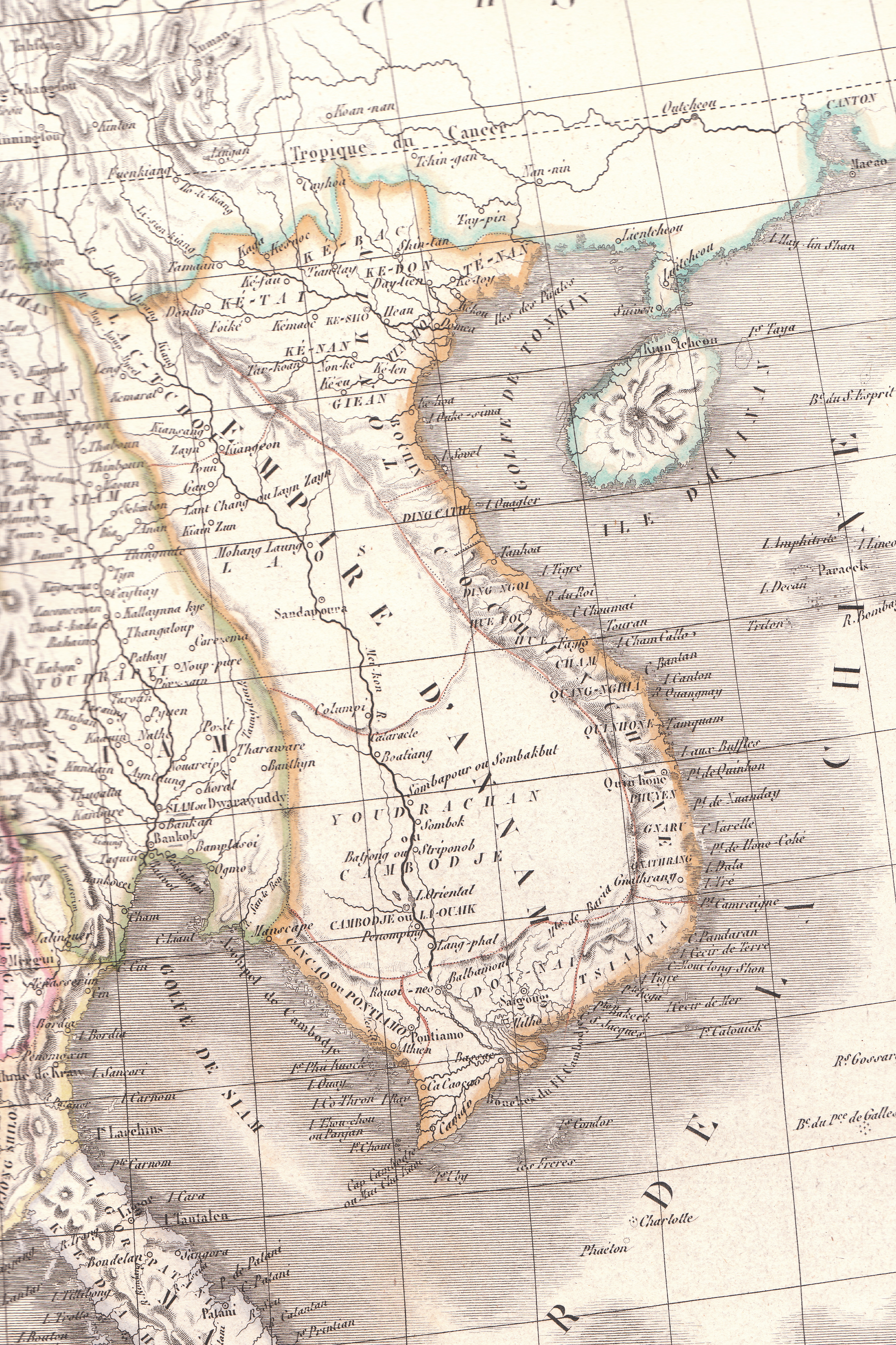
| 当前 | 2010年4月26日 (一) 06:23 | | 3,464 × 5,200(8.83 MB) | Duyet-pho(留言 | 贡献) | {{Information |Description={{en|1=Plate 35E "Carte de l’Inde endeca et audela du Gange" from Lapie's ''Atlas Universel'' printed in 1829}} |Source=Atlas Universel |Author=Pierre M. Lapie |Date= |Permission={{PD-1923}} |other_versions= }} [[Category:Map |
您不可以覆盖此文件。
文件用途
以下2个页面使用本文件:
全域文件用途
以下其他wiki使用此文件:
- ca.wikipedia.org上的用途
- en.wikipedia.org上的用途
- eu.wikipedia.org上的用途
- gl.wikipedia.org上的用途
- id.wikipedia.org上的用途
- it.wikipedia.org上的用途
- pt.wikipedia.org上的用途
- ru.wikipedia.org上的用途
- th.wikipedia.org上的用途
- tr.wikipedia.org上的用途
- vi.wikipedia.org上的用途
- www.wikidata.org上的用途
- zh-min-nan.wikipedia.org上的用途
- zh-yue.wikipedia.org上的用途