File:Mapa de la reserva natural Fuente de Piedra.jpg
Jump to navigation
Jump to search
Size of this preview: 800 × 599 pixels. Other resolutions: 320 × 240 pixels | 640 × 479 pixels | 1,024 × 767 pixels | 1,280 × 959 pixels | 2,159 × 1,617 pixels.
Original file (2,159 × 1,617 pixels, file size: 1.86 MB, MIME type: image/jpeg)
Captions
Captions
Add a one-line explanation of what this file represents
Summary[edit]
| Description |
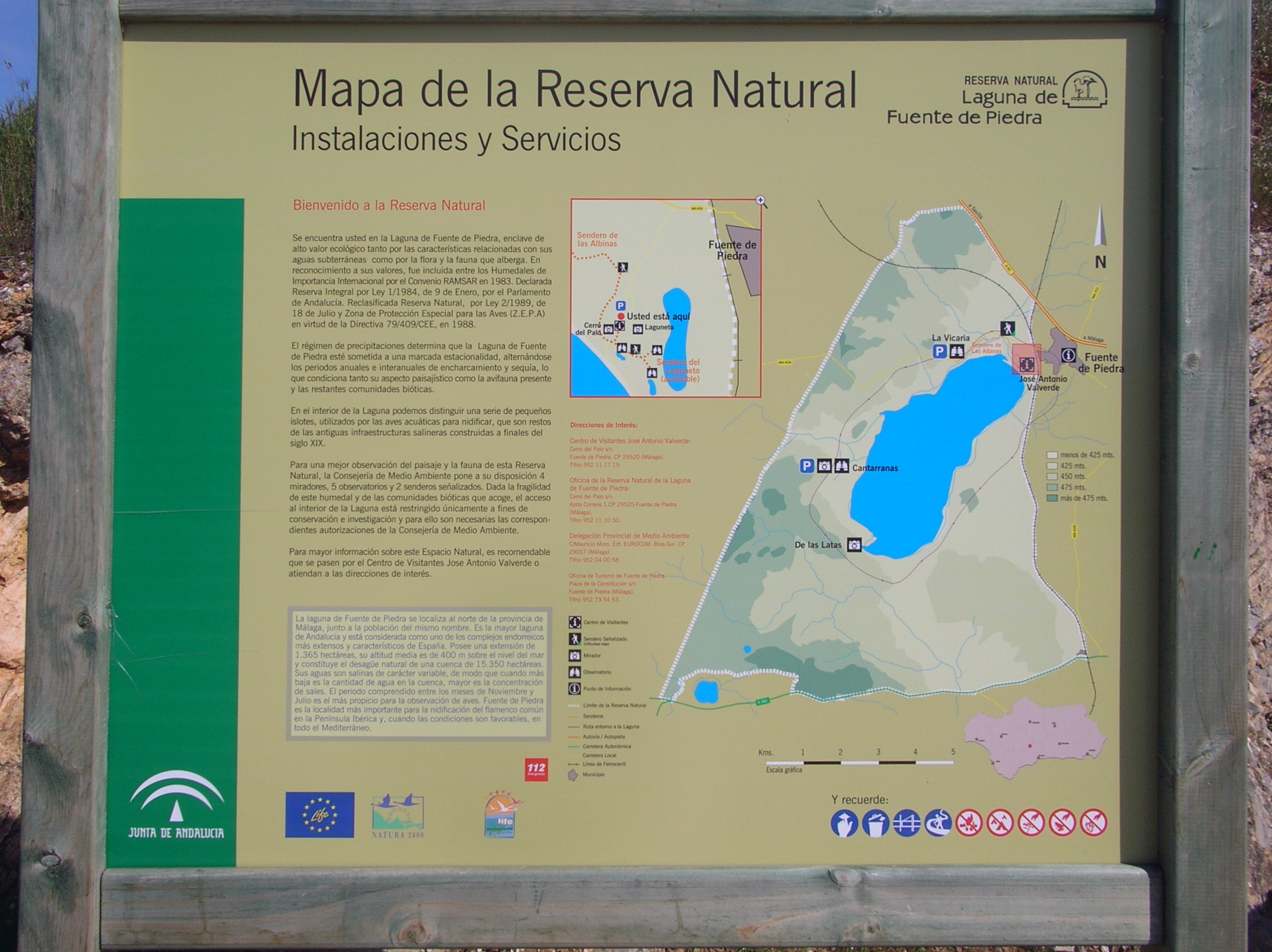
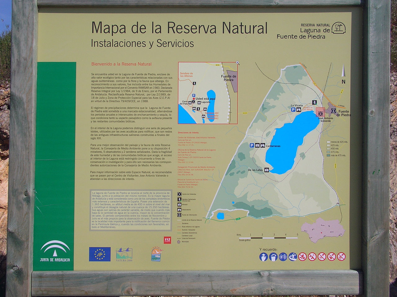
Français : Carte de la réserve naturelle Laguna Fuente de Piedra, situé au bord de la lagune, dans le centre d'information. Español: Mapa de la reserva natural Laguna de Fuente de Piedra, situada al lado de la laguna, en el centro de interpretación. |
| Date | |
| Source | Own work |
| Author | Gzzz |
| Camera location | | View this and other nearby images on: OpenStreetMap |
|---|
Licensing[edit]
I, the copyright holder of this work, hereby publish it under the following license:
This file is licensed under the Creative Commons Attribution-Share Alike 3.0 Unported license.
- You are free:
- to share – to copy, distribute and transmit the work
- to remix – to adapt the work
- Under the following conditions:
- attribution – You must give appropriate credit, provide a link to the license, and indicate if changes were made. You may do so in any reasonable manner, but not in any way that suggests the licensor endorses you or your use.
- share alike – If you remix, transform, or build upon the material, you must distribute your contributions under the same or compatible license as the original.
File history
Click on a date/time to view the file as it appeared at that time.
| Date/Time | Thumbnail | Dimensions | User | Comment | |
|---|---|---|---|---|---|
| current | 19:55, 9 July 2013 | | 2,159 × 1,617 (1.86 MB) | Gzzz (talk | contribs) | User created page with UploadWizard |
You cannot overwrite this file.
File usage on Commons
There are no pages that use this file.