File:Messtischblatt Hebalm.jpg
Original file (1,601 × 2,237 pixels, file size: 2.57 MB, MIME type: image/jpeg)
Captions
Captions
Summary[edit]
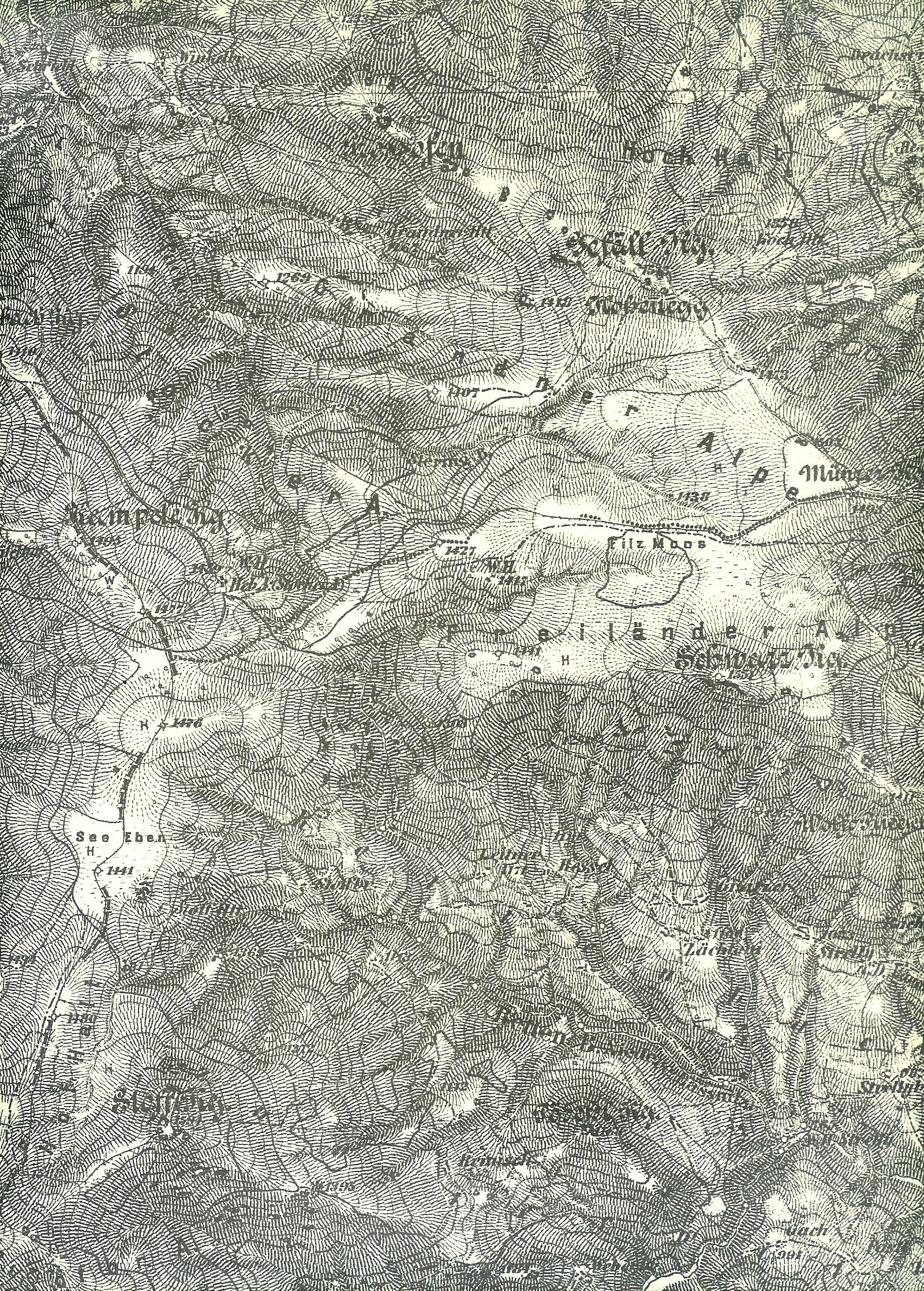
| Description | Landkarte 1:25000 Messtischblatt Hebalm ca 1890 |
| Date | scan 7. Dezember 2007 |
| Source | ausschnittweiser scan: Landkarte Sektion 5254/1 1:25.000 des Gebietes um Hebalm und Preitenegg. Kein Titel. Druck und Verlag: Kartographisches, früher Militärgeographisches Institut in Wien. Es handelt sich bei der Vorlage um eine sw-Kopie des Aufnahmeblattes der Franzisko-Josephinischen Landesaufnahme mit Stand 1877/78, die ursprünglich für Dienstzwecke angefertigt wurde, aber zumindest ab ungefähr 1920 auch als Ersatz für die noch nicht vorhanden Blätter 1:25.000 der 4. Landesaufnahme in den Verkauf gelangte. |
| Author | Josef Moser |
| Permission (Reusing this file) |
Scan eines freien Werkes nach Ablauf der Schutzfristen nach dem Urheberrecht. |
Licensing[edit]
|
This work is in the public domain in its country of origin and other countries and areas where the copyright term is the author's life plus 70 years or fewer.
| |
| This file has been identified as being free of known restrictions under copyright law, including all related and neighboring rights. | |
File history
Click on a date/time to view the file as it appeared at that time.
| Date/Time | Thumbnail | Dimensions | User | Comment | |
|---|---|---|---|---|---|
| current | 22:10, 8 December 2007 | | 1,601 × 2,237 (2.57 MB) | Josef Moser (talk | contribs) | |
| 22:04, 8 December 2007 |  | 1,662 × 2,310 (2.79 MB) | Josef Moser (talk | contribs) | {{Information |Description=Landkarte 1:25000 Messtischblatt Hebalm ca 1890 |Source=ausschnittweiser scan: Landkarte Sektion 5254/1 1:25.000 des Gebietes um Hebalm und Preitenegg. Kein Titel. Druck und Verlag: Kartographisches, früher Militärgeographisch |
You cannot overwrite this file.
File usage on Commons
There are no pages that use this file.
File usage on other wikis
The following other wikis use this file:
- Usage on de.wikipedia.org