File:Mexico Veracruz Sayula location map.svg
Jump to navigation
Jump to search

Size of this PNG preview of this SVG file: 576 × 600 pixels. Other resolutions: 230 × 240 pixels | 461 × 480 pixels | 737 × 768 pixels | 983 × 1,024 pixels | 1,966 × 2,048 pixels | 2,404 × 2,504 pixels.
Original file (SVG file, nominally 2,404 × 2,504 pixels, file size: 2.46 MB)
Captions
Captions
Add a one-line explanation of what this file represents
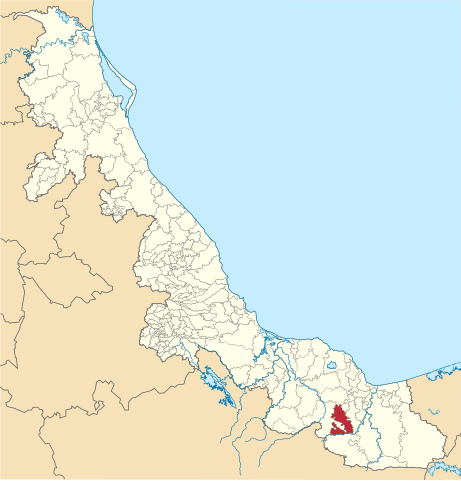
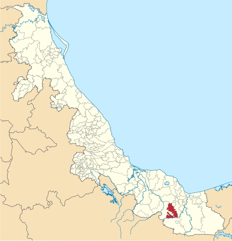
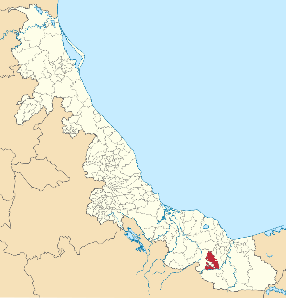
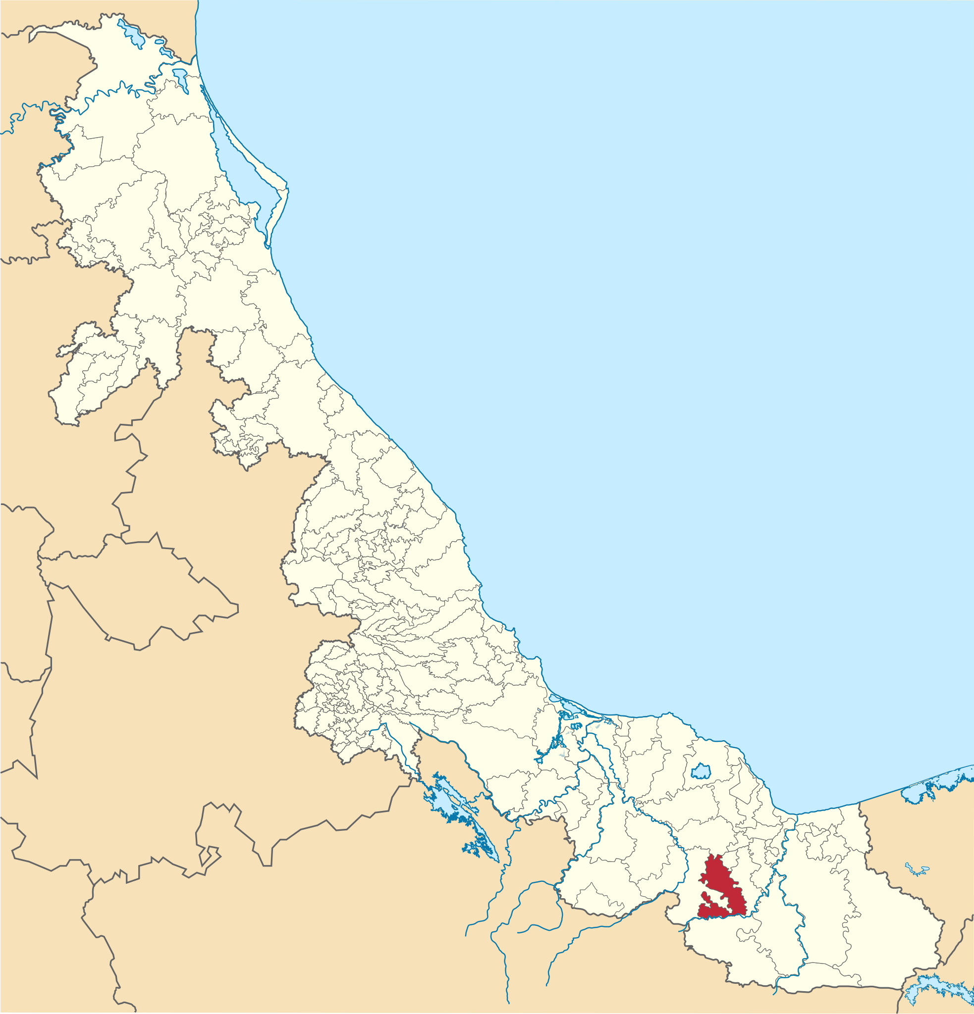
| Description | Mapa de localización del municipio de Sayula de Alemán en estado de Veracruz, México. | ||
| Date | |||
| Source |
Own work This W3C-unspecified vector image was created with Inkscape . |
||
| Author | Battroid | ||
| Permission (Reusing this file) |
|
File history
Click on a date/time to view the file as it appeared at that time.
| Date/Time | Thumbnail | Dimensions | User | Comment | |
|---|---|---|---|---|---|
| current | 06:16, 17 September 2013 | | 2,404 × 2,504 (2.46 MB) | Battroid (talk | contribs) | {{Information |Description=Mapa de localización del municipio de Sayula de Alemán en estado de Veracruz, México. |Source={{own}} {{Inkscape}} |Date=2012-01-22 |Author= Battroid |Permission={{PD-self}} |other_versions= }} [[Categor... |
| 08:45, 22 January 2012 |  | 2,404 × 2,504 (2.46 MB) | Battroid (talk | contribs) | {{Information |Description=Mapa de localización del municipio de Sayula de Alemán en estado de Veracruz, México. |Source={{own}} {{Inkscape}} |Date=2012-01-22 |Author= Battroid |Permission={{PD-self}} |other_versions= }} [[Category:S |
You cannot overwrite this file.
File usage on Commons
There are no pages that use this file.
File usage on other wikis
The following other wikis use this file:
- Usage on es.wikipedia.org
- Usage on eu.wikipedia.org
- Usage on fr.wikipedia.org
- Usage on vi.wikipedia.org
- Usage on www.wikidata.org