File:Netzplan Straßenbahn Innsbruck 2019.png
Jump to navigation
Jump to search

Size of this preview: 800 × 326 pixels. Other resolutions: 320 × 130 pixels | 640 × 261 pixels | 1,024 × 418 pixels | 1,280 × 522 pixels | 3,475 × 1,417 pixels.
Original file (3,475 × 1,417 pixels, file size: 2.5 MB, MIME type: image/png)
Captions
Captions
Add a one-line explanation of what this file represents
Summary[edit]
| Description |
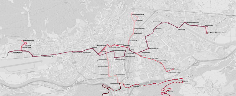
Deutsch: Netzplan Straßenbahn Innsbruck ab Fahrplanwechsel 2019-01-26 |
|||||||||||||||
| Date | ||||||||||||||||
| Source | Own work, based on OpenStreetMap data (style: https://github.com/gravitystorm/openstreetmap-carto) | |||||||||||||||
| Author | Simon Legner (User:simon04) | |||||||||||||||
| Permission (Reusing this file) |
|
|||||||||||||||
| Other versions |
Netzplan Straßenbahn Innsbruck 2019 Einzugsgebiet.png:  |
Licensing[edit]
I, the copyright holder of this work, hereby publish it under the following license:
This file is licensed under the Creative Commons Attribution-Share Alike 4.0 International license.
- You are free:
- to share – to copy, distribute and transmit the work
- to remix – to adapt the work
- Under the following conditions:
- attribution – You must give appropriate credit, provide a link to the license, and indicate if changes were made. You may do so in any reasonable manner, but not in any way that suggests the licensor endorses you or your use.
- share alike – If you remix, transform, or build upon the material, you must distribute your contributions under the same or compatible license as the original.
File history
Click on a date/time to view the file as it appeared at that time.
| Date/Time | Thumbnail | Dimensions | User | Comment | |
|---|---|---|---|---|---|
| current | 21:47, 21 January 2019 | 3,475 × 1,417 (2.5 MB) | Simon04 (talk | contribs) | fix missing stops | |
| 22:36, 19 January 2019 | 3,475 × 1,417 (2.5 MB) | Simon04 (talk | contribs) | =={{int:filedesc}}== {{Information |description={{de|1=Netzplan Straßenbahn Innsbruck ab Fahrplanwechsel 2019-01-26}} |date=2019-01-19 |Source={{own}}, based on OpenStreetMap data (style: https://github.com/gravitystorm/openstreetmap-carto) |author={{User:Simon04/Author}} |Permission={{OpenStreetMap}} |other_versions= |other_fields= }} =={{int:license-header}}== {{self|cc-by-sa-4.0}} Category:Tram maps of Innsbruck |
You cannot overwrite this file.
File usage on Commons
The following 11 pages use this file:
- User:Anton-kurt/Tyrol new files/2019 January 11-20
- User:Anton-kurt/Tyrol new files/2019 January 21-31
- User:Chumwa/OgreBot/Potential transport maps/2019 January 11-20
- User:Chumwa/OgreBot/Potential transport maps/2019 January 21-31
- User:Chumwa/OgreBot/Public transport information/2019 January 11-20
- User:Chumwa/OgreBot/Public transport information/2019 January 21-31
- User:Chumwa/OgreBot/Transport Maps/2019 January 11-20
- User:Chumwa/OgreBot/Transport Maps/2019 January 21-31
- User:Chumwa/OgreBot/Travel and communication maps/2019 January 11-20
- User:Chumwa/OgreBot/Travel and communication maps/2019 January 21-31
- File:Netzplan Straßenbahn Innsbruck 2019 Einzugsgebiet.png
File usage on other wikis
The following other wikis use this file:
- Usage on pl.wikipedia.org
- Usage on www.wikidata.org