File:1966 Ohio gubernatorial election results map by county.svg
(Redirected from File:Ohio Governor Election Results by County, 1966.svg)

Size of this PNG preview of this SVG file: 600 × 600 pixels. Other resolutions: 240 × 240 pixels | 480 × 480 pixels | 768 × 768 pixels | 1,024 × 1,024 pixels | 2,048 × 2,048 pixels | 744 × 744 pixels.
Original file (SVG file, nominally 744 × 744 pixels, file size: 205 KB)
Captions
Captions
Add a one-line explanation of what this file represents
Summary[edit]
| Description | |
| Date | |
| Source | Own work, File:Map of Ohio highlighting Stark County.svg |
| Author | Ibagli |
Licensing[edit]
I, the copyright holder of this work, hereby publish it under the following license:
| This file is made available under the Creative Commons CC0 1.0 Universal Public Domain Dedication. | |
| The person who associated a work with this deed has dedicated the work to the public domain by waiving all of their rights to the work worldwide under copyright law, including all related and neighboring rights, to the extent allowed by law. You can copy, modify, distribute and perform the work, even for commercial purposes, all without asking permission.
|
File history
Click on a date/time to view the file as it appeared at that time.
| Date/Time | Thumbnail | Dimensions | User | Comment | |
|---|---|---|---|---|---|
| current | 20:35, 21 February 2023 | | 744 × 744 (205 KB) | Putitonamap98 (talk | contribs) | shapes |
| 19:56, 14 June 2019 |  | 230 × 260 (40 KB) | Over9000edits (talk | contribs) | county percentage data from https://uselectionatlas.org/RESULTS/state.php?f=0&fips=39&off=5&elect=0&year=1966 | |
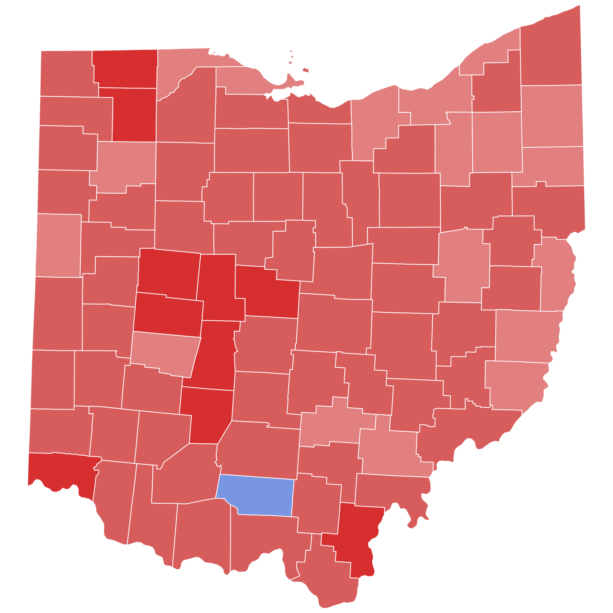
| 01:12, 17 March 2011 |  | 3,675 × 3,995 (81 KB) | Ibagli (talk | contribs) | {{Information |Description ={{en|1=Results of the 1966 gubernatorial election. {{legend|#0075d8|{{w|Frazier Reams Jr.}} (D)}} {{legend|#ff1515|{{w|Jim Rhodes}} (R)}}}} |Source ={{own}}, File:Map of Ohio highlighting Stark County.svg |Autho |
You cannot overwrite this file.
File usage on Commons
The following 3 pages use this file:
File usage on other wikis
The following other wikis use this file:
- Usage on en.wikipedia.org