File:PIGS 2010.PNG
Jump to navigation
Jump to search
Size of this preview: 489 × 599 pixels. Other resolutions: 196 × 240 pixels | 392 × 480 pixels | 1,017 × 1,246 pixels.
Original file (1,017 × 1,246 pixels, file size: 69 KB, MIME type: image/png)
Captions
Captions
Add a one-line explanation of what this file represents
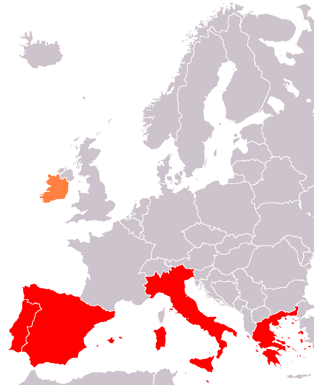
| Description | Mapa de los llamados PIGS : España, Portugal, Grecia, Italia (más Irlanda para los PIIGS) |
| Date | (UTC) |
| Source | |
| Author |
|
| This is a retouched picture, which means that it has been digitally altered from its original version. Modifications: PIGS map. The original can be viewed here: Europe blank map.png:
|
| I, the copyright holder of this work, release this work into the public domain. This applies worldwide. In some countries this may not be legally possible; if so: I grant anyone the right to use this work for any purpose, without any conditions, unless such conditions are required by law. |
Original upload log[edit]
This image is a derivative work of the following images:
- File:Europe_blank_map.png licensed with PD-user
- 2008-08-04T13:35:42Z Avala 1360x1245 (86403 Bytes) http://news.xinhuanet.com/english/2008-02/19/content_7629464.htm
- 2008-08-01T02:34:17Z Wikibob 1360x1245 (86480 Bytes) Reverted to version as of 16:34, 13 March 2008
- 2008-07-31T14:52:04Z Avala 1360x1245 (86403 Bytes)
- 2008-03-22T21:58:51Z Nightstallion 1360x1245 (86480 Bytes) Reverted to version as of 16:34, 13 March 2008
- 2008-03-19T19:36:05Z Patstuart 1360x1245 (86403 Bytes) Reverted to version as of 18:15, 11 March 2008 - see [[Image talk:BlankMap-World-v6.png#As stated in reversion]]
- 2008-03-13T16:34:01Z Nightstallion 1360x1245 (86480 Bytes) upload a variant if you wish, but the majority in Europe recognises or will recognise.
- 2008-03-11T18:15:58Z Avala 1360x1245 (86403 Bytes) there is no consensus in Europe
- 2008-02-24T14:02:27Z Hoshie 1360x1245 (86480 Bytes) Added Kosovo since it has been internationally recognized
- 2006-06-10T00:20:20Z QuartierLatin1968 1360x1245 (86403 Bytes) Montenegro is now independent; widespread recognition can be expected within the next few weeks
- 2005-08-31T22:16:23Z Gugganij 1360x1245 (47472 Bytes) and again some changes
- 2005-08-31T22:09:44Z Gugganij 1360x1245 (49669 Bytes) some minor changes
- 2005-03-26T19:56:55Z Wiki-vr 1245x1245 (54567 Bytes) Blank map of Europe - use to show countries' locations, EU members, etc. – see examples: *http://commons.wikimedia.org/wiki/Image:EU_Members_Candidates_2004_2007.png *http://commons.wikimedia.org/wiki/Image:Europe_location
File history
Click on a date/time to view the file as it appeared at that time.
| Date/Time | Thumbnail | Dimensions | User | Comment | |
|---|---|---|---|---|---|
| current | 21:29, 28 August 2010 | | 1,017 × 1,246 (69 KB) | Pahpaha (talk | contribs) | {{Information |Description=Mapa de los llamados PIGS : España, Portugal, Grecia, Italia (más Irlanda para los PIIGS) |Source=*File:Europe_blank_map.png |Date=2010-08-28 21:27 (UTC) |Author=*File:Europe_blank_map.png: User:Pahpaha *deriva |
You cannot overwrite this file.
File usage on Commons
There are no pages that use this file.
File usage on other wikis
The following other wikis use this file:
- Usage on ast.wikipedia.org
- Usage on es.wikipedia.org