File:Pacific intertie geographic map.png
Jump to navigation
Jump to search
Size of this preview: 309 × 599 pixels. Other resolutions: 124 × 240 pixels | 247 × 480 pixels | 854 × 1,655 pixels.
Original file (854 × 1,655 pixels, file size: 154 KB, MIME type: image/png)
Captions
Captions
Add a one-line explanation of what this file represents
Summary
[edit]
| Description |
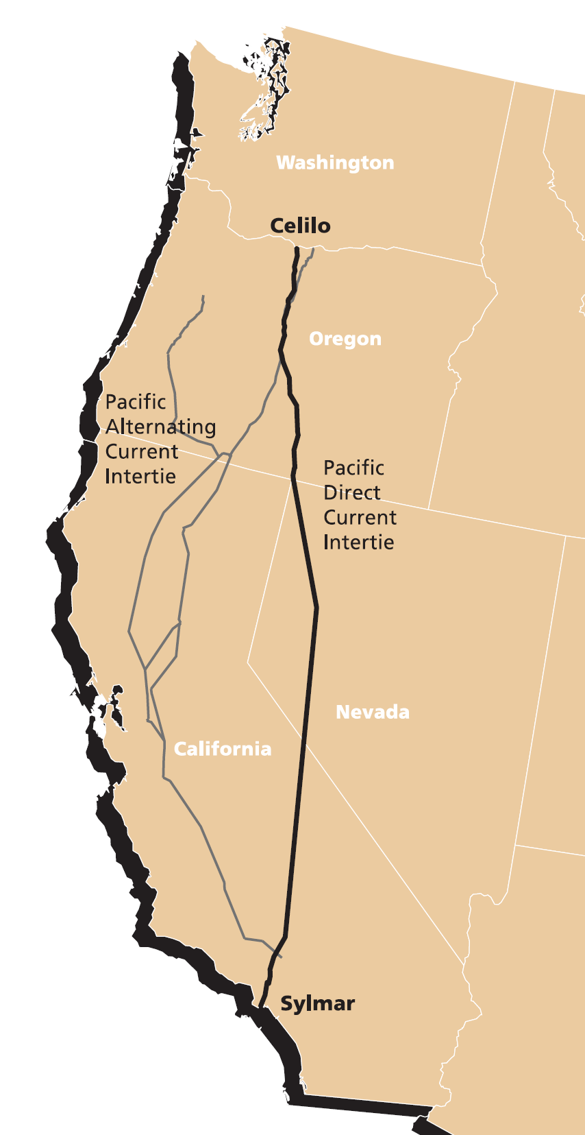
English: Map of Pacific DC Intertie (HVDC electrical transmission line) from Celilo Converter Station near The Dalles, Oregon to the Sylmar Converter Station near Los Angeles. |
| Date | source document last modified 2003-04-15, image extracted 2007-03-08 |
| Source | extracted from http://www.transmission.bpa.gov/PlanProj/Transmission_Projects/Completed-TransP/Celilo/4-15-03FactSheet.pdf |
| Author | Bonneville Power Administration |
Licensing
[edit]
This work is in the public domain in the United States because it is a work prepared by an officer or employee of the United States Government as part of that person’s official duties under the terms of Title 17, Chapter 1, Section 105 of the US Code.
Note: This only applies to original works of the Federal Government and not to the work of any individual U.S. state, territory, commonwealth, county, municipality, or any other subdivision. This template also does not apply to postage stamp designs published by the United States Postal Service since 1978. (See § 313.6(C)(1) of Compendium of U.S. Copyright Office Practices). It also does not apply to certain US coins; see The US Mint Terms of Use.
|
 | |
| This file has been identified as being free of known restrictions under copyright law, including all related and neighboring rights. | ||
File history
Click on a date/time to view the file as it appeared at that time.
| Date/Time | Thumbnail | Dimensions | User | Comment | |
|---|---|---|---|---|---|
| current | 01:59, 9 March 2007 | | 854 × 1,655 (154 KB) | EncMstr (talk | contribs) | {{Information |Description=Map of Pacific Intertie HVDC electrical transmission line from Celilo Converter Station near The Dalles, Oregon to the Sylmar Converter Station |
| 08:19, 11 September 2006 |  | 361 × 601 (34 KB) | EncMstr (talk | contribs) | {{Information |Description=Map of Pacific Intertie HVDC electrical transmission line from Celilo Converter Station near The Dalles, Oregon to the Sylmar Converter Station |
You cannot overwrite this file.
File usage on Commons
The following page uses this file:
File usage on other wikis
The following other wikis use this file:
- Usage on de.wikipedia.org
- Usage on en.wikipedia.org
- Usage on fr.wikipedia.org
- Usage on www.wikidata.org