File:Paraqvaria Vulgo Paragvay Cum adjacentibus. NYPL1505059.tiff
Jump to navigation
Jump to search
Size of this JPG preview of this TIF file: 503 × 599 pixels. Other resolutions: 201 × 240 pixels | 403 × 480 pixels | 645 × 768 pixels | 859 × 1,024 pixels | 1,719 × 2,048 pixels | 4,320 × 5,147 pixels.
Original file (4,320 × 5,147 pixels, file size: 63.62 MB, MIME type: image/tiff)
Captions
Captions
Add a one-line explanation of what this file represents
Summary[edit]
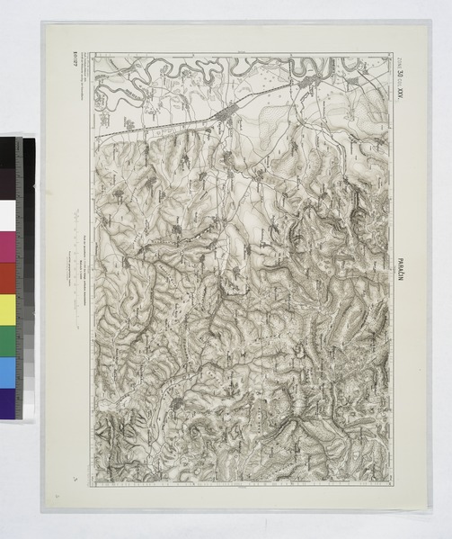
| Description | Paraqvaria Vulgo Paragvay Cum adjacentibus.; Lawrence H. Slaughter Collection of English maps, charts, globes, books and atlases / Atlases / America: being the latest, and most accurate description of the Nevv vvorld; containing the original of the inhabitants, and the remarkable voyages thither. The conquest of the vast empires of Mexico and Peru, and other large provinces and territories, with the several European plantations in those parts. Also their cities, fortresses, towns, temples, mountains, and rivers. Their habits, customs, manners, and religions. Their plants, beasts, birds, and serpents. With an appendix, containing, besides several other considerable additions, a brief survey of what hath been discover'd of the vnknown south-land and the Arctick region. Collected from most authentick authors, augmented with later observations, and adorn'd with maps and sculptures, by John Ogilby ... | |||||||||||||||||||||||
| Catalogue call number | Map Div. 97-6451 [LHS 3050, in atlas cases] | |||||||||||||||||||||||
| Item/Page/Plate | btw. pg. 474, 475 | |||||||||||||||||||||||
| Standard reference | Sabin 50089 | |||||||||||||||||||||||
| Date | ||||||||||||||||||||||||
| Source |
http://digitalgallery.nypl.org/nypldigital/dgkeysearchdetail.cfm?imageID=1505059
|
|||||||||||||||||||||||
| Author | ||||||||||||||||||||||||
| Permission (Reusing this file) |
From The Lionel Pincus and Princess Firyal Map Division. http://maps.nypl.org
|
|||||||||||||||||||||||
| Source description | 5 p. l., 674, [1] p. illus., 32 pl. (part fold.) 6 port., 19 maps (part fold.) 41.5 cm. | |||||||||||||||||||||||
| Location | Stephen A. Schwarzman Building / The Lionel Pincus and Princess Firyal Map Division | |||||||||||||||||||||||
| Digital item published | 2-17-2006; updated 1-9-2012 | |||||||||||||||||||||||
| Digital ID | 1505059 | |||||||||||||||||||||||

The making of this file was supported by Wikimedia UK.
To see other files made with the support of Wikimedia UK, please see the category Supported by Wikimedia UK.
|
File history
Click on a date/time to view the file as it appeared at that time.
| Date/Time | Thumbnail | Dimensions | User | Comment | |
|---|---|---|---|---|---|
| current | 07:37, 3 May 2014 |  | 4,320 × 5,147 (63.62 MB) | Fæ (talk | contribs) | GWToolset:: Creating mediafile for Fæ. Tranche 3 11591-16518 @ 2 May, 06:47 BST |
You cannot overwrite this file.
File usage on Commons
There are no pages that use this file.