File:Photocopy of photograph (original print in collection of Gerald A. Doyle, Phoenix)-Emil Eger, Photographer, November 11, 1948.-AERIAL VIEW LOOKING SOUTH OF THE YUMA CROSSING. THE SPRR HAER AZ-66-5.tif
Jump to navigation
Jump to search
Size of this JPG preview of this TIF file: 758 × 600 pixels. Other resolutions: 303 × 240 pixels | 607 × 480 pixels | 971 × 768 pixels | 1,280 × 1,013 pixels | 2,560 × 2,026 pixels | 5,634 × 4,459 pixels.
Original file (5,634 × 4,459 pixels, file size: 23.96 MB, MIME type: image/tiff)
Captions
Captions
Add a one-line explanation of what this file represents
Summary[edit]
| Photographer |
Emil Eger |
|||
| Title |
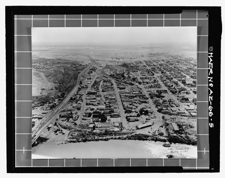
Photocopy of photograph (original print in collection of Gerald A. Doyle, Phoenix) Emil Eger, Photographer, November 11, 1948. AERIAL VIEW LOOKING SOUTH OF THE YUMA CROSSING. THE SPRR WATER SETTLING RESERVOIR IS ON THE HILLOCK AT THE BOTTOM RIGHT CORNER OF THE IMAGE. THE LOCATION OF THE SPRR BRIDGES AT MADISON AVENUE IS MARKED BY THE TWO PIERS IN THE RIVER. THE CIRCULAR FOUNDATION OF THE SWING SPAN IS ON THE SHORELINE IMMEDIATELY BEYOND THE SECOND PIER. THE RESERVOIR ROOF IS INTACT. - Southern Pacific Railroad Water Settling Reservoir, Yuma Crossing, south bank of Colorado River at foot of Madison Avenue, Yuma, Yuma County, AZ |
|||
| Depicted place | Arizona; Yuma County; Yuma | |||
| Date | 11 November 1948 | |||
| Dimensions | height: 4 in (10.1 cm); width: 5 in (12.7 cm) | |||
| Current location |
Library of Congress Prints and Photographs Division Washington, D.C. 20540 USA http://hdl.loc.gov/loc.pnp/pp.print |
|||
| Accession number |
HAER AZ-66-5 |
|||
| Credit line |
|
|||
| Source |
|
|||
| Permission (Reusing this file) |
|


| Camera location | | View this and other nearby images on: OpenStreetMap |
|---|
File history
Click on a date/time to view the file as it appeared at that time.
| Date/Time | Thumbnail | Dimensions | User | Comment | |
|---|---|---|---|---|---|
| current | 22:19, 1 July 2014 |  | 5,634 × 4,459 (23.96 MB) | Fæ (talk | contribs) | GWToolset: Creating mediafile for Fæ. HABS 1 July 2014 (201:300) |
You cannot overwrite this file.
File usage on Commons
The following page uses this file: