File:Plaque Raatinharjuntie 1 Oulu 20220227.jpg
Jump to navigation
Jump to search

Size of this preview: 800 × 534 pixels. Other resolutions: 320 × 214 pixels | 640 × 427 pixels | 1,024 × 684 pixels | 1,280 × 855 pixels | 2,560 × 1,709 pixels | 3,400 × 2,270 pixels.
Original file (3,400 × 2,270 pixels, file size: 1.66 MB, MIME type: image/jpeg)
Captions
Captions
Add a one-line explanation of what this file represents
Summary
[edit]
| Description |
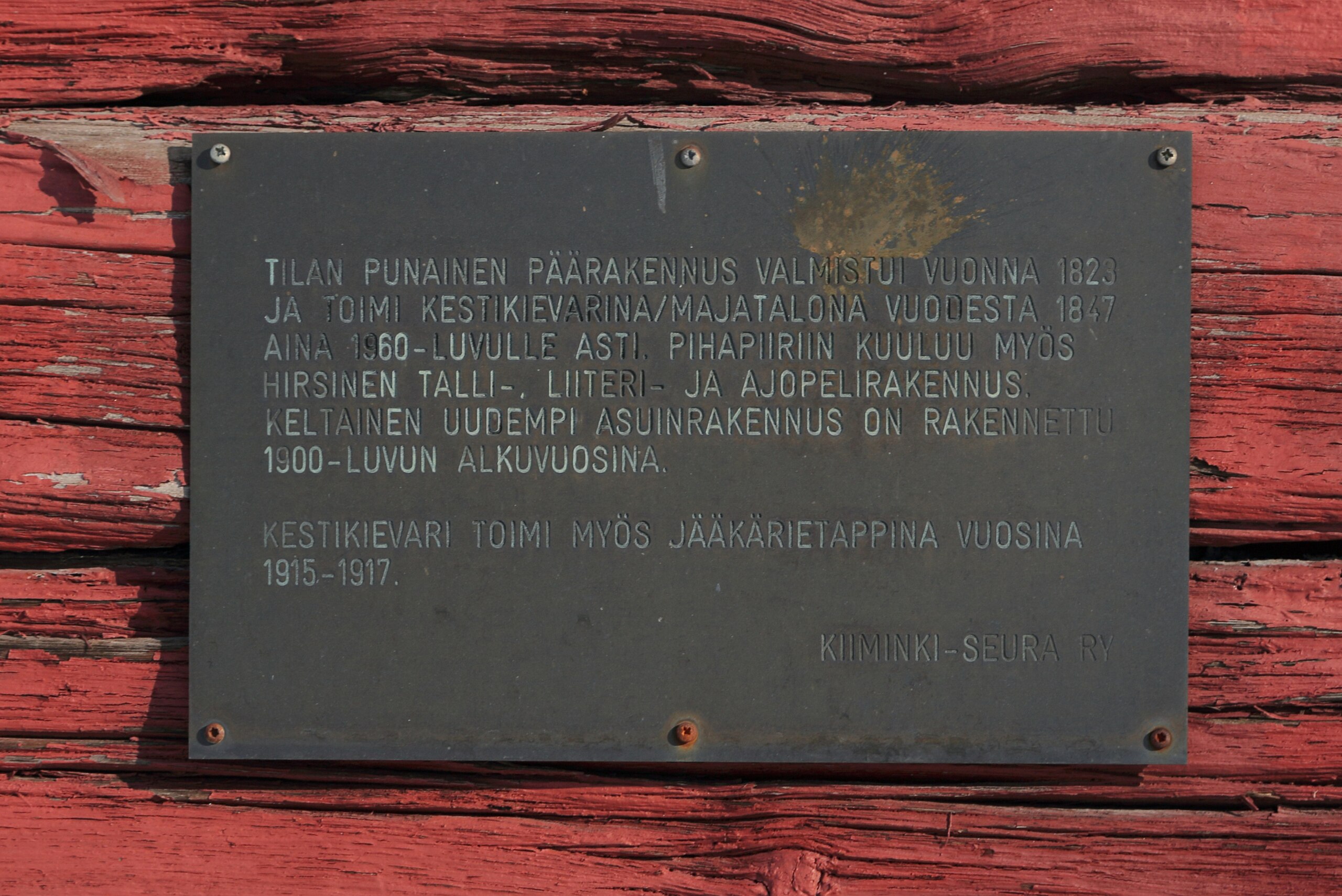
Suomi: Muistolaatta Ukkolan tilan vanhan päärakennuksen seinässä Oulun Kiimingin kaupunginosassa.
English: Memorial plaque of the Ukkola farm in the Kiiminki district of Oulu. |
| Date | Taken on 27 February 2022 |
| Source | Own work |
| Author | Estormiz |
| Inscription | Suomi: Tilan punainen päärakennus valmistui 1823 ja toimi kestikievarina/majatalona vuodesta 1847 aina 1960-luvulle asti. Pihapiiriin kuuluu myös hirsinen talli-, liiteri- ja ajopelirakennus. Keltainen uudempi asuinrakennus on rakennettu 1900-luvun alkuvuosina. Kestikievari toimi myös jääkärietappina vuosina 1915-1917. Kiiminki-Seura ry English: The red main building of the farm was completed in 1823 and served as an inn from 1847 until the 1960s. The courtyard also includes a log stable building. The new yellow residential building was built in the early 20th century. The inn also served as a hiding place for the Finnish Jaegers in 1915-1917.(Informal translation) |
| Camera location | | View this and other nearby images on: OpenStreetMap |
|---|
Licensing
[edit]
I, the copyright holder of this work, hereby publish it under the following license:
| This file is made available under the Creative Commons CC0 1.0 Universal Public Domain Dedication. | |
| The person who associated a work with this deed has dedicated the work to the public domain by waiving all of their rights to the work worldwide under copyright law, including all related and neighboring rights, to the extent allowed by law. You can copy, modify, distribute and perform the work, even for commercial purposes, all without asking permission.
|
File history
Click on a date/time to view the file as it appeared at that time.
| Date/Time | Thumbnail | Dimensions | User | Comment | |
|---|---|---|---|---|---|
| current | 15:20, 9 April 2022 | | 3,400 × 2,270 (1.66 MB) | Estormiz (talk | contribs) | Uploaded own work with UploadWizard |
You cannot overwrite this file.
File usage on Commons
The following page uses this file:
File usage on other wikis
The following other wikis use this file:
- Usage on fi.wikipedia.org