File:Railroad tracks on the maryland avenue corridor.tif
Jump to navigation
Jump to search

Size of this JPG preview of this TIF file: 800 × 571 pixels. Other resolutions: 320 × 228 pixels | 640 × 457 pixels | 1,024 × 730 pixels | 1,280 × 913 pixels | 2,560 × 1,826 pixels | 4,898 × 3,494 pixels.
Original file (4,898 × 3,494 pixels, file size: 16.32 MB, MIME type: image/tiff)
Captions
Captions
Add a one-line explanation of what this file represents
Summary[edit]
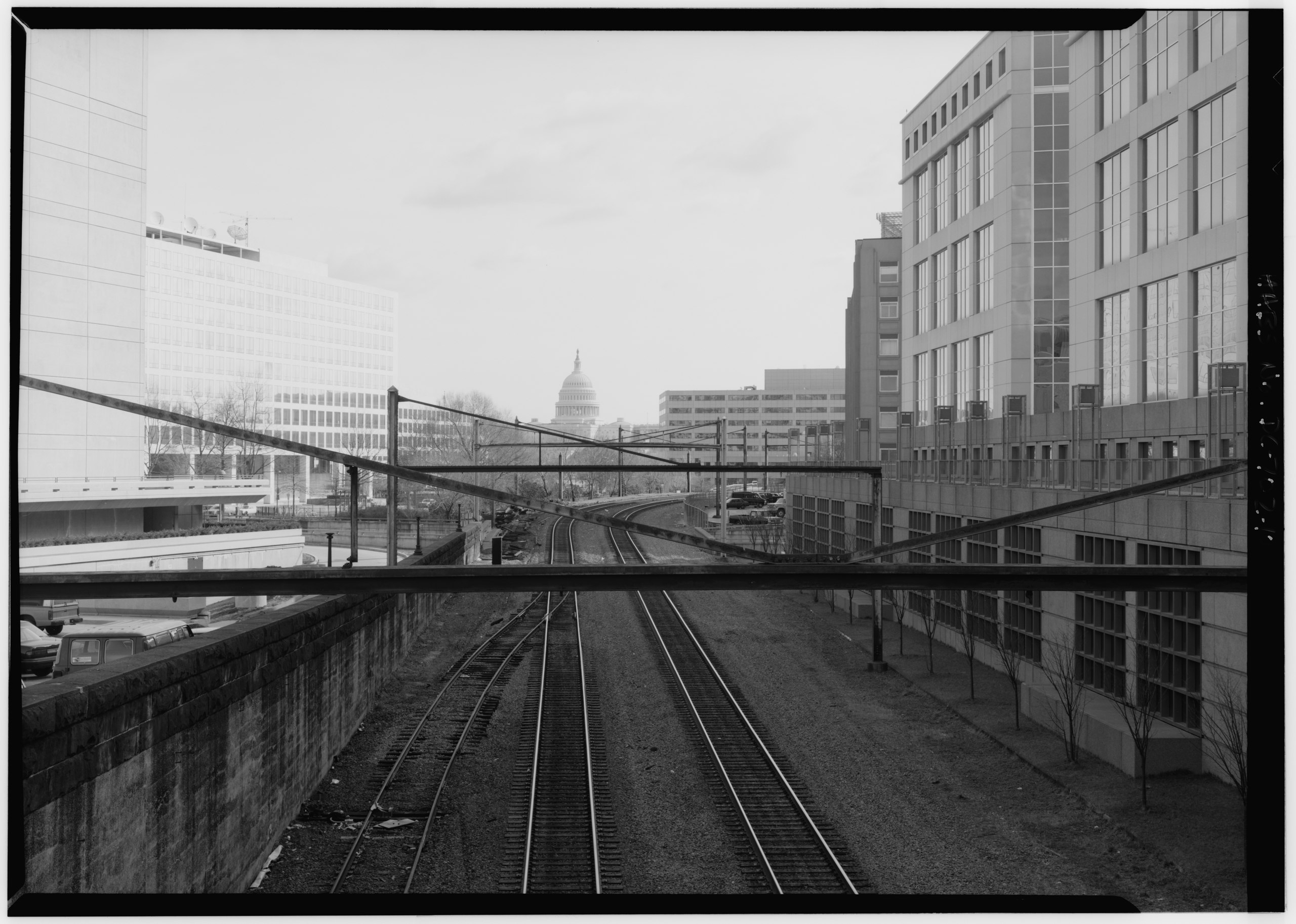
| English: RAILROAD TRACKS ON THE MARYLAND AVENUE CORRIDOR, LOOKING NORTHEAST TO THE CAPITOL FROM THE TENTH STREET OVERPASS, SW.
( |
||||||||||||||||||||||||
|---|---|---|---|---|---|---|---|---|---|---|---|---|---|---|---|---|---|---|---|---|---|---|---|---|
| Photographer |
unknown creator |
|||||||||||||||||||||||
| Title |
English: RAILROAD TRACKS ON THE MARYLAND AVENUE CORRIDOR, LOOKING NORTHEAST TO THE CAPITOL FROM THE TENTH STREET OVERPASS, SW. |
|||||||||||||||||||||||
| Description |
English: 10. VIEW OF RAILROAD TRACKS ON THE MARYLAND AVENUE CORRIDOR, LOOKING NORTHEAST TO THE CAPITOL FROM THE TENTH STREET OVERPASS, SW. - Maryland Avenue, Washington, District of Columbia, DC |
|||||||||||||||||||||||
| Dimensions | 5 x 7 in. | |||||||||||||||||||||||
| Collection |
|
|||||||||||||||||||||||
| Accession number |
HABS DC,WASH,618--10 |
|||||||||||||||||||||||
| Source |
|
|||||||||||||||||||||||
| Permission (Reusing this file) |
Rights Advisory: No known restrictions on publication. | |||||||||||||||||||||||
| Other versions |
|
|||||||||||||||||||||||


| Camera location | | View this and other nearby images on: OpenStreetMap |
|---|
Licensing[edit]

|
This file comes from the Historic American Buildings Survey (HABS), Historic American Engineering Record (HAER) or Historic American Landscapes Survey (HALS). These are programs of the National Park Service established for the purpose of documenting historic places. Records consist of measured drawings, archival photographs, and written reports.
|
| This image or media file contains material based on a work of a National Park Service employee, created as part of that person's official duties. As a work of the U.S. federal government, such work is in the public domain in the United States. See the NPS website and NPS copyright policy for more information. |
File history
Click on a date/time to view the file as it appeared at that time.
| Date/Time | Thumbnail | Dimensions | User | Comment | |
|---|---|---|---|---|---|
| current | 02:19, 16 July 2013 |  | 4,898 × 3,494 (16.32 MB) | Slowking4 (talk | contribs) | User created page with UploadWizard |
You cannot overwrite this file.
File usage on Commons
The following 2 pages use this file: