File:Roof Plan - St. Elizabeths Hospital, West Wing, 539-559 Cedar Drive, Southeast, Washington, District of Columbia, DC HABS DC-349-X (sheet 5 of 7).tif

Original file (17,600 × 13,600 pixels, file size: 997 KB, MIME type: image/tiff)
Captions
Captions
Summary[edit]
| Warning | The original file is very high-resolution. It might not load properly or could cause your browser to freeze when opened at full size. |
|---|
| Roof Plan - St. Elizabeths Hospital, West Wing, 539-559 Cedar Drive, Southeast, Washington, District of Columbia, DC | ||||
|---|---|---|---|---|
| Photographer |
Burian, Andrew Related names:
|
|||
| Title |
Roof Plan - St. Elizabeths Hospital, West Wing, 539-559 Cedar Drive, Southeast, Washington, District of Columbia, DC |
|||
| Depicted place | District of Columbia; District of Columbia; Washington | |||
| Date | Documentation compiled after 1933 | |||
| Dimensions | 34 x 44 in. (E size) | |||
| Current location |
Library of Congress Prints and Photographs Division Washington, D.C. 20540 USA http://hdl.loc.gov/loc.pnp/pp.print |
|||
| Accession number |
HABS DC-349-X (sheet 5 of 7) |
|||
| Credit line |
|
|||
| Notes |
The Center Building group was sited to offer views of Washington, D.C., as part of the overall landscape planning for the campus. The north-south axis of the original central wing of the Center Building group, which does not correspond to orthogonal compass points, established the axis for most of the nineteenth-century buildings at St. Elizabeths. The Center Building group formed the core of the campus during its initial period of development. The Center Building group is also significant for its architectural design. The building as it evolved from 1853 through the onset of the Civil War exemplified the innovative echelon plan, as developed by Superintendent Charles Nichols and architect Thomas U. Walter; this plan was a variation of the Kirkbride plan that became widely adopted in the second half of the nineteenth century. The detailing of the masonry facades incorporates Gothic Revival stylistic elements that were popular in the mid-nineteenth century, including masonry buttresses and towers, cast iron window hoods, wood window sash with narrow divided lights, rusticated masonry bands, and a crenellated parapet wall. The brick units used in construction of the building were reportedly manufactured on the site. The West Wing was connected to a railway system that ran through the basement of the Center Building group and adjacent free-standing buildings. Originally, the railway system allowed for the quick transport of food from the Bakery (Building 46) and General Kitchen (Building 45) as well as supplies between buildings. The building was also technologically innovative; the 1859 Annual Report described the heating system in detail, which was an early example of central heating and ventilating installation for a building of this size.
|
|||
| References |
|
|||
| Source | https://www.loc.gov/pictures/item/dc1100.sheet.00005a | |||
| Permission (Reusing this file) |
|
|||
| Other versions |
.png) .png) .png) .png) .png) .png) .png) |
|||

| Camera location | | View this and other nearby images on: OpenStreetMap |
|---|
File history
Click on a date/time to view the file as it appeared at that time.
| Date/Time | Thumbnail | Dimensions | User | Comment | |
|---|---|---|---|---|---|
| current | 02:14, 10 July 2014 | 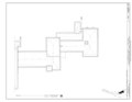 | 17,600 × 13,600 (997 KB) | Fæ (talk | contribs) | GWToolset: Creating mediafile for Fæ. HABS 09 July 2014 (801:1000) |
You cannot overwrite this file.
File usage on Commons
The following page uses this file: