File:Sadowne (gmina) location map.png
Jump to navigation
Jump to search
Size of this preview: 800 × 556 pixels. Other resolutions: 320 × 222 pixels | 640 × 444 pixels | 1,024 × 711 pixels | 1,116 × 775 pixels.
Original file (1,116 × 775 pixels, file size: 115 KB, MIME type: image/png)
Captions
Captions
Add a one-line explanation of what this file represents
| Description |
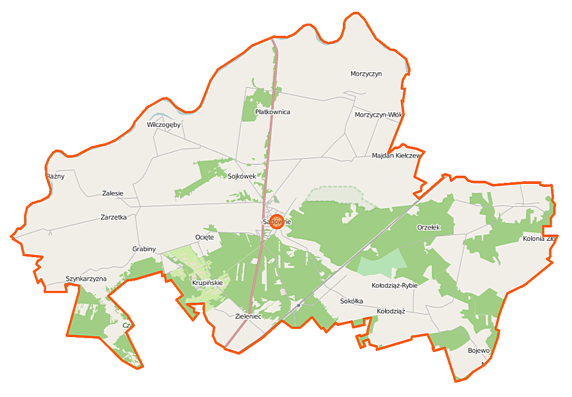
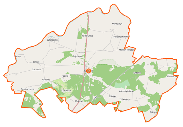
Polski: Mapa gminy Sadowne, Polska
English: Map of Gmina Sadowne, Poland |
|||||||||
| Date | ||||||||||
| Source | You may find a page on the OpenStreetMap wiki page for Sadowne (gmina) | |||||||||
| Creator |
OpenStreetMap contributors OpenStreetMap contributors |
|||||||||
| Permission (Reusing this file) |
OpenStreetMap data is available under the Open Database License (details). Map tiles are licensed under the Creative Commons Attribution-ShareAlike 2.0 license (CC-BY-SA 2.0).
This file is licensed under the Creative Commons Attribution-Share Alike 2.0 Generic license.
|
|||||||||
| Geotemporal data | ||||||||||
| Bounding box |
|
|||||||||
| Georeferencing | If inappropriate please set warp_status = skip to hide. | |||||||||
File history
Click on a date/time to view the file as it appeared at that time.
| Date/Time | Thumbnail | Dimensions | User | Comment | |
|---|---|---|---|---|---|
| current | 11:27, 12 October 2014 | | 1,116 × 775 (115 KB) | VanWiel (talk | contribs) | {{OpenStreetMap | name = Sadowne (gmina) | location = Sadowne (gmina) | description = {{pl|Mapa gminy Sadowne, Polska}} {{en|Map of Gmina Sadowne, Poland}} | top = 52.7074 | left = 21.7042 | right... |
You cannot overwrite this file.
File usage on Commons
There are no pages that use this file.
File usage on other wikis
The following other wikis use this file:
- Usage on fr.wikipedia.org
- Usage on pl.wikipedia.org
- Sadowne (gmina)
- Zalesie (gmina Sadowne)
- Sadowne
- Bojewo
- Krupińskie
- Kolonia Złotki
- Kołodziąż-Rybie
- Morzyczyn Włościański
- Morzyczyn-Włóki
- Ocięte
- Płatkownica
- Rażny
- Sadoleś
- Szynkarzyzna
- Sojkówek
- Wilczogęby
- Zarzetka
- Grabiny (gmina Sadowne)
- Sokółka (województwo mazowieckie)
- Kołodziąż (powiat węgrowski)
- Orzełek (wieś w województwie mazowieckim)
- Zieleniec (wieś w powiecie węgrowskim)
- Złotki (powiat węgrowski)
- Kocielnik
- Sadowne Węgrowskie
- Parafia św. Jana Chrzciciela w Sadownem
- Ukazy (Kołodziąż-Rybie)
- Rezerwat przyrody Mokry Jegiel
- Kościół św. Jana Chrzciciela w Sadownem
- Majdan Kiełczewski
- Czaplowizna-Gajówka
- Podkole (województwo mazowieckie)
- Orzełek (osada leśna w województwie mazowieckim)
- Sadowne (osada leśna)
- Sadowne (osada)
- Muzeum Ziemi Sadowieńskiej
- Zieleniec (osada leśna w powiecie węgrowskim)
- Moduł:Mapa/dane/Sadowne (gmina)
- Zastruże (Ocięte)
- Klin (Bojewo)
- Klin (Rażny)
- Czaplowizna
- Zakurze
- Cegielnia (Kolonia Złotki)
- Usage on pl.wikibooks.org
_location_map.png&oldid=506878409)