File:Sarek National Park Landsat image.jpg
Jump to navigation
Jump to search
Size of this preview: 598 × 600 pixels. Other resolutions: 239 × 240 pixels | 479 × 480 pixels | 714 × 716 pixels.
Original file (714 × 716 pixels, file size: 560 KB, MIME type: image/jpeg)
Captions
Captions
Add a one-line explanation of what this file represents
Summary[edit]
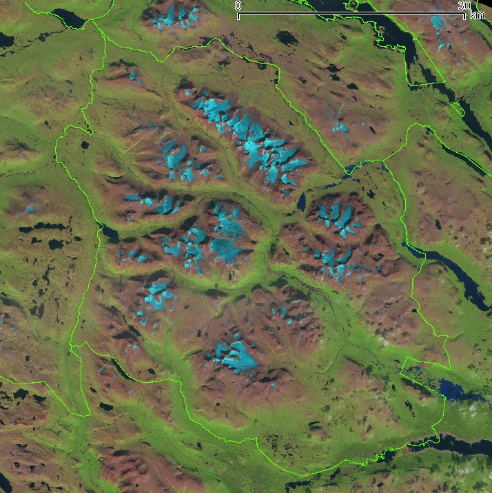
| Description |
Français : Photo satellite découpée Landsat 4-5 TM du 19 août 2006 : les glaciers du parc national de Sarek sont nettement visibles. |
| Date | |
| Source |
Approximate geographic limits of this cropped photo : |
| Author | NASA + Bourrichon (reprojection, découpage) |
Licensing[edit]
| This file is in the public domain in the United States because it was solely created by NASA. NASA copyright policy states that "NASA material is not protected by copyright unless noted". (See Template:PD-USGov, NASA copyright policy page or JPL Image Use Policy.) | ||
 |
Warnings:
|
File history
Click on a date/time to view the file as it appeared at that time.
| Date/Time | Thumbnail | Dimensions | User | Comment | |
|---|---|---|---|---|---|
| current | 19:04, 5 November 2011 | | 714 × 716 (560 KB) | Bourrichon (talk | contribs) | =={{int:filedesc}}== {{Information |description={{fr|1=Photo satellite découpée Landsat 4-5 TM du 19 août 2006 : les glaciers du fr:parc national de Sarek sont nettement visibles.}} |date=2011-11-02 |source=Landsat 4-5 TM du 19 août 2006. Additi |
You cannot overwrite this file.
File usage on Commons
There are no pages that use this file.
File usage on other wikis
The following other wikis use this file:
- Usage on en.wikipedia.org
- Usage on fr.wikipedia.org