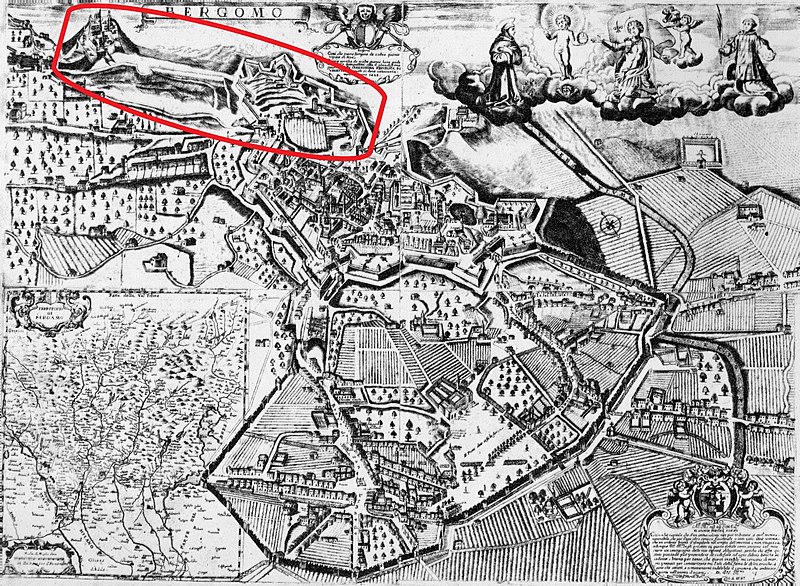
File:Stefano Scolari, Mappa di Bergamo, XVII secolo.jpg

From Wikimedia Commons, the free media repository
Jump to navigation Jump to search

Original file(2,151 × 1,575 pixels, file size: 1.73 MB, MIME type: image/jpeg)

Captions

Captions

Stefano Scolari, Mappa di Bergamo, XVII secolo

Summary[edit]

Description
English: Stefano Scolari, Planimetria prospettica di Bergamo di Stefano Scolari da Macherio (Venezia, 1680); incisione su rame, Venezia 1680. Evidenziati: il Forte di San Marco e il Castello di San Vigilio collegati dalla strada coperta
Date
Source

Ufficio Tecnico del Comune di Bergamo, via bergamo da scoprire

Mappa pubblicata anche in: Sandro Angelini, «Bergamo d’altri tempi» (Istituto Italiano di Arti Grafiche, 1976)

Cf. anche l'incisione custodita presso il Museo Correr di Venezia
Author Stefano Scolari (ca.1610-1691)
Other versions

Licensing[edit]

Public domain

This work is in the public domain in its country of origin and other countries and areas where the copyright term is the author's life plus 100 years or fewer.


This work is in the public domain in the United States because it was published (or registered with the U.S. Copyright Office) before January 1, 1929.

File history

Click on a date/time to view the file as it appeared at that time.

Date/TimeThumbnailDimensionsUserComment
current15:40, 18 October 2020Thumbnail for version as of 15:40, 18 October 20202,151 × 1,575 (1.73 MB)Dans (talk | contribs)better resolution
14:18, 18 October 2020Thumbnail for version as of 14:18, 18 October 2020651 × 480 (108 KB)Dans (talk | contribs)Uploaded a work by Various from Various with UploadWizard