File:Takeshima map ja.svg
Jump to navigation
Jump to search

Size of this PNG preview of this SVG file: 657 × 600 pixels. Other resolutions: 263 × 240 pixels | 526 × 480 pixels | 841 × 768 pixels | 1,121 × 1,024 pixels | 2,243 × 2,048 pixels | 748 × 683 pixels.
Original file (SVG file, nominally 748 × 683 pixels, file size: 76 KB)
Captions
Captions
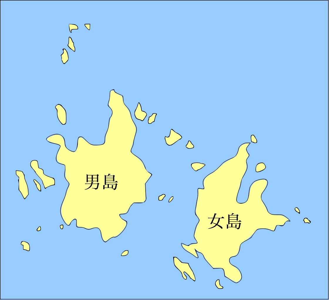
Map of the Takeshima.
| Description |
English: Map of the Liancourt Rocks.
日本語: 竹島の地図
한국어: 독도의 지도. |
| Date | (UTC) |
| Source | |
| Author |
|
| This is a retouched picture, which means that it has been digitally altered from its original version. Modifications: Names changed for the usage on ja-wp.. The original can be viewed here: Liancourt Rocks Map.svg:
|
I, the copyright holder of this work, hereby publish it under the following licenses:
This file is licensed under the Creative Commons Attribution-Share Alike 3.0 Unported, 2.5 Generic, 2.0 Generic and 1.0 Generic license.
- You are free:
- to share – to copy, distribute and transmit the work
- to remix – to adapt the work
- Under the following conditions:
- attribution – You must give appropriate credit, provide a link to the license, and indicate if changes were made. You may do so in any reasonable manner, but not in any way that suggests the licensor endorses you or your use.
- share alike – If you remix, transform, or build upon the material, you must distribute your contributions under the same or compatible license as the original.

|
Permission is granted to copy, distribute and/or modify this document under the terms of the GNU Free Documentation License, Version 1.2 or any later version published by the Free Software Foundation; with no Invariant Sections, no Front-Cover Texts, and no Back-Cover Texts. A copy of the license is included in the section entitled GNU Free Documentation License. |
You may select the license of your choice.
Original upload log
[edit]
This image is a derivative work of the following images:
- File:Liancourt_Rocks_Map.svg licensed with Cc-by-sa-3.0,2.5,2.0,1.0, GFDL
- 2009-07-16T10:39:15Z Forestfarmer 748x683 (133691 Bytes) {{Information |Description= |Source=self-made |Date= |Author= [[User:Forestfarmer|Forestfarmer]] |Permission= |other_versions= }}
- 2009-07-15T12:52:06Z Forestfarmer 748x683 (65776 Bytes)
- 2009-07-15T12:22:45Z Forestfarmer 748x683 (5615 Bytes) {{Information |Description={{en|1=Map of the Liancourt Rocks }} |Source=*[[:File:Liancourt_Rocks_Map.png|Liancourt_Rocks_Map.png]] *[[:File:Dokdo_Map.png|Dokdo_Map.png]] |Author=[[User:Forestfarmer]] |Date=2009-07-15 |Permiss
Uploaded with derivativeFX
File history
Click on a date/time to view the file as it appeared at that time.
| Date/Time | Thumbnail | Dimensions | User | Comment | |
|---|---|---|---|---|---|
| current | 11:43, 22 February 2021 | | 748 × 683 (76 KB) | TKsdik8900 (talk | contribs) | Fixed fonts |
| 07:24, 13 February 2021 |  | 748 × 683 (70 KB) | TKsdik8900 (talk | contribs) | Fixed fonts | |
| 17:30, 8 November 2009 |  | 748 × 683 (69 KB) | Valentim (talk | contribs) | letter size reduced (40px) | |
| 17:25, 8 November 2009 |  | 748 × 683 (69 KB) | Valentim (talk | contribs) | {{Information |Description={{en|1=Map of the Liancourt Rocks.}} {{ja|竹島の地図}} {{ko|1=독도의 지도.}} |Source=*File:Liancourt_Rocks_Map.svg |Date=2009-11-08 17:24 (U |
You cannot overwrite this file.
File usage on Commons
The following 2 pages use this file: