File:The mighty John Day River (24851093949).jpg

Original file (1,936 × 1,288 pixels, file size: 2.94 MB, MIME type: image/jpeg)
Captions
Captions
Summary[edit]
.jpg&action=edit§ion=1)
| Description |
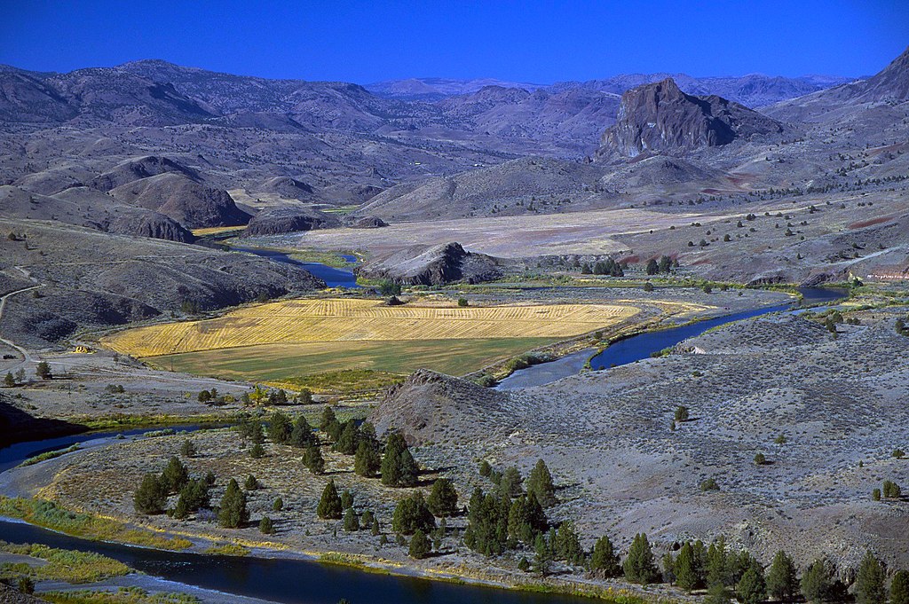
The John Day River basin drains nearly 8,100 square miles of central and northeast Oregon. It is one of our nation’s longest free-flowing river systems. Elevations range from 265 feet at the confluence with the Columbia River to over 9,000 feet at the headwaters in the Strawberry Mountain Range.
Silhouetted rocks and sun lit rocks above the John Day River. Recreation opportunities include hunting, fishing, sightseeing, horseback riding, hiking, snowmobiling, skiing, camping, and whitewater rafting. The John Day Wild and Scenic River is part of the Bureau of Land Management's National Conservation Lands. The National Conservation Lands include nearly 27 million acres of National Monuments, National Conservation Areas, Wild and Scenic Rivers, and National Scenic and Historic Trails. The National Conservation Lands work to conserve the essential fabric of the West, while offering exceptional opportunities for recreation, solitude, wildlife viewing, exploring history, and scientific research. To find out more about the John Day head on over to: <a href="http://www.blm.gov/or/resources/recreation/johnday/" rel="nofollow">www.blm.gov/or/resources/recreation/johnday/</a> |
| Date | |
| Source | The mighty John Day River |
| Author | Bureau of Land Management Oregon and Washington from Portland, America |
Licensing[edit]
.jpg&action=edit§ion=2)
- You are free:
- to share – to copy, distribute and transmit the work
- to remix – to adapt the work
- Under the following conditions:
- attribution – You must give appropriate credit, provide a link to the license, and indicate if changes were made. You may do so in any reasonable manner, but not in any way that suggests the licensor endorses you or your use.
| This image was originally posted to Flickr by BLMOregon at https://flickr.com/photos/50169152@N06/24851093949. It was reviewed on 12 May 2018 by FlickreviewR 2 and was confirmed to be licensed under the terms of the cc-by-2.0. |
| This image is a work of a Bureau of Land Management* employee, taken or made as part of that person's official duties. As a work of the U.S. federal government, the image is in the public domain in the United States. *or predecessor organization |
File history
Click on a date/time to view the file as it appeared at that time.
| Date/Time | Thumbnail | Dimensions | User | Comment | |
|---|---|---|---|---|---|
| current | 17:04, 12 May 2018 | | 1,936 × 1,288 (2.94 MB) | OceanAtoll (talk | contribs) | Transferred from Flickr via #flickr2commons |
You cannot overwrite this file.
File usage on Commons
There are no pages that use this file.
.jpg&oldid=450773286)