File:The northern hills - geograph.org.uk - 1604251.jpg
Jump to navigation
Jump to search
No higher resolution available.
The_northern_hills_-_geograph.org.uk_-_1604251.jpg (640 × 480 pixels, file size: 98 KB, MIME type: image/jpeg)
Captions
Captions
Add a one-line explanation of what this file represents
Summary[edit]
| Description |
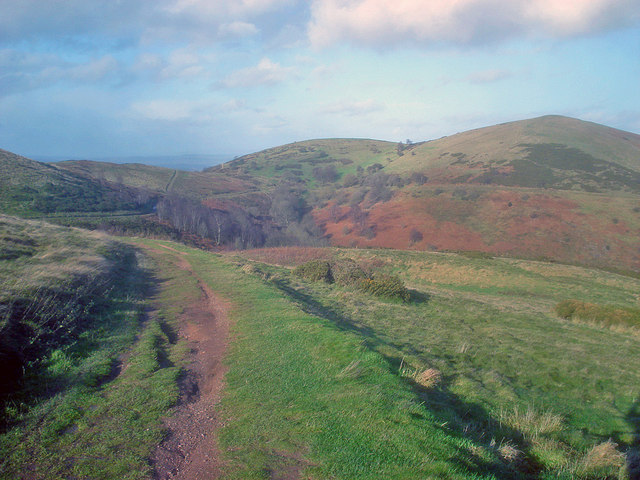
English: The northern hills. From a path leading off the Worcestershire Beacon looking north. From right to left is North Hill, Table Hill and Sugarloaf Hill. Lady Howard de Walden Drive is the main path in view, which circles all three hills. The drive was built to provide an easy carriage access to the hills for Lady Howard de Walden, who lived in West Malvern - see 5516. |
| Date | |
| Source | From geograph.org.uk |
| Author | Trevor Rickard |
| Attribution (required by the license) | Trevor Rickard / The northern hills / |
| Camera location | | View this and other nearby images on: OpenStreetMap |
|---|
_heading:337.00&language=en)
| Object location | | View this and other nearby images on: OpenStreetMap |
|---|
_heading:337.00&language=en)
Licensing[edit]

|
This image was taken from the Geograph project collection. See this photograph's page on the Geograph website for the photographer's contact details. The copyright on this image is owned by Trevor Rickard and is licensed for reuse under the Creative Commons Attribution-ShareAlike 2.0 license.
|
This file is licensed under the Creative Commons Attribution-Share Alike 2.0 Generic license.
Attribution: Trevor Rickard
- You are free:
- to share – to copy, distribute and transmit the work
- to remix – to adapt the work
- Under the following conditions:
- attribution – You must give appropriate credit, provide a link to the license, and indicate if changes were made. You may do so in any reasonable manner, but not in any way that suggests the licensor endorses you or your use.
- share alike – If you remix, transform, or build upon the material, you must distribute your contributions under the same or compatible license as the original.
File history
Click on a date/time to view the file as it appeared at that time.
| Date/Time | Thumbnail | Dimensions | User | Comment | |
|---|---|---|---|---|---|
| current | 07:47, 4 March 2011 | | 640 × 480 (98 KB) | GeographBot (talk | contribs) | == {{int:filedesc}} == {{Information |description={{en|1=The northern hills From a path leading off the Worcestershire Beacon looking north. From right to left is North Hill, Table Hill and Sugarloaf Hill. Lady Howard de Walden Drive is the main path in v |
You cannot overwrite this file.
File usage on Commons
There are no pages that use this file.