File:The ruins of Picker Hill Farm - geograph.org.uk - 503422.jpg
Jump to navigation
Jump to search
No higher resolution available.
The_ruins_of_Picker_Hill_Farm_-_geograph.org.uk_-_503422.jpg (640 × 480 pixels, file size: 112 KB, MIME type: image/jpeg)
Captions
Captions
Add a one-line explanation of what this file represents
Summary[edit]
| Description |
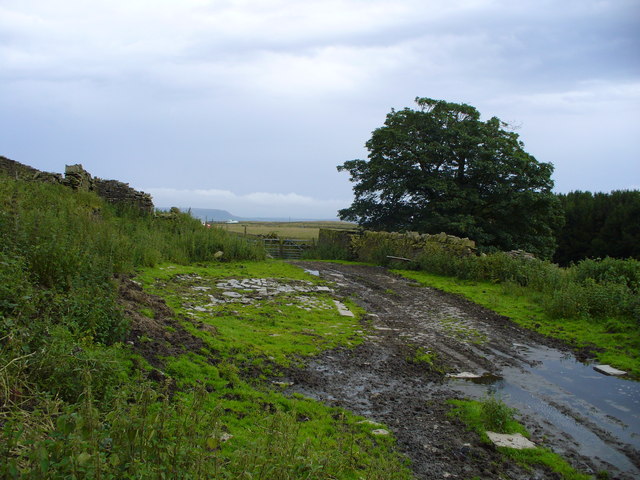
English: The ruins of Picker Hill Farm The ruin of Picker Hill Farm is on the left. In the centre under a covering of mud is the well paved farm road/yard. The 1844 Ordnance Survey map describes this farm as Pickerings though it is not known where this name came from or who lived there at that time. About 1883 to 1887 the farm was occupied by a family called Holdsworth. In 1901 the Ramsbottom family, farmers and weavers, lived here and were probably the last occupants as it is thought that the farm was abandoned early in the 20th century. |
| Date | |
| Source | From geograph.org.uk |
| Author | Peter Worrell |
| Attribution (required by the license) | Peter Worrell / The ruins of Picker Hill Farm / |
| Camera location | | View this and other nearby images on: OpenStreetMap |
|---|
_heading:180.00&language=en)
| Object location | | View this and other nearby images on: OpenStreetMap |
|---|
_heading:180.00&language=en)
Licensing[edit]

|
This image was taken from the Geograph project collection. See this photograph's page on the Geograph website for the photographer's contact details. The copyright on this image is owned by Peter Worrell and is licensed for reuse under the Creative Commons Attribution-ShareAlike 2.0 license.
|
This file is licensed under the Creative Commons Attribution-Share Alike 2.0 Generic license.
Attribution: Peter Worrell
- You are free:
- to share – to copy, distribute and transmit the work
- to remix – to adapt the work
- Under the following conditions:
- attribution – You must give appropriate credit, provide a link to the license, and indicate if changes were made. You may do so in any reasonable manner, but not in any way that suggests the licensor endorses you or your use.
- share alike – If you remix, transform, or build upon the material, you must distribute your contributions under the same or compatible license as the original.
File history
Click on a date/time to view the file as it appeared at that time.
| Date/Time | Thumbnail | Dimensions | User | Comment | |
|---|---|---|---|---|---|
| current | 10:36, 5 February 2011 | | 640 × 480 (112 KB) | GeographBot (talk | contribs) | == {{int:filedesc}} == {{Information |description={{en|1=The ruins of Picker Hill Farm The ruin of Picker Hill Farm is on the left. In the centre under a covering of mud is the well paved farm road/yard. The 1844 Ordnance Survey map describes this farm |
You cannot overwrite this file.
File usage on Commons
There are no pages that use this file.