File:Tremont Street Subway.jpg
Jump to navigation
Jump to search
Size of this preview: 800 × 556 pixels. Other resolutions: 320 × 222 pixels | 640 × 444 pixels | 1,024 × 711 pixels | 1,152 × 800 pixels.
Original file (1,152 × 800 pixels, file size: 587 KB, MIME type: image/jpeg)
Captions
Captions
Add a one-line explanation of what this file represents
| Description |
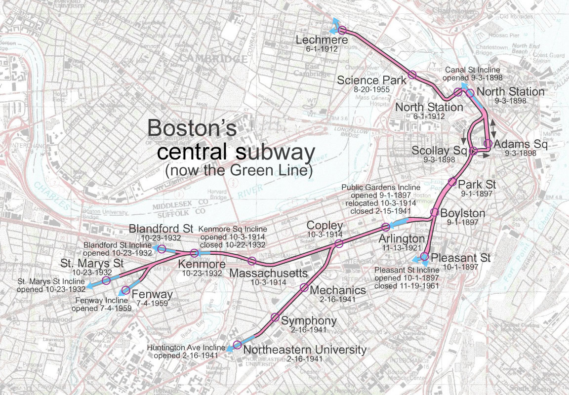
English: Tremont Street Subway in Boston, Massachusetts
Corrections:
|
| Date | |
| Source | Own work |
| Author | User:SPUI |
| This work has been released into the public domain by its author, SPUI. This applies worldwide. In some countries this may not be legally possible; if so: |
File history
Click on a date/time to view the file as it appeared at that time.
| Date/Time | Thumbnail | Dimensions | User | Comment | |
|---|---|---|---|---|---|
| current | 05:21, 13 June 2020 | | 1,152 × 800 (587 KB) | Dicklyon (talk | contribs) | Relabel for the full scope: central subway, not just Tremont Street subway |
| 06:03, 13 May 2005 |  | 1,152 × 800 (311 KB) | SPUI~commonswiki (talk | contribs) | {{spuimap}} Tremont Street Subway, Boston category:Boston subwaycategory:railroad maps |
You cannot overwrite this file.
File usage on Commons
The following 4 pages use this file:
File usage on other wikis
The following other wikis use this file:
- Usage on de.wikipedia.org
- Usage on en.wikipedia.org
- Usage on fr.wikipedia.org
- Usage on ja.wikipedia.org
- Usage on www.wikidata.org