File:Trockental Feldbergdonau-Aitrachtal Schwaebische-Alb.jpg

Original file (1,800 × 1,200 pixels, file size: 2.25 MB, MIME type: image/jpeg)
Captions
Captions
Summary[edit]
| Description |
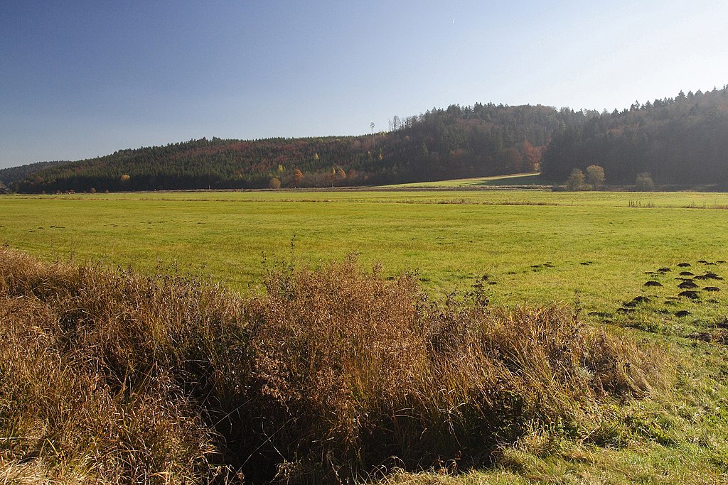
Deutsch: Besonderes Trockental (Aitrachtal). In diesem ca. 300 bis 750 m breiten, ca. 17,5 km langen Aitrachtal fließt bei relativ geringem Gefälle von 2,2‰ (38 m insgesamt) Wasser zwischen Blumberg und Geisingen in einem durchschnittlich 2 m breiten Wassergraben. Dieses Trockental ist nicht das Ergebnis nur anhaltender Verkarstung - wie meistens üblich. Die enorme Talbreite ergibt sich vielmehr aus seiner pleistozänen Vergangenheit als Flussbett der so genannten Feldbergdonau. Durch rückschreitende Erosion drang die rheinische Wutach vor und zapfte schließlich die den Feldberg-Gletscher entwässernde Feldbergdonau an (belegt durch Fossilien in würmzeitlichen Kiesen). Während die Wutach den oberen Teil der wasserreichen Feldbergdonau übernahm, fiel der Teil von Blumberg bis zur Mündung in das Durchbruchstal der heutigen Oberen Donau trocken. Seit der Anzapfung am Wutachknie vor erst ca. 20 Tsd Jahren (!) hat die durch Schneeschmelze und andere Hochwässer große Erosion der Wutach eine Höhendifferenz von gewaltigen 170 m zum Aitrachtal bewirkt. English: dry valley oft the Pleistocene “Feldbergdonau”. At that time the Aare-connection and the direct Ur-Rhine-Ur-Danube connection had long been given up. The Feldbergdonau which drained the melting Feldberg (Back Forest)-glacier became the foremost of river Danube. Strong headward erosion of the rhenish Wutach captured the Feldbergdonau only ca. 20 thousand years ago. By this victory of the rhenish river system over the danube system the 300-750 m wide, 17,5 km long riverbed between the capture near Blumberg and the recent Danube valley fell completely dry. The river Aitrach rather is a tiny drainage ditch of the marshy fluvial sediment in the valley. In 1988 ca. 2,8 km of the valley was declared a strictly protected biotope (nature reserve of a wetland habitat). Meanwhile more parts of the valley are protected biotopes. FFH-rules (Natura 2000) even cover a still larger part - one third of the valley. |
| Date | |
| Source | Own work |
| Author | Ustill |
Licensing[edit]
- You are free:
- to share – to copy, distribute and transmit the work
- to remix – to adapt the work
- Under the following conditions:
- attribution – You must give appropriate credit, provide a link to the license, and indicate if changes were made. You may do so in any reasonable manner, but not in any way that suggests the licensor endorses you or your use.
- share alike – If you remix, transform, or build upon the material, you must distribute your contributions under the same or compatible license as the original.

File history
Click on a date/time to view the file as it appeared at that time.
| Date/Time | Thumbnail | Dimensions | User | Comment | |
|---|---|---|---|---|---|
| current | 11:16, 19 May 2015 | | 1,800 × 1,200 (2.25 MB) | Ustill (talk | contribs) | User created page with UploadWizard |
You cannot overwrite this file.
File usage on Commons
There are no pages that use this file.
File usage on other wikis
The following other wikis use this file:
- Usage on de.wikipedia.org